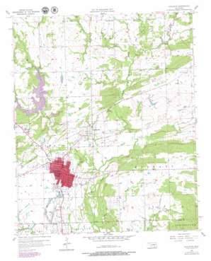
Coalgate Topo Map Oklahoma
To zoom in, hover over the map of Coalgate
USGS Topo Quad 34096e2 - 1:24,000 scale
| Topo Map Name: | Coalgate |
| USGS Topo Quad ID: | 34096e2 |
| Print Size: | ca. 21 1/4" wide x 27" high |
| Southeast Coordinates: | 34.5° N latitude / 96.125° W longitude |
| Map Center Coordinates: | 34.5625° N latitude / 96.1875° W longitude |
| U.S. State: | OK |
| Filename: | o34096e2.jpg |
| Download Map JPG Image: | Coalgate topo map 1:24,000 scale |
| Map Type: | Topographic |
| Topo Series: | 7.5´ |
| Map Scale: | 1:24,000 |
| Source of Map Images: | United States Geological Survey (USGS) |
| Alternate Map Versions: |
Coalgate OK 1957, updated 1958 Download PDF Buy paper map Coalgate OK 1957, updated 1979 Download PDF Buy paper map Coalgate OK 2009 Download PDF Buy paper map Coalgate OK 2012 Download PDF Buy paper map Coalgate OK 2016 Download PDF Buy paper map |
1:24,000 Topo Quads surrounding Coalgate
> Back to 34096e1 at 1:100,000 scale
> Back to 34096a1 at 1:250,000 scale
> Back to U.S. Topo Maps home
Coalgate topo map: Gazetteer
Coalgate: Airports
City of Coalgate Airport elevation 188m 616′Coalgate Municipal Airport elevation 188m 616′
Coalgate: Dams
Bill Lake Dam elevation 200m 656′Caney Coon Creek Site 2 Dam elevation 186m 610′
Caney-Coon Creek Site 3 Dam elevation 184m 603′
Cook Lake Dam elevation 189m 620′
Coalgate: Mines
Mine Number 21 elevation 180m 590′Phillips Strip Mine elevation 188m 616′
Sandmann Mine Number 2 elevation 182m 597′
Coalgate: Populated Places
Cairo elevation 200m 656′Coalgate elevation 185m 606′
Cottonwood elevation 183m 600′
Phillips elevation 181m 593′
Coalgate: Reservoirs
Caney Coon Creek Site 2 Reservoir elevation 186m 610′Caney-Coon Creek Site 3 Reservoir elevation 184m 603′
Coalgate Reservoir elevation 186m 610′
Cook and McEntire Reservoir elevation 189m 620′
Gill Lake elevation 200m 656′
Coalgate: Streams
Caney Creek elevation 171m 561′Coal Creek elevation 171m 561′
Coon Creek elevation 177m 580′
Keel Creek elevation 177m 580′
Salt Creek elevation 177m 580′
Sulphur Creek elevation 167m 547′
Coalgate digital topo map on disk
Buy this Coalgate topo map showing relief, roads, GPS coordinates and other geographical features, as a high-resolution digital map file on DVD:


