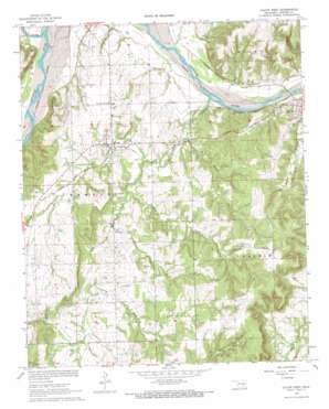
Calvin West Topo Map Oklahoma
To zoom in, hover over the map of Calvin West
USGS Topo Quad 34096h3 - 1:24,000 scale
| Topo Map Name: | Calvin West |
| USGS Topo Quad ID: | 34096h3 |
| Print Size: | ca. 21 1/4" wide x 27" high |
| Southeast Coordinates: | 34.875° N latitude / 96.25° W longitude |
| Map Center Coordinates: | 34.9375° N latitude / 96.3125° W longitude |
| U.S. State: | OK |
| Filename: | o34096h3.jpg |
| Download Map JPG Image: | Calvin West topo map 1:24,000 scale |
| Map Type: | Topographic |
| Topo Series: | 7.5´ |
| Map Scale: | 1:24,000 |
| Source of Map Images: | United States Geological Survey (USGS) |
| Alternate Map Versions: |
Calvin West OK 1967, updated 1968 Download PDF Buy paper map Calvin West OK 2009 Download PDF Buy paper map Calvin West OK 2012 Download PDF Buy paper map Calvin West OK 2016 Download PDF Buy paper map |
1:24,000 Topo Quads surrounding Calvin West
> Back to 34096e1 at 1:100,000 scale
> Back to 34096a1 at 1:250,000 scale
> Back to U.S. Topo Maps home
Calvin West topo map: Gazetteer
Calvin West: Airports
Pace Field elevation 250m 820′Calvin West: Dams
C H Black Dam elevation 227m 744′Jack Coppedge Dam elevation 218m 715′
Kenneth West Dam elevation 258m 846′
Laverne Cates Dam elevation 245m 803′
Marvin Sells Dam elevation 231m 757′
Oknoname 063001 Dam elevation 249m 816′
Oknoname 063027 Dam elevation 221m 725′
Oknoname 063028 Dam elevation 229m 751′
Oknoname 063033 Dam elevation 237m 777′
Calvin West: Oilfields
North Atwood Oil Field elevation 232m 761′Calvin West: Populated Places
Atwood elevation 244m 800′Calvin West: Reservoirs
C H Black Reservoir elevation 227m 744′Jack Coppedge Reservoir elevation 218m 715′
Kenneth West Reservoir elevation 258m 846′
Laverne Cates Reservoir elevation 245m 803′
Marvin Sells Reservoir elevation 231m 757′
Oknoname 063001 Reservoir elevation 249m 816′
Oknoname 063027 Reservoir elevation 221m 725′
Oknoname 063027 Reservoir elevation 229m 751′
Oknoname 063033 Reservoir elevation 237m 777′
Calvin West: Streams
Big Creek elevation 212m 695′Cindy Creek elevation 214m 702′
Dark Hollow Creek elevation 214m 702′
Leader Creek elevation 218m 715′
Little River elevation 217m 711′
Pond Creek elevation 234m 767′
Wildcat Creek elevation 222m 728′
Calvin West digital topo map on disk
Buy this Calvin West topo map showing relief, roads, GPS coordinates and other geographical features, as a high-resolution digital map file on DVD:


