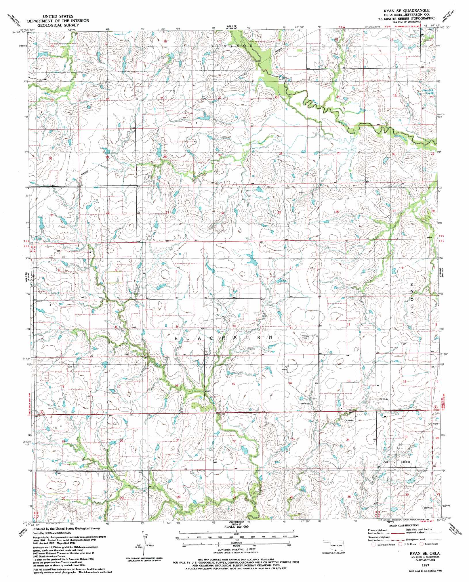
Ryan Se Topo Map Oklahoma
To zoom in, hover over the map of Ryan Se
USGS Topo Quad 34097a7 - 1:24,000 scale
| Topo Map Name: | Ryan Se |
| USGS Topo Quad ID: | 34097a7 |
| Print Size: | ca. 21 1/4" wide x 27" high |
| Southeast Coordinates: | 34° N latitude / 97.75° W longitude |
| Map Center Coordinates: | 34.0625° N latitude / 97.8125° W longitude |
| U.S. State: | OK |
| Filename: | o34097a7.jpg |
| Download Map JPG Image: | Ryan Se topo map 1:24,000 scale |
| Map Type: | Topographic |
| Topo Series: | 7.5´ |
| Map Scale: | 1:24,000 |
| Source of Map Images: | United States Geological Survey (USGS) |
| Alternate Map Versions: |
Ryan SE OK 1987, updated 1988 Download PDF Buy paper map Ryan SE OK 2010 Download PDF Buy paper map Ryan SE OK 2012 Download PDF Buy paper map Ryan SE OK 2016 Download PDF Buy paper map |
1:24,000 Topo Quads surrounding Ryan Se
Corum |
Comanche |
Comanche Se |
Loco |
Cottonwood Creek |
Waurika West |
Waurika East |
Ryan Ne |
Ringling Nw |
Ringling |
Irving |
Ryan |
Ryan Se |
Grady |
Orr |
Riverland Cemetery |
Terral |
Fleetwood |
Prairie Valley School |
Spanish Fort |
Dickworsham |
Ringgold |
Belcherville |
Nocona |
Bonita |
> Back to 34097a1 at 1:100,000 scale
> Back to 34096a1 at 1:250,000 scale
> Back to U.S. Topo Maps home
Ryan Se digital topo map on disk
Buy this Ryan Se topo map showing relief, roads, GPS coordinates and other geographical features, as a high-resolution digital map file on DVD: