Ringling Nw Topo Map Oklahoma
To zoom in, hover over the map of Ringling Nw
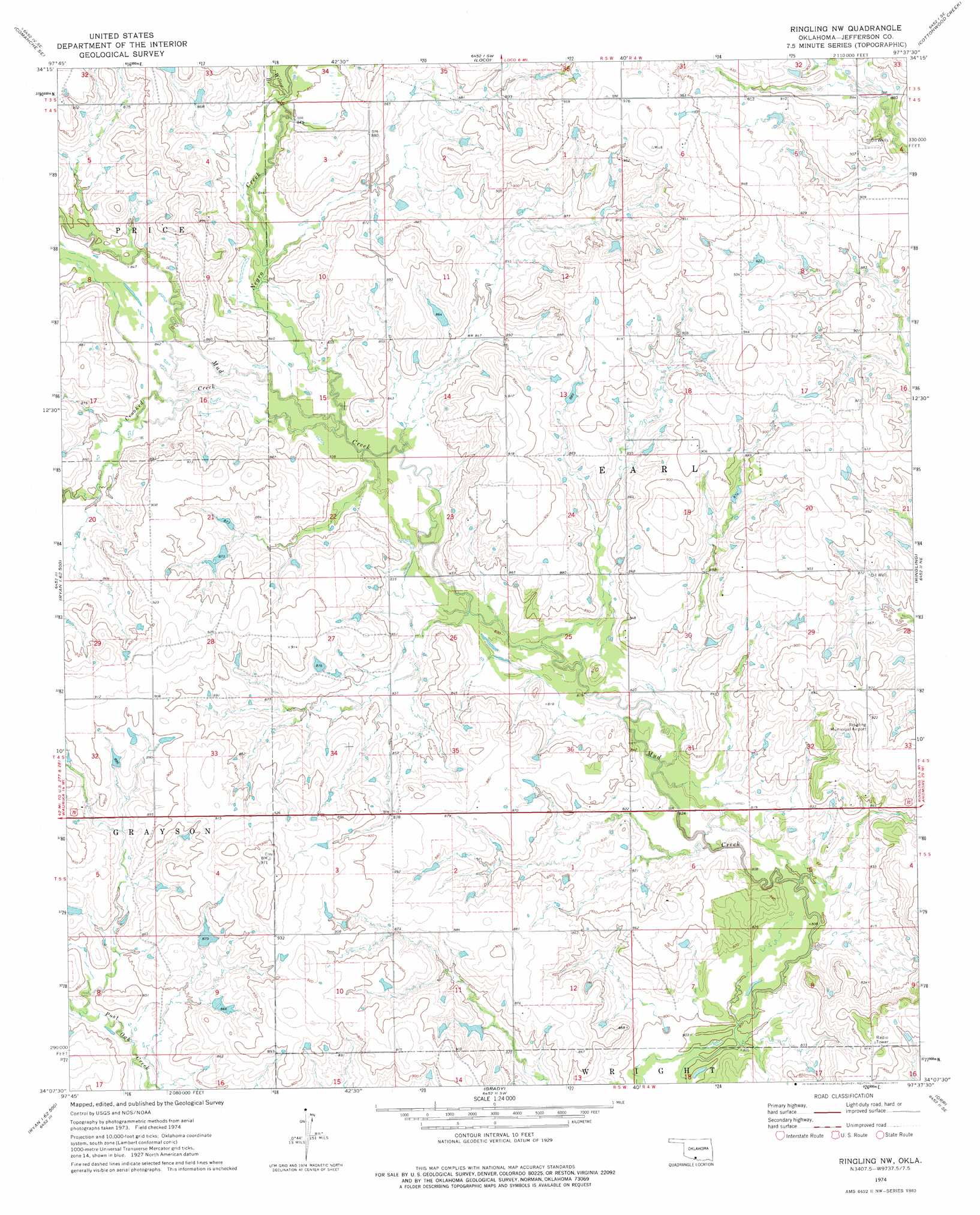
USGS Topo Quad 34097b6 - 1:24,000 scale
| Topo Map Name: | Ringling Nw |
| USGS Topo Quad ID: | 34097b6 |
| Print Size: | ca. 21 1/4" wide x 27" high |
| Southeast Coordinates: | 34.125° N latitude / 97.625° W longitude |
| Map Center Coordinates: | 34.1875° N latitude / 97.6875° W longitude |
| U.S. State: | OK |
| Filename: | o34097b6.jpg |
| Download Map JPG Image: | Ringling Nw topo map 1:24,000 scale |
| Map Type: | Topographic |
| Topo Series: | 7.5´ |
| Map Scale: | 1:24,000 |
| Source of Map Images: | United States Geological Survey (USGS) |
| Alternate Map Versions: |
Ringling NW OK 1974, updated 1977 Download PDF Buy paper map Ringling NW OK 2009 Download PDF Buy paper map Ringling NW OK 2012 Download PDF Buy paper map Ringling NW OK 2016 Download PDF Buy paper map |
1:24,000 Topo Quads surrounding Ringling Nw
Duncan South |
Harrisburg |
Velma |
Ratliff City |
Tatums |
Comanche |
Comanche Se |
Loco |
Cottonwood Creek |
Fox |
Waurika East |
Ryan Ne |
Ringling Nw |
Ringling |
Healdton |
Ryan |
Ryan Se |
Grady |
Orr |
Healdton Sw |
Terral |
Fleetwood |
Prairie Valley School |
Spanish Fort |
Leon North |
> Back to 34097a1 at 1:100,000 scale
> Back to 34096a1 at 1:250,000 scale
> Back to U.S. Topo Maps home
Ringling Nw topo map: Gazetteer
Ringling Nw: Airports
Ringling Municipal Airport elevation 281m 921′Ringling Nw: Dams
Oknoname 067007 Dam elevation 270m 885′Ringling Nw: Reservoirs
Oknoname 067007 Reservoir elevation 270m 885′Ringling Nw: Streams
Crooked Creek elevation 253m 830′Negro Creek elevation 253m 830′
Willow Branch elevation 259m 849′
Ringling Nw digital topo map on disk
Buy this Ringling Nw topo map showing relief, roads, GPS coordinates and other geographical features, as a high-resolution digital map file on DVD: