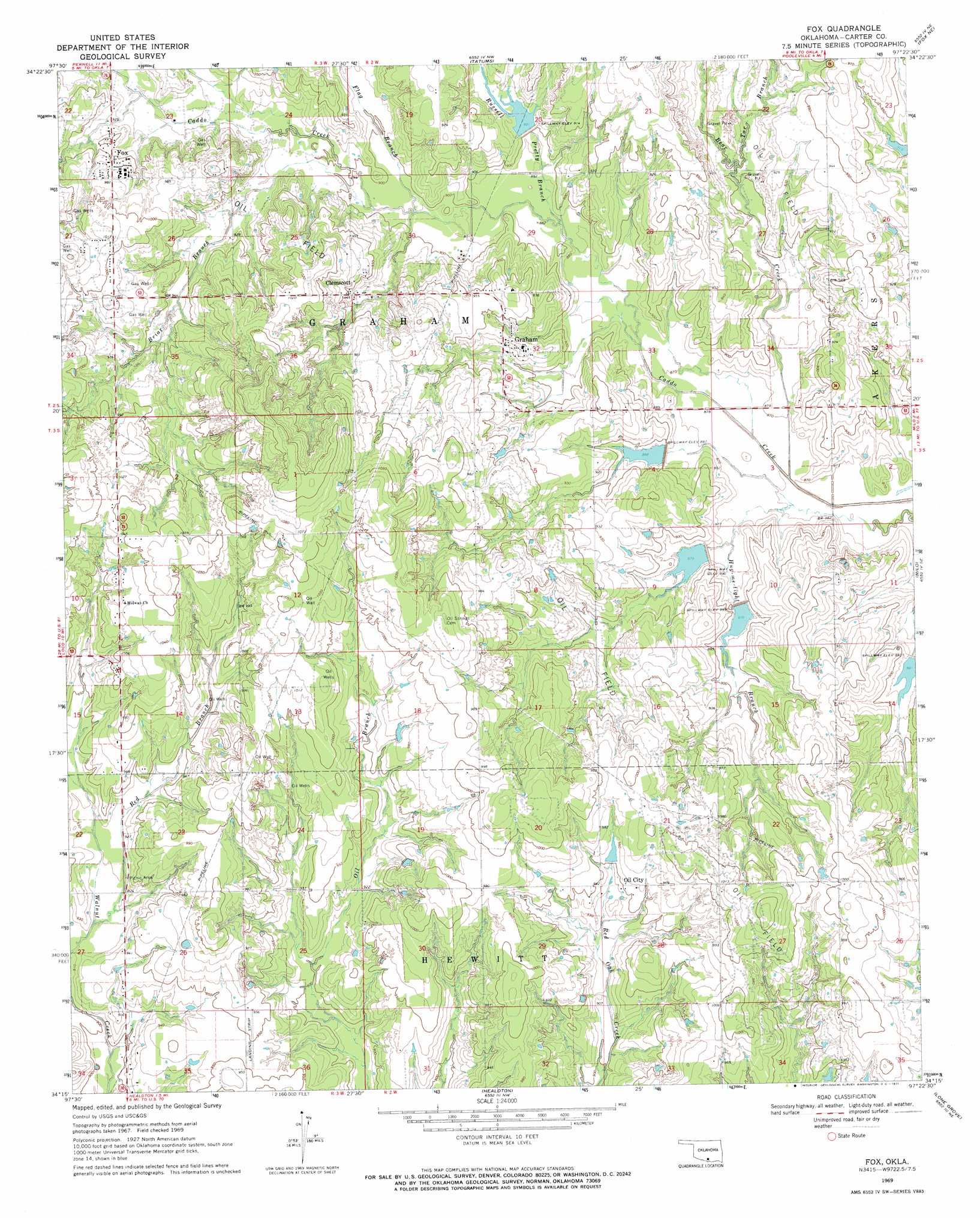
Fox Topo Map Oklahoma
To zoom in, hover over the map of Fox
USGS Topo Quad 34097c4 - 1:24,000 scale
| Topo Map Name: | Fox |
| USGS Topo Quad ID: | 34097c4 |
| Print Size: | ca. 21 1/4" wide x 27" high |
| Southeast Coordinates: | 34.25° N latitude / 97.375° W longitude |
| Map Center Coordinates: | 34.3125° N latitude / 97.4375° W longitude |
| U.S. State: | OK |
| Filename: | o34097c4.jpg |
| Download Map JPG Image: | Fox topo map 1:24,000 scale |
| Map Type: | Topographic |
| Topo Series: | 7.5´ |
| Map Scale: | 1:24,000 |
| Source of Map Images: | United States Geological Survey (USGS) |
| Alternate Map Versions: |
Fox OK 1969, updated 1971 Download PDF Buy paper map Fox OK 2010 Download PDF Buy paper map Fox OK 2012 Download PDF Buy paper map Fox OK 2016 Download PDF Buy paper map |
1:24,000 Topo Quads surrounding Fox
Lake Fuqua |
Pernell |
Elmore City South |
Hennepin |
Joy |
Velma |
Ratliff City |
Tatums |
Fox Ne |
Turner Falls |
Loco |
Cottonwood Creek |
Fox |
Milo |
Springer |
Ringling Nw |
Ringling |
Healdton |
Lone Grove |
Ardmore West |
Grady |
Orr |
Healdton Sw |
Healdton Se |
Overbrook |
> Back to 34097a1 at 1:100,000 scale
> Back to 34096a1 at 1:250,000 scale
> Back to U.S. Topo Maps home
Fox topo map: Gazetteer
Fox: Dams
Caddo Creek Site 22 Dam elevation 269m 882′Caddo Creek Site 23 Dam elevation 271m 889′
Caddo Creek Site 24 Dam elevation 269m 882′
Caddo Creek Site 25 Dam elevation 273m 895′
Caddo Creek Site 3 Dam elevation 272m 892′
Caddo Creek Site 6 Dam elevation 276m 905′
Fox: Populated Places
Clemscott elevation 286m 938′Fox elevation 294m 964′
Graham elevation 284m 931′
Oil City elevation 291m 954′
Old Scott elevation 274m 898′
Fox: Reservoirs
Caddo Creek Site 22 Reservoir elevation 269m 882′Caddo Creek Site 23 Reservoir elevation 271m 889′
Caddo Creek Site 24 Reservoir elevation 269m 882′
Caddo Creek Site 25 Reservoir elevation 273m 895′
Caddo Creek Site 3 Reservoir elevation 272m 892′
Caddo Creek Site 6 Reservoir elevation 276m 905′
Fox: Streams
Bear Creek elevation 260m 853′Briar Branch elevation 271m 889′
Flag Branch elevation 271m 889′
Hug-me-tight Branch elevation 261m 856′
Red Branch elevation 277m 908′
Russell Pretty Branch elevation 269m 882′
Tar Branch elevation 272m 892′
Fox digital topo map on disk
Buy this Fox topo map showing relief, roads, GPS coordinates and other geographical features, as a high-resolution digital map file on DVD: