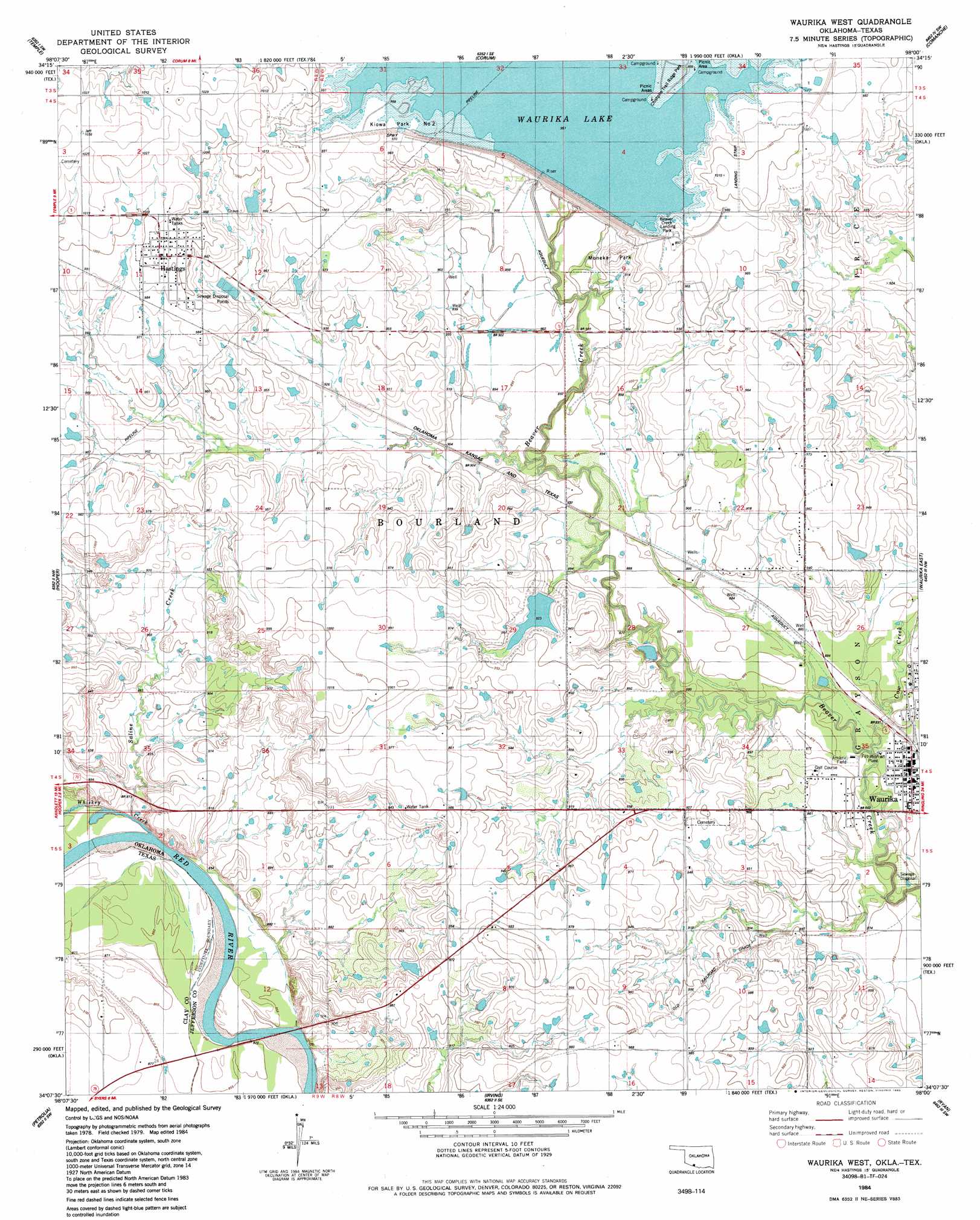
Waurika West Topo Map Oklahoma
To zoom in, hover over the map of Waurika West
USGS Topo Quad 34098b1 - 1:24,000 scale
| Topo Map Name: | Waurika West |
| USGS Topo Quad ID: | 34098b1 |
| Print Size: | ca. 21 1/4" wide x 27" high |
| Southeast Coordinates: | 34.125° N latitude / 98° W longitude |
| Map Center Coordinates: | 34.1875° N latitude / 98.0625° W longitude |
| U.S. States: | OK, TX |
| Filename: | o34098b1.jpg |
| Download Map JPG Image: | Waurika West topo map 1:24,000 scale |
| Map Type: | Topographic |
| Topo Series: | 7.5´ |
| Map Scale: | 1:24,000 |
| Source of Map Images: | United States Geological Survey (USGS) |
| Alternate Map Versions: |
Waurika West OK 1984, updated 1985 Download PDF Buy paper map Waurika West OK 2010 Download PDF Buy paper map Waurika West OK 2012 Download PDF Buy paper map Waurika West OK 2016 Download PDF Buy paper map |
1:24,000 Topo Quads surrounding Waurika West
Walters Ne |
Temple Nw |
Empire City |
Duncan South |
Harrisburg |
Walters |
Temple |
Corum |
Comanche |
Comanche Se |
Taylor |
Hooper |
Waurika West |
Waurika East |
Ryan Ne |
Charlie |
Byers |
Irving |
Ryan |
Ryan Se |
Dean |
Hurnville |
Riverland Cemetery |
Terral |
Fleetwood |
> Back to 34098a1 at 1:100,000 scale
> Back to 34098a1 at 1:250,000 scale
> Back to U.S. Topo Maps home
Waurika West topo map: Gazetteer
Waurika West: Airports
Jefferson County Airport elevation 307m 1007′Waurika West: Bridges
State Highway 79 Bridge elevation 259m 849′Waurika West: Dams
Japanese Beaver Lake Dam elevation 281m 921′Oknoname 067001 Dam elevation 311m 1020′
Oknoname 067002 Dam elevation 294m 964′
Oknoname 067003 Dam elevation 278m 912′
Waurika Dam elevation 279m 915′
Waurika West: Parks
Beaver Creek Landing Park elevation 299m 980′Kiowa Park Number 2 elevation 294m 964′
Moneka Park elevation 289m 948′
Waurika West: Populated Places
Hastings elevation 306m 1003′Waurika West: Reservoirs
Oknoname 067001 Reservoir elevation 311m 1020′Oknoname 067002 Reservoir elevation 294m 964′
Oknoname 067003 Reservoir elevation 278m 912′
Waurika Lake elevation 281m 921′
Waurika West: Streams
Cow Creek elevation 262m 859′Saline Creek elevation 264m 866′
Waurika West digital topo map on disk
Buy this Waurika West topo map showing relief, roads, GPS coordinates and other geographical features, as a high-resolution digital map file on DVD: