Randlett Topo Map Oklahoma
To zoom in, hover over the map of Randlett
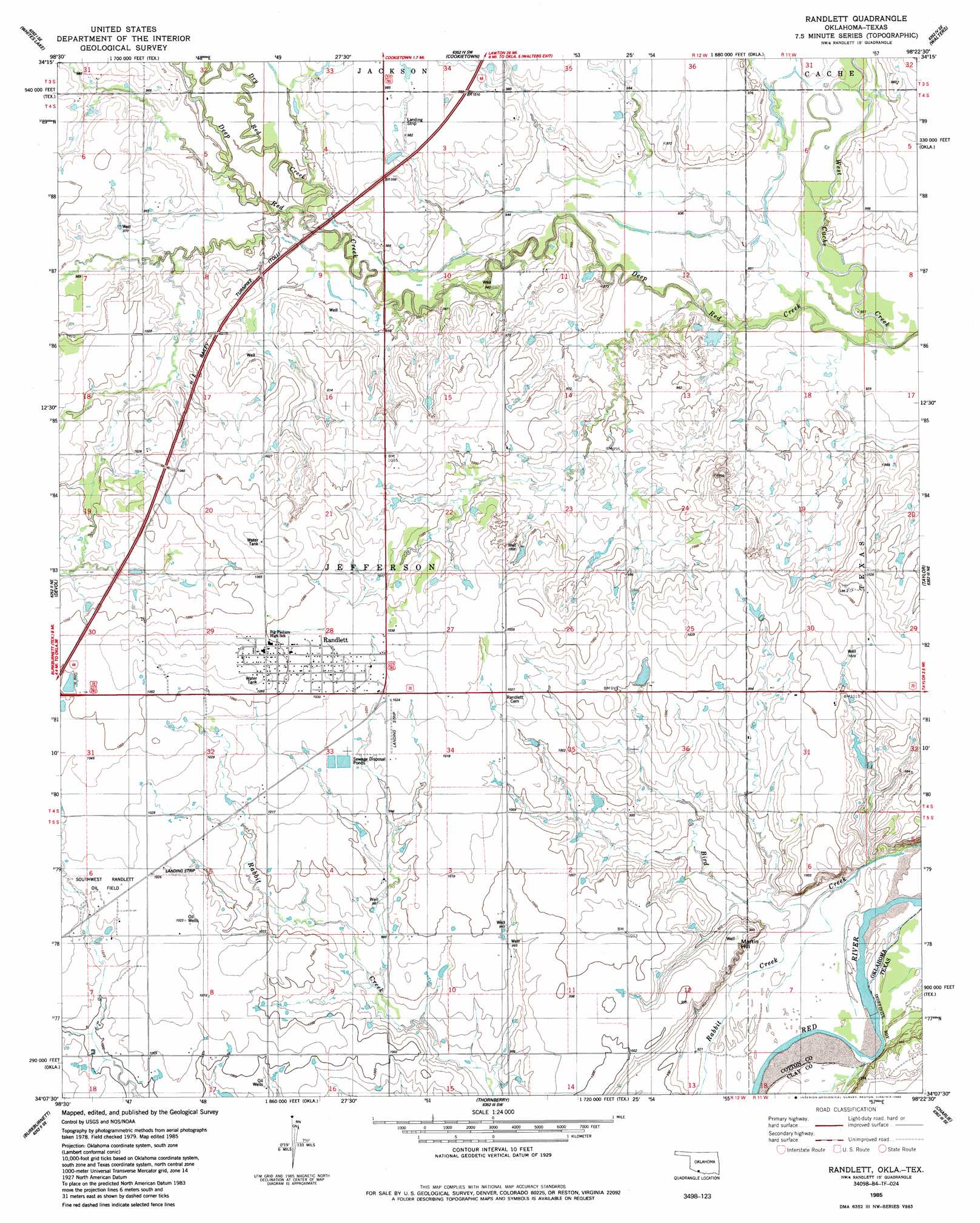
USGS Topo Quad 34098b4 - 1:24,000 scale
| Topo Map Name: | Randlett |
| USGS Topo Quad ID: | 34098b4 |
| Print Size: | ca. 21 1/4" wide x 27" high |
| Southeast Coordinates: | 34.125° N latitude / 98.375° W longitude |
| Map Center Coordinates: | 34.1875° N latitude / 98.4375° W longitude |
| U.S. States: | OK, TX |
| Filename: | o34098b4.jpg |
| Download Map JPG Image: | Randlett topo map 1:24,000 scale |
| Map Type: | Topographic |
| Topo Series: | 7.5´ |
| Map Scale: | 1:24,000 |
| Source of Map Images: | United States Geological Survey (USGS) |
| Alternate Map Versions: |
Randlett OK 1985, updated 1985 Download PDF Buy paper map Randlett OK 2010 Download PDF Buy paper map Randlett OK 2012 Download PDF Buy paper map Randlett OK 2016 Download PDF Buy paper map |
1:24,000 Topo Quads surrounding Randlett
Chattanooga |
Faxon |
Geronimo |
Walters Ne |
Temple Nw |
Chattanooga Sw |
Whites Lake |
Cookietown |
Walters |
Temple |
Grandfield |
Devol |
Randlett |
Taylor |
Hooper |
Clara |
Burkburnett |
Thornberry |
Charlie |
Byers |
Iowa Park |
Wichita Falls West |
Wichita Falls East |
Dean |
Hurnville |
> Back to 34098a1 at 1:100,000 scale
> Back to 34098a1 at 1:250,000 scale
> Back to U.S. Topo Maps home
Randlett topo map: Gazetteer
Randlett: Dams
Oknoname 033009 Dam elevation 299m 980′Randlett: Oilfields
Southwest Randlett Oil Field elevation 312m 1023′West Rabbit Creek Oil Field elevation 302m 990′
Randlett: Populated Places
Randlett elevation 317m 1040′Randlett: Reservoirs
Oknoname 033009 Reservoir elevation 299m 980′Randlett: Streams
Deep Red Creek elevation 281m 921′Dry Red Creek elevation 289m 948′
Rabbit Creek elevation 280m 918′
Randlett: Summits
Martin Hill elevation 303m 994′Randlett digital topo map on disk
Buy this Randlett topo map showing relief, roads, GPS coordinates and other geographical features, as a high-resolution digital map file on DVD: