Devol Topo Map Oklahoma
To zoom in, hover over the map of Devol
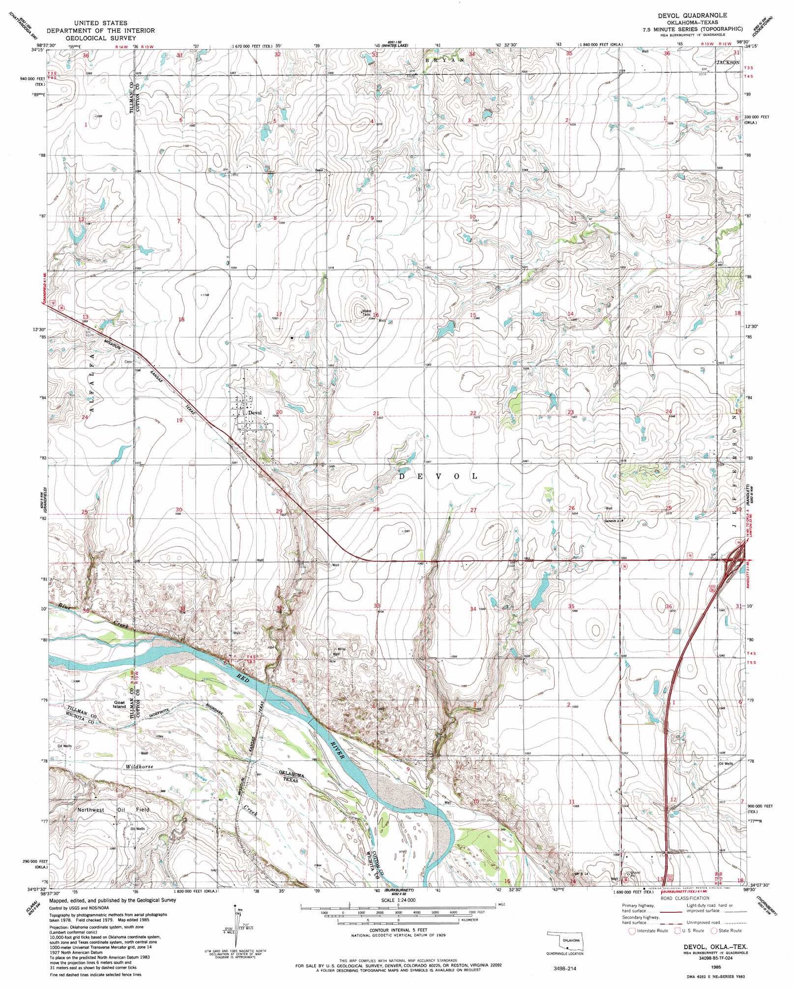
USGS Topo Quad 34098b5 - 1:24,000 scale
| Topo Map Name: | Devol |
| USGS Topo Quad ID: | 34098b5 |
| Print Size: | ca. 21 1/4" wide x 27" high |
| Southeast Coordinates: | 34.125° N latitude / 98.5° W longitude |
| Map Center Coordinates: | 34.1875° N latitude / 98.5625° W longitude |
| U.S. States: | OK, TX |
| Filename: | o34098b5.jpg |
| Download Map JPG Image: | Devol topo map 1:24,000 scale |
| Map Type: | Topographic |
| Topo Series: | 7.5´ |
| Map Scale: | 1:24,000 |
| Source of Map Images: | United States Geological Survey (USGS) |
| Alternate Map Versions: |
Devol OK 1985, updated 1985 Download PDF Buy paper map Devol OK 2010 Download PDF Buy paper map Devol OK 2012 Download PDF Buy paper map Devol OK 2016 Download PDF Buy paper map |
1:24,000 Topo Quads surrounding Devol
Hollister Ne |
Chattanooga |
Faxon |
Geronimo |
Walters Ne |
Hollister |
Chattanooga Sw |
Whites Lake |
Cookietown |
Walters |
Augar Creek |
Grandfield |
Devol |
Randlett |
Taylor |
Sunshine Hill |
Clara |
Burkburnett |
Thornberry |
Charlie |
Fowlkes |
Iowa Park |
Wichita Falls West |
Wichita Falls East |
Dean |
> Back to 34098a1 at 1:100,000 scale
> Back to 34098a1 at 1:250,000 scale
> Back to U.S. Topo Maps home
Devol topo map: Gazetteer
Devol: Dams
Tulssis Dam elevation 315m 1033′Devol: Islands
Goat Island elevation 301m 987′Devol: Populated Places
Devol elevation 327m 1072′Thrift elevation 330m 1082′
Devol: Reservoirs
Tullis Lake elevation 315m 1033′Devol digital topo map on disk
Buy this Devol topo map showing relief, roads, GPS coordinates and other geographical features, as a high-resolution digital map file on DVD: