Grandfield Topo Map Oklahoma
To zoom in, hover over the map of Grandfield
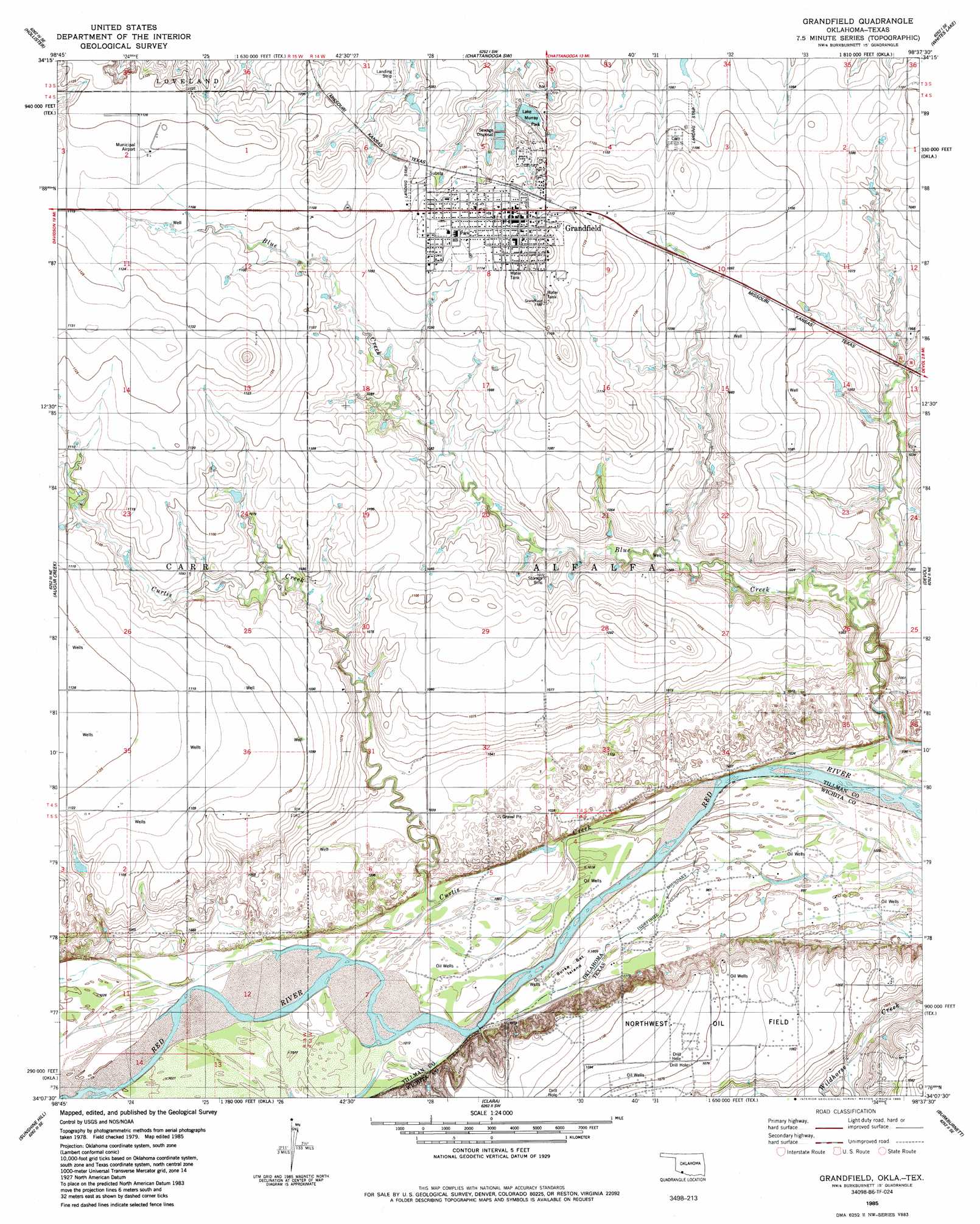
USGS Topo Quad 34098b6 - 1:24,000 scale
| Topo Map Name: | Grandfield |
| USGS Topo Quad ID: | 34098b6 |
| Print Size: | ca. 21 1/4" wide x 27" high |
| Southeast Coordinates: | 34.125° N latitude / 98.625° W longitude |
| Map Center Coordinates: | 34.1875° N latitude / 98.6875° W longitude |
| U.S. States: | OK, TX |
| Filename: | o34098b6.jpg |
| Download Map JPG Image: | Grandfield topo map 1:24,000 scale |
| Map Type: | Topographic |
| Topo Series: | 7.5´ |
| Map Scale: | 1:24,000 |
| Source of Map Images: | United States Geological Survey (USGS) |
| Alternate Map Versions: |
Grandfield OK 1985, updated 1985 Download PDF Buy paper map Grandfield OK 2010 Download PDF Buy paper map Grandfield OK 2012 Download PDF Buy paper map Grandfield OK 2016 Download PDF Buy paper map |
1:24,000 Topo Quads surrounding Grandfield
Hollister Nw |
Hollister Ne |
Chattanooga |
Faxon |
Geronimo |
Hackberry Flat |
Hollister |
Chattanooga Sw |
Whites Lake |
Cookietown |
Cowboy Springs |
Augar Creek |
Grandfield |
Devol |
Randlett |
Electra |
Sunshine Hill |
Clara |
Burkburnett |
Thornberry |
Beaver Creek |
Fowlkes |
Iowa Park |
Wichita Falls West |
Wichita Falls East |
> Back to 34098a1 at 1:100,000 scale
> Back to 34098a1 at 1:250,000 scale
> Back to U.S. Topo Maps home
Grandfield topo map: Gazetteer
Grandfield: Airports
Grandfield Municipal Airport elevation 341m 1118′Grandfield: Islands
Burke Bet Island elevation 306m 1003′Grandfield: Oilfields
Northwest Oil Field elevation 323m 1059′Northwest Oil Field elevation 306m 1003′
Red River Oil Field elevation 310m 1017′
Grandfield: Parks
Lake Murray Park elevation 330m 1082′Grandfield: Populated Places
Grandfield elevation 345m 1131′Grandfield: Streams
Bule Creek elevation 303m 994′Curtis Creek elevation 306m 1003′
Grandfield digital topo map on disk
Buy this Grandfield topo map showing relief, roads, GPS coordinates and other geographical features, as a high-resolution digital map file on DVD: