Corum Topo Map Oklahoma
To zoom in, hover over the map of Corum
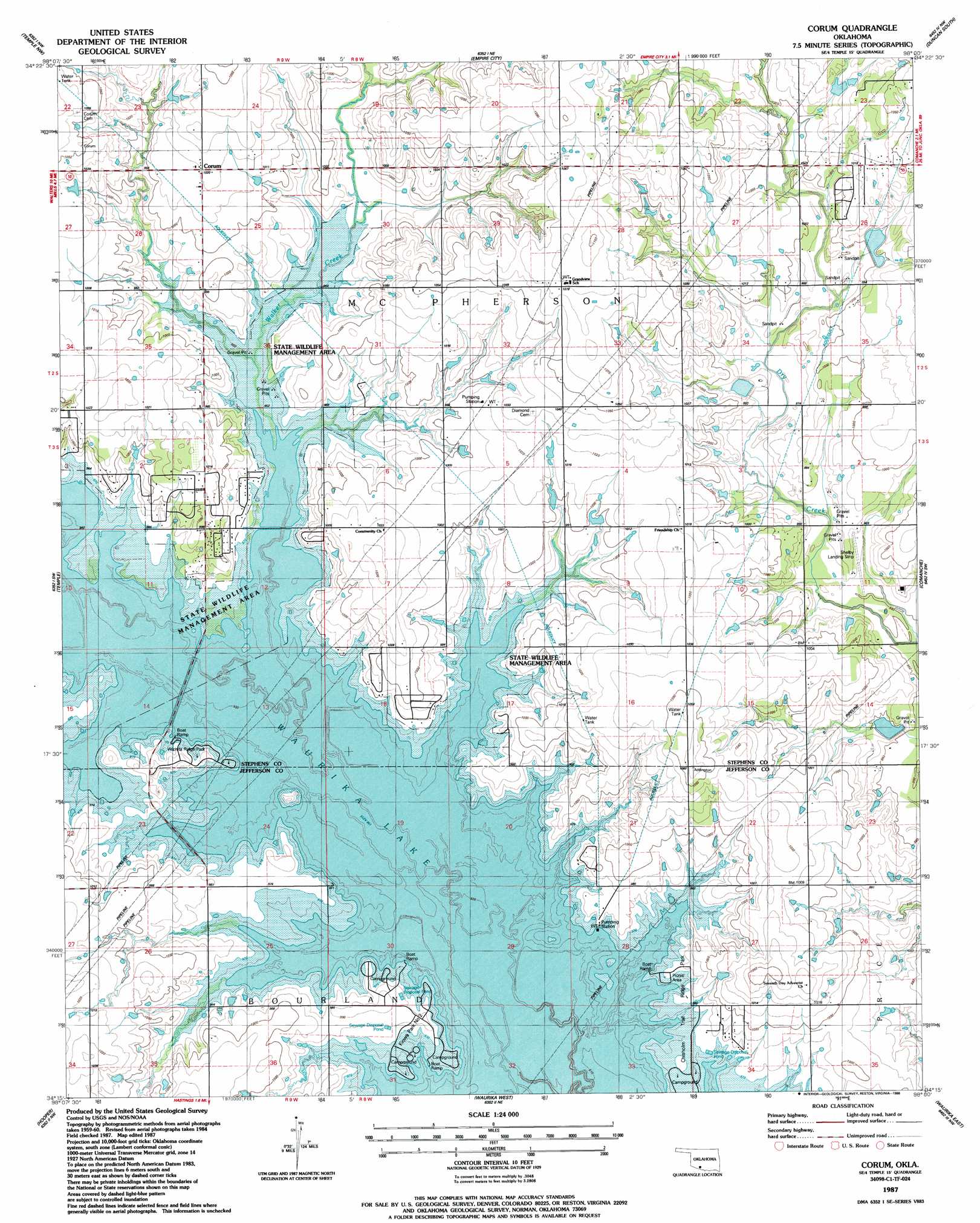
USGS Topo Quad 34098c1 - 1:24,000 scale
| Topo Map Name: | Corum |
| USGS Topo Quad ID: | 34098c1 |
| Print Size: | ca. 21 1/4" wide x 27" high |
| Southeast Coordinates: | 34.25° N latitude / 98° W longitude |
| Map Center Coordinates: | 34.3125° N latitude / 98.0625° W longitude |
| U.S. State: | OK |
| Filename: | o34098c1.jpg |
| Download Map JPG Image: | Corum topo map 1:24,000 scale |
| Map Type: | Topographic |
| Topo Series: | 7.5´ |
| Map Scale: | 1:24,000 |
| Source of Map Images: | United States Geological Survey (USGS) |
| Alternate Map Versions: |
Corum OK 1987, updated 1988 Download PDF Buy paper map Corum OK 2010 Download PDF Buy paper map Corum OK 2012 Download PDF Buy paper map Corum OK 2016 Download PDF Buy paper map |
1:24,000 Topo Quads surrounding Corum
Ninemile Creek |
Letitia |
Nellie |
Duncan North |
Hope |
Walters Ne |
Temple Nw |
Empire City |
Duncan South |
Harrisburg |
Walters |
Temple |
Corum |
Comanche |
Comanche Se |
Taylor |
Hooper |
Waurika West |
Waurika East |
Ryan Ne |
Charlie |
Byers |
Irving |
Ryan |
Ryan Se |
> Back to 34098a1 at 1:100,000 scale
> Back to 34098a1 at 1:250,000 scale
> Back to U.S. Topo Maps home
Corum topo map: Gazetteer
Corum: Airports
Shelby Landing Strip elevation 293m 961′Corum: Dams
Cow Creek Site 34 Dam elevation 304m 997′Corum: Parks
Chisholm Trail Ridge Park elevation 293m 961′Kiowa Park Number 2 elevation 299m 980′
Wichita Ridge Park elevation 293m 961′
Corum: Populated Places
Corum elevation 311m 1020′Corum: Reservoirs
Cow Creek Site 34 Reservoir elevation 304m 997′Corum: Streams
Walker Creek elevation 290m 951′Corum digital topo map on disk
Buy this Corum topo map showing relief, roads, GPS coordinates and other geographical features, as a high-resolution digital map file on DVD: