Cookietown Topo Map Oklahoma
To zoom in, hover over the map of Cookietown
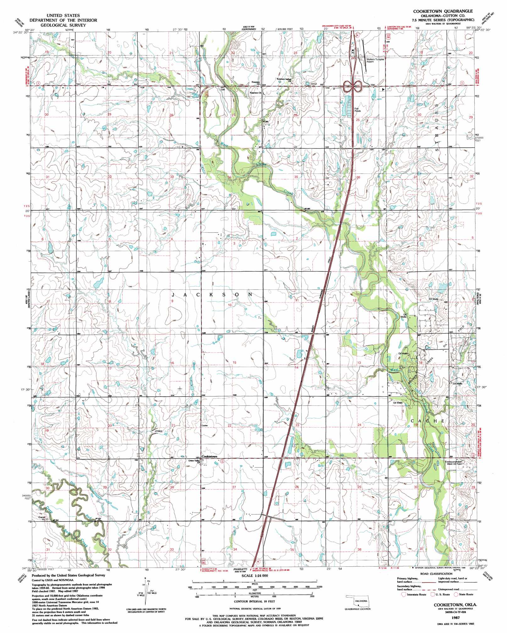
USGS Topo Quad 34098c4 - 1:24,000 scale
| Topo Map Name: | Cookietown |
| USGS Topo Quad ID: | 34098c4 |
| Print Size: | ca. 21 1/4" wide x 27" high |
| Southeast Coordinates: | 34.25° N latitude / 98.375° W longitude |
| Map Center Coordinates: | 34.3125° N latitude / 98.4375° W longitude |
| U.S. State: | OK |
| Filename: | o34098c4.jpg |
| Download Map JPG Image: | Cookietown topo map 1:24,000 scale |
| Map Type: | Topographic |
| Topo Series: | 7.5´ |
| Map Scale: | 1:24,000 |
| Source of Map Images: | United States Geological Survey (USGS) |
| Alternate Map Versions: |
Cookietown OK 1987, updated 1988 Download PDF Buy paper map Cookietown OK 2009 Download PDF Buy paper map Cookietown OK 2012 Download PDF Buy paper map Cookietown OK 2016 Download PDF Buy paper map |
1:24,000 Topo Quads surrounding Cookietown
Post Oak Creek |
Taupa |
Lawton |
Ninemile Creek |
Letitia |
Chattanooga |
Faxon |
Geronimo |
Walters Ne |
Temple Nw |
Chattanooga Sw |
Whites Lake |
Cookietown |
Walters |
Temple |
Grandfield |
Devol |
Randlett |
Taylor |
Hooper |
Clara |
Burkburnett |
Thornberry |
Charlie |
Byers |
> Back to 34098a1 at 1:100,000 scale
> Back to 34098a1 at 1:250,000 scale
> Back to U.S. Topo Maps home
Cookietown topo map: Gazetteer
Cookietown: Airports
Walters Municipal Airport elevation 323m 1059′Cookietown: Dams
Oknoname 033004 Dam elevation 301m 987′Cookietown: Oilfields
Essaquanahdale West Oil Field elevation 298m 977′Soldier Creek Oil Field elevation 309m 1013′
Cookietown: Populated Places
Cookietown elevation 314m 1030′Cookietown: Reservoirs
Oknoname 033004 Reservoir elevation 301m 987′Cookietown digital topo map on disk
Buy this Cookietown topo map showing relief, roads, GPS coordinates and other geographical features, as a high-resolution digital map file on DVD: