Walters Ne Topo Map Oklahoma
To zoom in, hover over the map of Walters Ne
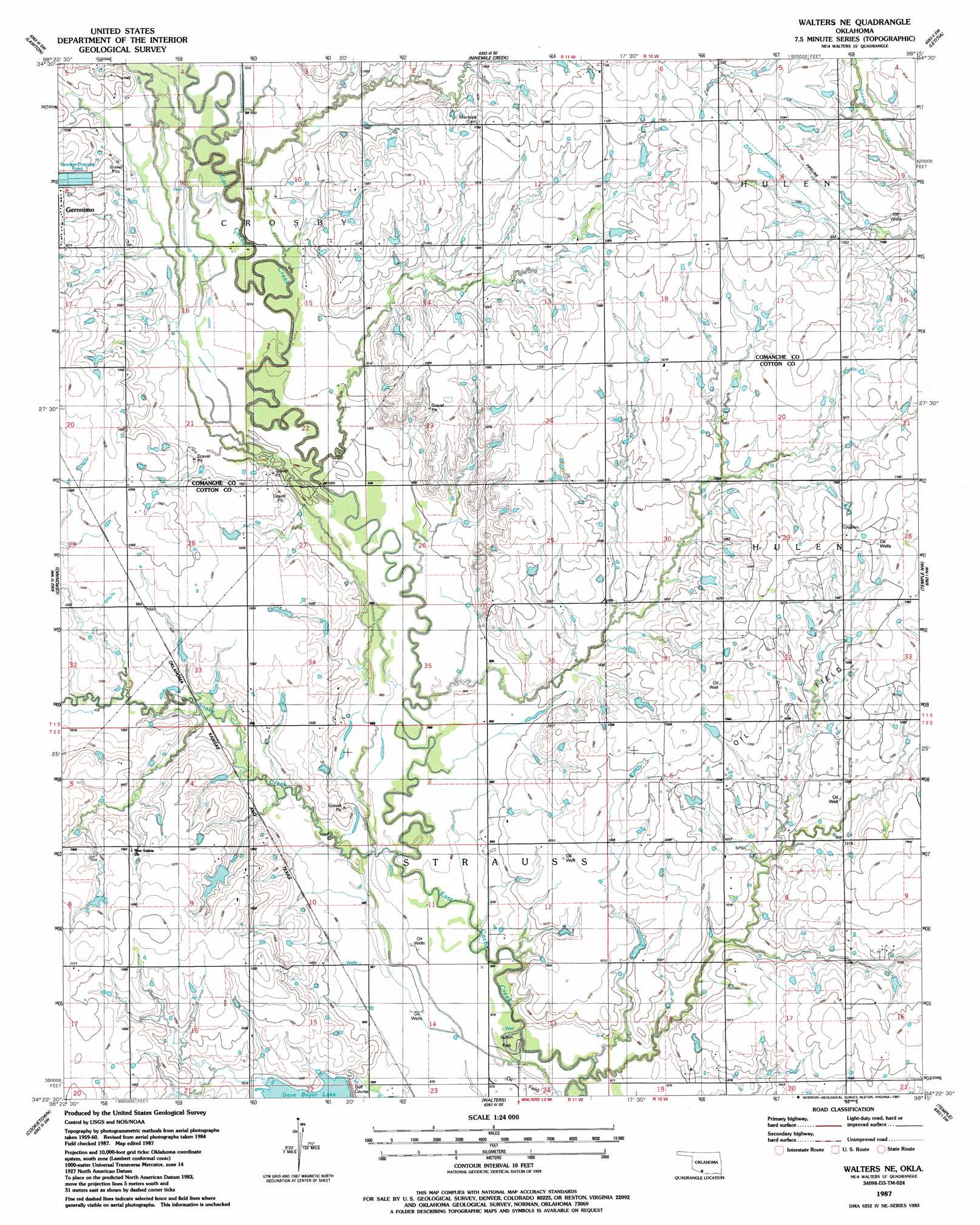
USGS Topo Quad 34098d3 - 1:24,000 scale
| Topo Map Name: | Walters Ne |
| USGS Topo Quad ID: | 34098d3 |
| Print Size: | ca. 21 1/4" wide x 27" high |
| Southeast Coordinates: | 34.375° N latitude / 98.25° W longitude |
| Map Center Coordinates: | 34.4375° N latitude / 98.3125° W longitude |
| U.S. State: | OK |
| Filename: | o34098d3.jpg |
| Download Map JPG Image: | Walters Ne topo map 1:24,000 scale |
| Map Type: | Topographic |
| Topo Series: | 7.5´ |
| Map Scale: | 1:24,000 |
| Source of Map Images: | United States Geological Survey (USGS) |
| Alternate Map Versions: |
Walters NE OK 1987, updated 1987 Download PDF Buy paper map Walters NE OK 2009 Download PDF Buy paper map Walters NE OK 2012 Download PDF Buy paper map Walters NE OK 2016 Download PDF Buy paper map |
1:24,000 Topo Quads surrounding Walters Ne
Mount Scott |
Fort Sill |
Arbuckle Hill |
Sterling |
Denton |
Taupa |
Lawton |
Ninemile Creek |
Letitia |
Nellie |
Faxon |
Geronimo |
Walters Ne |
Temple Nw |
Empire City |
Whites Lake |
Cookietown |
Walters |
Temple |
Corum |
Devol |
Randlett |
Taylor |
Hooper |
Waurika West |
> Back to 34098a1 at 1:100,000 scale
> Back to 34098a1 at 1:250,000 scale
> Back to U.S. Topo Maps home
Walters Ne topo map: Gazetteer
Walters Ne: Dams
Oknoname 031027 Dam elevation 329m 1079′Oknoname 031028 Dam elevation 332m 1089′
Oknoname 031029 Dam elevation 332m 1089′
Oknoname 033007 Dam elevation 326m 1069′
Oknoname 033010 Dam elevation 319m 1046′
Oknoname 141015 Dam elevation 316m 1036′
Walters Dam elevation 309m 1013′
Walters Ne: Parks
Sulton Park elevation 316m 1036′Walters Ne: Reservoirs
Dave Boyer Lake elevation 309m 1013′Oknoname 031027 Reservoir elevation 329m 1079′
Oknoname 031028 Reservoir elevation 332m 1089′
Oknoname 031029 Reservoir elevation 332m 1089′
Oknoname 033007 Reservoir elevation 326m 1069′
Oknoname 033010 Reservoir elevation 319m 1046′
Oknoname 141015 Reservoir elevation 316m 1036′
Walters Lake elevation 309m 1013′
Walters Ne: Streams
Snake Creek elevation 298m 977′Walters Ne digital topo map on disk
Buy this Walters Ne topo map showing relief, roads, GPS coordinates and other geographical features, as a high-resolution digital map file on DVD: