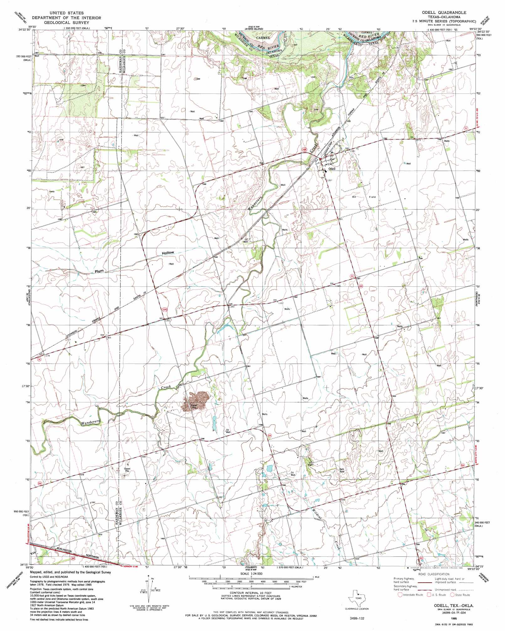
Odell Topo Map Texas
To zoom in, hover over the map of Odell
USGS Topo Quad 34099c4 - 1:24,000 scale
| Topo Map Name: | Odell |
| USGS Topo Quad ID: | 34099c4 |
| Print Size: | ca. 21 1/4" wide x 27" high |
| Southeast Coordinates: | 34.25° N latitude / 99.375° W longitude |
| Map Center Coordinates: | 34.3125° N latitude / 99.4375° W longitude |
| U.S. States: | TX, OK |
| Filename: | o34099c4.jpg |
| Download Map JPG Image: | Odell topo map 1:24,000 scale |
| Map Type: | Topographic |
| Topo Series: | 7.5´ |
| Map Scale: | 1:24,000 |
| Source of Map Images: | United States Geological Survey (USGS) |
| Alternate Map Versions: |
Odell TX 1985, updated 1986 Download PDF Buy paper map Odell TX 2010 Download PDF Buy paper map Odell TX 2012 Download PDF Buy paper map Odell TX 2016 Download PDF Buy paper map |
1:24,000 Topo Quads surrounding Odell
Duke Sw |
Prairie Hill |
Olustee |
Altus Se |
Tipton |
Eldorado |
Elmer Nw |
Ayers Island |
Elmer |
Frederick Nw |
Quanah East |
Chillicothe |
Odell |
Northside |
Frederick Sw |
Big Mound |
Medicine Mound |
Tolbert |
Vernon |
Oklaunion |
Margaret |
Warrior Hollow |
Rayland |
Lockett |
Boggy Creek |
> Back to 34099a1 at 1:100,000 scale
> Back to 34098a1 at 1:250,000 scale
> Back to U.S. Topo Maps home
Odell topo map: Gazetteer
Odell: Populated Places
Odell elevation 411m 1348′Odell: Valleys
Plum Hollow elevation 405m 1328′Odell digital topo map on disk
Buy this Odell topo map showing relief, roads, GPS coordinates and other geographical features, as a high-resolution digital map file on DVD: