Elmer Nw Topo Map Oklahoma
To zoom in, hover over the map of Elmer Nw
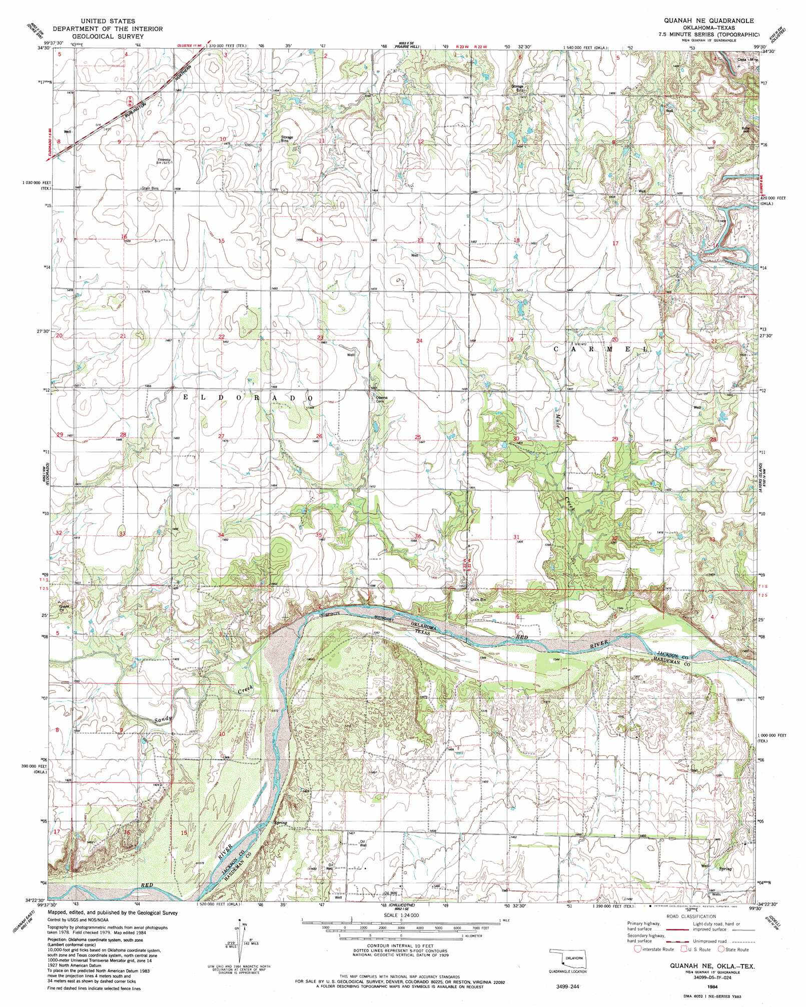
USGS Topo Quad 34099d5 - 1:24,000 scale
| Topo Map Name: | Elmer Nw |
| USGS Topo Quad ID: | 34099d5 |
| Print Size: | ca. 21 1/4" wide x 27" high |
| Southeast Coordinates: | 34.375° N latitude / 99.5° W longitude |
| Map Center Coordinates: | 34.4375° N latitude / 99.5625° W longitude |
| U.S. States: | OK, TX |
| Filename: | o34099d5.jpg |
| Download Map JPG Image: | Elmer Nw topo map 1:24,000 scale |
| Map Type: | Topographic |
| Topo Series: | 7.5´ |
| Map Scale: | 1:24,000 |
| Source of Map Images: | United States Geological Survey (USGS) |
| Alternate Map Versions: |
Quanah NE OK 1984, updated 1985 Download PDF Buy paper map Quanah NE OK 2010 Download PDF Buy paper map Quanah NE OK 2012 Download PDF Buy paper map Quanah NE OK 2016 Download PDF Buy paper map |
1:24,000 Topo Quads surrounding Elmer Nw
Gould |
Mcqueen |
Duke |
Martha |
Altus |
Hollis Se |
Duke Sw |
Prairie Hill |
Olustee |
Altus Se |
North Groesbeck |
Eldorado |
Elmer Nw |
Ayers Island |
Elmer |
Quanah West |
Quanah East |
Chillicothe |
Odell |
Northside |
Maybell Canyon |
Big Mound |
Medicine Mound |
Tolbert |
Vernon |
> Back to 34099a1 at 1:100,000 scale
> Back to 34098a1 at 1:250,000 scale
> Back to U.S. Topo Maps home
Elmer Nw topo map: Gazetteer
Elmer Nw: Mines
Walker Quarry elevation 450m 1476′Elmer Nw: Streams
Mule Creek elevation 408m 1338′Sandy Creek elevation 411m 1348′
Elmer Nw digital topo map on disk
Buy this Elmer Nw topo map showing relief, roads, GPS coordinates and other geographical features, as a high-resolution digital map file on DVD: