Olustee Topo Map Oklahoma
To zoom in, hover over the map of Olustee
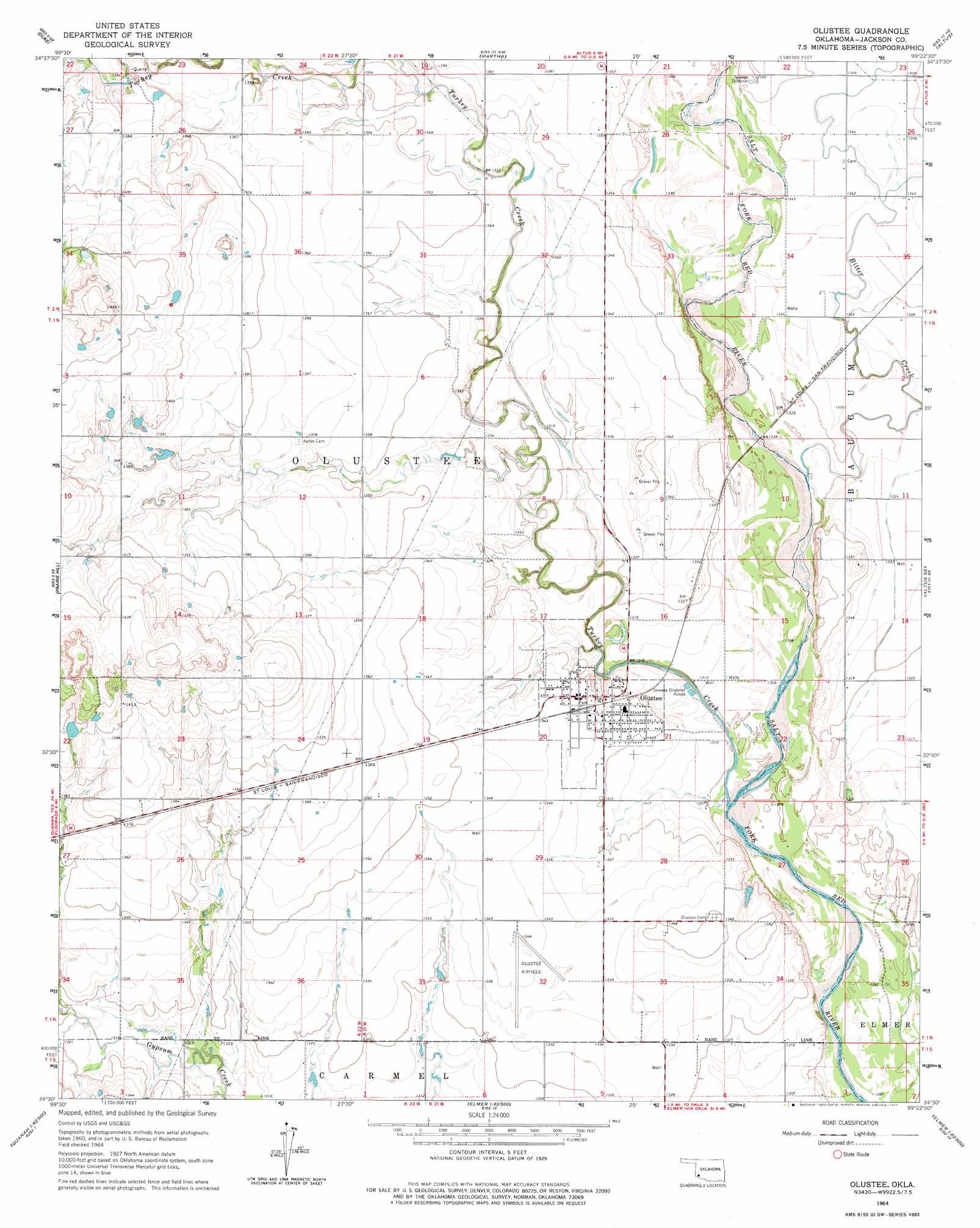
USGS Topo Quad 34099e4 - 1:24,000 scale
| Topo Map Name: | Olustee |
| USGS Topo Quad ID: | 34099e4 |
| Print Size: | ca. 21 1/4" wide x 27" high |
| Southeast Coordinates: | 34.5° N latitude / 99.375° W longitude |
| Map Center Coordinates: | 34.5625° N latitude / 99.4375° W longitude |
| U.S. State: | OK |
| Filename: | o34099e4.jpg |
| Download Map JPG Image: | Olustee topo map 1:24,000 scale |
| Map Type: | Topographic |
| Topo Series: | 7.5´ |
| Map Scale: | 1:24,000 |
| Source of Map Images: | United States Geological Survey (USGS) |
| Alternate Map Versions: |
Olustee OK 1964, updated 1965 Download PDF Buy paper map Olustee OK 1964, updated 1977 Download PDF Buy paper map Olustee OK 2010 Download PDF Buy paper map Olustee OK 2012 Download PDF Buy paper map Olustee OK 2016 Download PDF Buy paper map |
1:24,000 Topo Quads surrounding Olustee
Russell |
Mangum South |
Hester |
Blair |
Warren |
Mcqueen |
Duke |
Martha |
Altus |
Headrick |
Duke Sw |
Prairie Hill |
Olustee |
Altus Se |
Tipton |
Eldorado |
Elmer Nw |
Ayers Island |
Elmer |
Frederick Nw |
Quanah East |
Chillicothe |
Odell |
Northside |
Frederick Sw |
> Back to 34099e1 at 1:100,000 scale
> Back to 34098a1 at 1:250,000 scale
> Back to U.S. Topo Maps home
Olustee topo map: Gazetteer
Olustee: Airports
Olustee Municipal Airport elevation 408m 1338′Olustee: Populated Places
Olustee elevation 406m 1332′Olustee: Streams
Bitter Creek elevation 400m 1312′Turkey Creek elevation 394m 1292′
Olustee digital topo map on disk
Buy this Olustee topo map showing relief, roads, GPS coordinates and other geographical features, as a high-resolution digital map file on DVD: