Duke Sw Topo Map Oklahoma
To zoom in, hover over the map of Duke Sw
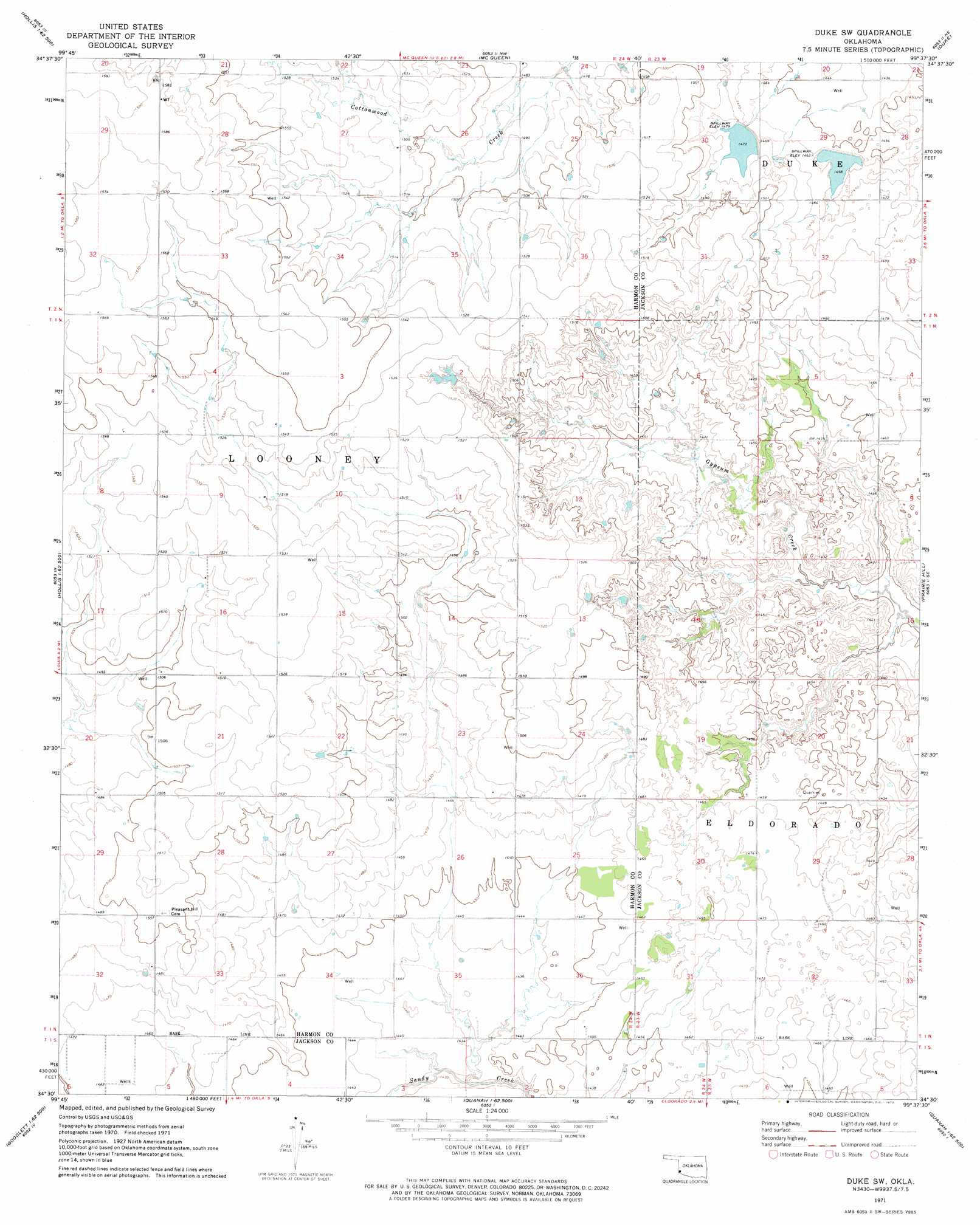
USGS Topo Quad 34099e6 - 1:24,000 scale
| Topo Map Name: | Duke Sw |
| USGS Topo Quad ID: | 34099e6 |
| Print Size: | ca. 21 1/4" wide x 27" high |
| Southeast Coordinates: | 34.5° N latitude / 99.625° W longitude |
| Map Center Coordinates: | 34.5625° N latitude / 99.6875° W longitude |
| U.S. State: | OK |
| Filename: | o34099e6.jpg |
| Download Map JPG Image: | Duke Sw topo map 1:24,000 scale |
| Map Type: | Topographic |
| Topo Series: | 7.5´ |
| Map Scale: | 1:24,000 |
| Source of Map Images: | United States Geological Survey (USGS) |
| Alternate Map Versions: |
Duke SW OK 1971, updated 1973 Download PDF Buy paper map Duke SW OK 2010 Download PDF Buy paper map Duke SW OK 2012 Download PDF Buy paper map Duke SW OK 2016 Download PDF Buy paper map |
1:24,000 Topo Quads surrounding Duke Sw
Mcknight |
Shrewder |
Russell |
Mangum South |
Hester |
Hollis |
Gould |
Mcqueen |
Duke |
Martha |
Hollis Sw |
Hollis Se |
Duke Sw |
Prairie Hill |
Olustee |
Williams |
North Groesbeck |
Eldorado |
Elmer Nw |
Ayers Island |
Goodlett |
Quanah West |
Quanah East |
Chillicothe |
Odell |
> Back to 34099e1 at 1:100,000 scale
> Back to 34098a1 at 1:250,000 scale
> Back to U.S. Topo Maps home
Duke Sw topo map: Gazetteer
Duke Sw: Dams
Tri-County Turkey Creek Site 23 Dam elevation 449m 1473′Tri-County Turkey Creek Site 24 Dam elevation 445m 1459′
Duke Sw: Reservoirs
Tri-County Turkey Creek Site 23 Reservoir elevation 449m 1473′Tri-County Turkey Creek Site 24 Reservoir elevation 445m 1459′
Duke Sw digital topo map on disk
Buy this Duke Sw topo map showing relief, roads, GPS coordinates and other geographical features, as a high-resolution digital map file on DVD: