Gould Topo Map Oklahoma
To zoom in, hover over the map of Gould
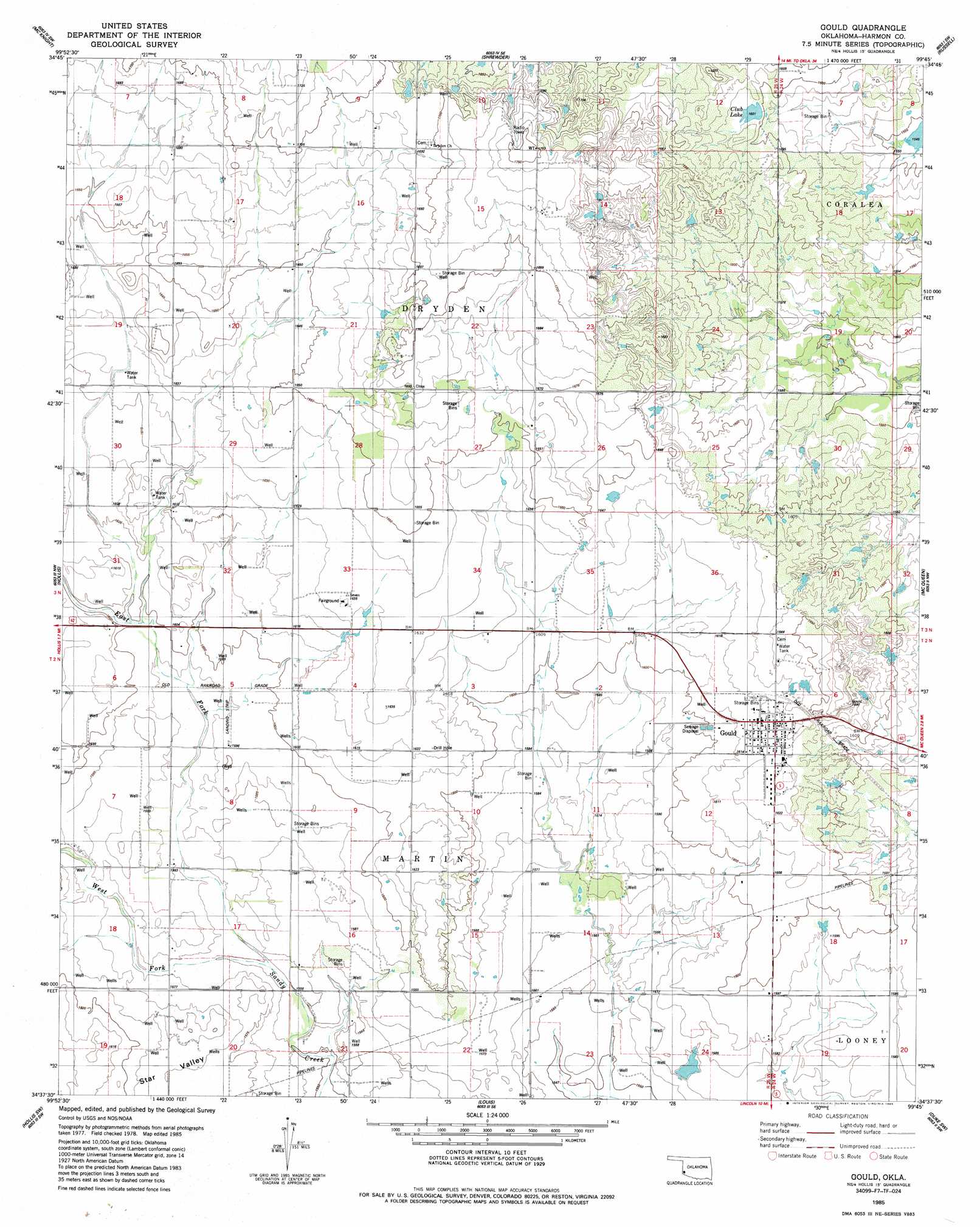
USGS Topo Quad 34099f7 - 1:24,000 scale
| Topo Map Name: | Gould |
| USGS Topo Quad ID: | 34099f7 |
| Print Size: | ca. 21 1/4" wide x 27" high |
| Southeast Coordinates: | 34.625° N latitude / 99.75° W longitude |
| Map Center Coordinates: | 34.6875° N latitude / 99.8125° W longitude |
| U.S. State: | OK |
| Filename: | o34099f7.jpg |
| Download Map JPG Image: | Gould topo map 1:24,000 scale |
| Map Type: | Topographic |
| Topo Series: | 7.5´ |
| Map Scale: | 1:24,000 |
| Source of Map Images: | United States Geological Survey (USGS) |
| Alternate Map Versions: |
Gould OK 1985, updated 1985 Download PDF Buy paper map Gould OK 2010 Download PDF Buy paper map Gould OK 2012 Download PDF Buy paper map Gould OK 2016 Download PDF Buy paper map |
1:24,000 Topo Quads surrounding Gould
Shinnery Creek |
Madge |
Vinson |
Reed |
Mangum North |
Dodson |
Mcknight |
Shrewder |
Russell |
Mangum South |
Arlie |
Hollis |
Gould |
Mcqueen |
Duke |
Garden Valley |
Hollis Sw |
Hollis Se |
Duke Sw |
Prairie Hill |
Kirkland North |
Williams |
North Groesbeck |
Eldorado |
Elmer Nw |
> Back to 34099e1 at 1:100,000 scale
> Back to 34098a1 at 1:250,000 scale
> Back to U.S. Topo Maps home
Gould topo map: Gazetteer
Gould: Airports
Michael Airport elevation 485m 1591′Gould: Populated Places
Gould elevation 497m 1630′Gould: Reservoirs
Club Lake elevation 488m 1601′Gould: Streams
East Fork Sandy Creek elevation 476m 1561′West Fork Sandy Creek elevation 475m 1558′
Gould: Valleys
Star Valley elevation 476m 1561′Gould digital topo map on disk
Buy this Gould topo map showing relief, roads, GPS coordinates and other geographical features, as a high-resolution digital map file on DVD: