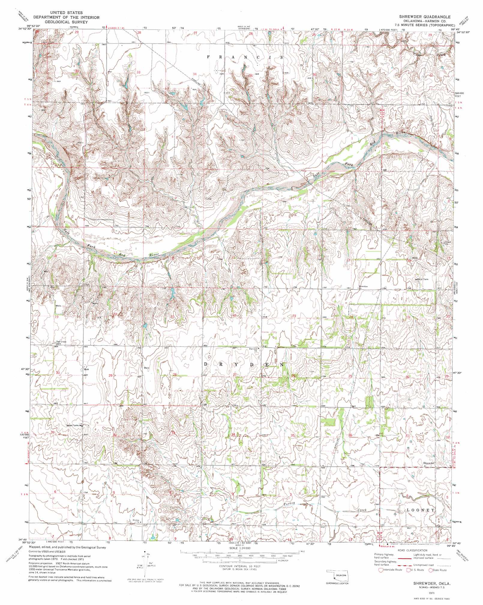
Shrewder Topo Map Oklahoma
To zoom in, hover over the map of Shrewder
USGS Topo Quad 34099g7 - 1:24,000 scale
| Topo Map Name: | Shrewder |
| USGS Topo Quad ID: | 34099g7 |
| Print Size: | ca. 21 1/4" wide x 27" high |
| Southeast Coordinates: | 34.75° N latitude / 99.75° W longitude |
| Map Center Coordinates: | 34.8125° N latitude / 99.8125° W longitude |
| U.S. State: | OK |
| Filename: | o34099g7.jpg |
| Download Map JPG Image: | Shrewder topo map 1:24,000 scale |
| Map Type: | Topographic |
| Topo Series: | 7.5´ |
| Map Scale: | 1:24,000 |
| Source of Map Images: | United States Geological Survey (USGS) |
| Alternate Map Versions: |
Shrewder OK 1971, updated 1973 Download PDF Buy paper map Shrewder OK 2010 Download PDF Buy paper map Shrewder OK 2012 Download PDF Buy paper map Shrewder OK 2016 Download PDF Buy paper map |
1:24,000 Topo Quads surrounding Shrewder
Little Wolf Creek |
Bull Creek |
Minnow Creek |
Plainview |
Willow |
Shinnery Creek |
Madge |
Vinson |
Reed |
Mangum North |
Dodson |
Mcknight |
Shrewder |
Russell |
Mangum South |
Arlie |
Hollis |
Gould |
Mcqueen |
Duke |
Garden Valley |
Hollis Sw |
Hollis Se |
Duke Sw |
Prairie Hill |
> Back to 34099e1 at 1:100,000 scale
> Back to 34098a1 at 1:250,000 scale
> Back to U.S. Topo Maps home
Shrewder topo map: Gazetteer
Shrewder: Dams
Bob Moran Dam elevation 537m 1761′Claude Seymour Dam elevation 543m 1781′
Danny E Hill Dam elevation 546m 1791′
Dewayne Meyers Dam elevation 515m 1689′
Gracie Chambers Dam elevation 554m 1817′
Kent Pence Dam elevation 530m 1738′
Tri-County Turkey Creek Site 1a Dam elevation 496m 1627′
Tri-County Turkey Creek Site 28b Dam elevation 496m 1627′
Tri-County Turkey Creek Site 28d Dam elevation 494m 1620′
Shrewder: Populated Places
Ron elevation 555m 1820′Shrewder elevation 483m 1584′
Shrewder: Reservoirs
Bob Moran Reservoir elevation 537m 1761′Claude Seymour Reservoir elevation 543m 1781′
Danny E Hill Reservoir elevation 546m 1791′
Dewayne Meyers Reservoir elevation 515m 1689′
Gracie Chambers Reservoir elevation 554m 1817′
Kent Pence Reservoir elevation 530m 1738′
Tri-County Turkey Creek Site 1a Reservoir elevation 496m 1627′
Tri-County Turkey Creek Site 28b Reservoir elevation 496m 1627′
Tri-County Turkey Creek Site 28d Reservoir elevation 494m 1620′
Shrewder digital topo map on disk
Buy this Shrewder topo map showing relief, roads, GPS coordinates and other geographical features, as a high-resolution digital map file on DVD: