Mcknight Topo Map Oklahoma
To zoom in, hover over the map of Mcknight
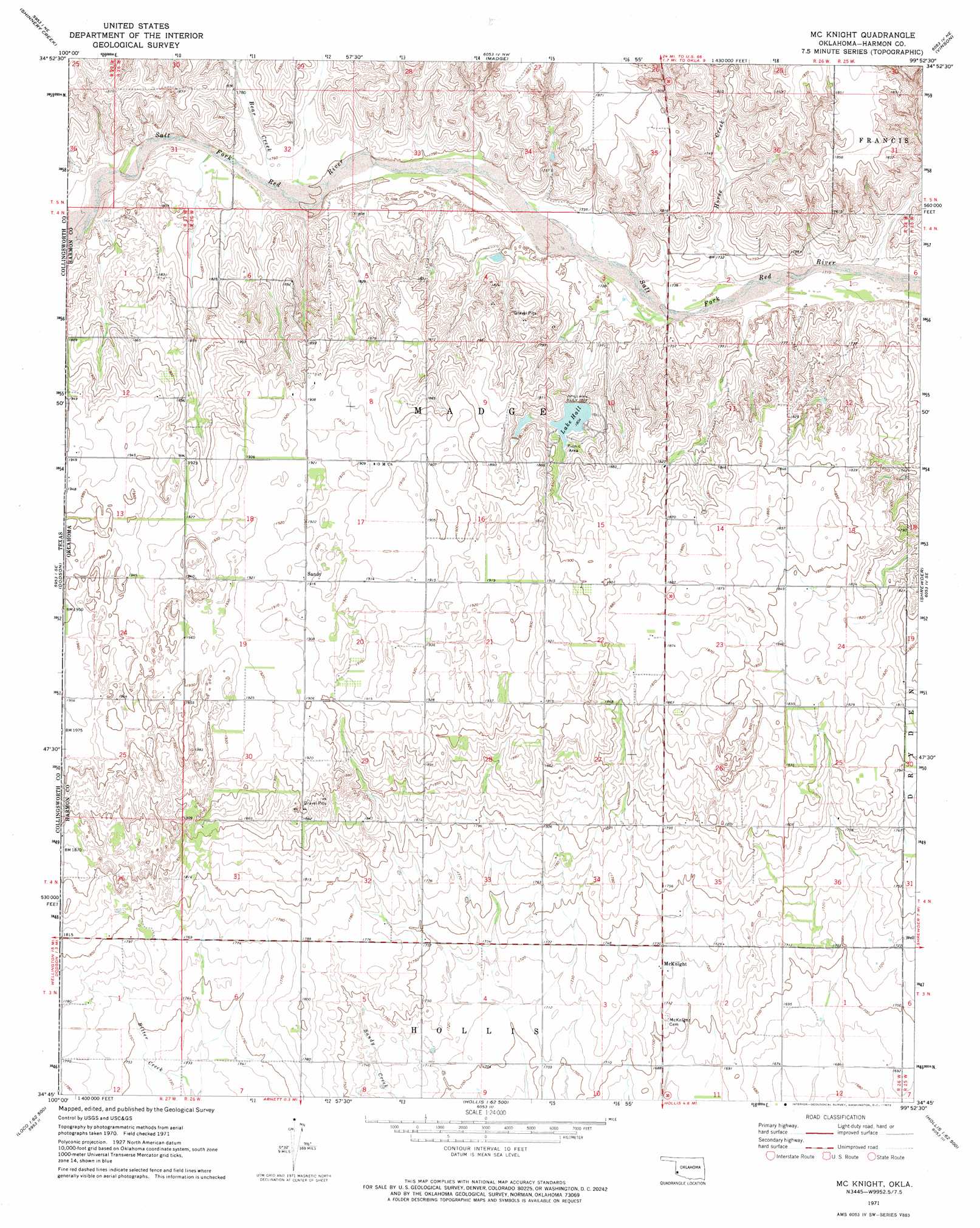
USGS Topo Quad 34099g8 - 1:24,000 scale
| Topo Map Name: | Mcknight |
| USGS Topo Quad ID: | 34099g8 |
| Print Size: | ca. 21 1/4" wide x 27" high |
| Southeast Coordinates: | 34.75° N latitude / 99.875° W longitude |
| Map Center Coordinates: | 34.8125° N latitude / 99.9375° W longitude |
| U.S. State: | OK |
| Filename: | o34099g8.jpg |
| Download Map JPG Image: | Mcknight topo map 1:24,000 scale |
| Map Type: | Topographic |
| Topo Series: | 7.5´ |
| Map Scale: | 1:24,000 |
| Source of Map Images: | United States Geological Survey (USGS) |
| Alternate Map Versions: |
Mc Knight OK 1971, updated 1973 Download PDF Buy paper map McKnight OK 2010 Download PDF Buy paper map McKnight OK 2012 Download PDF Buy paper map McKnight OK 2016 Download PDF Buy paper map |
1:24,000 Topo Quads surrounding Mcknight
Lutie |
Little Wolf Creek |
Bull Creek |
Minnow Creek |
Plainview |
Wellington Nw |
Shinnery Creek |
Madge |
Vinson |
Reed |
Wellington |
Dodson |
Mcknight |
Shrewder |
Russell |
Loco |
Arlie |
Hollis |
Gould |
Mcqueen |
Smithdale |
Garden Valley |
Hollis Sw |
Hollis Se |
Duke Sw |
> Back to 34099e1 at 1:100,000 scale
> Back to 34098a1 at 1:250,000 scale
> Back to U.S. Topo Maps home
Mcknight topo map: Gazetteer
Mcknight: Dams
Mary Kromer Dam elevation 560m 1837′Oklahoma State Fish and Wildlife Dam elevation 550m 1804′
Mcknight: Populated Places
McKnight elevation 526m 1725′Sandy elevation 585m 1919′
Mcknight: Reservoirs
Lake Halt elevation 548m 1797′Mary Kromer Reservoir elevation 560m 1837′
Oklahoma State Fish and Wildlife Reservoir elevation 550m 1804′
Mcknight: Streams
Bear Creek elevation 535m 1755′Horse Creek elevation 524m 1719′
Mcknight digital topo map on disk
Buy this Mcknight topo map showing relief, roads, GPS coordinates and other geographical features, as a high-resolution digital map file on DVD: