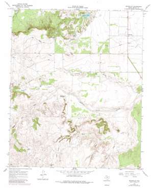
Whiteflat Topo Map Texas
To zoom in, hover over the map of Whiteflat
USGS Topo Quad 34100a8 - 1:24,000 scale
| Topo Map Name: | Whiteflat |
| USGS Topo Quad ID: | 34100a8 |
| Print Size: | ca. 21 1/4" wide x 27" high |
| Southeast Coordinates: | 34° N latitude / 100.875° W longitude |
| Map Center Coordinates: | 34.0625° N latitude / 100.9375° W longitude |
| U.S. State: | TX |
| Filename: | o34100a8.jpg |
| Download Map JPG Image: | Whiteflat topo map 1:24,000 scale |
| Map Type: | Topographic |
| Topo Series: | 7.5´ |
| Map Scale: | 1:24,000 |
| Source of Map Images: | United States Geological Survey (USGS) |
| Alternate Map Versions: |
Whiteflat TX 1967, updated 1970 Download PDF Buy paper map Whiteflat TX 1967, updated 1981 Download PDF Buy paper map Whiteflat TX 2010 Download PDF Buy paper map Whiteflat TX 2012 Download PDF Buy paper map Whiteflat TX 2016 Download PDF Buy paper map |
1:24,000 Topo Quads surrounding Whiteflat
> Back to 34100a1 at 1:100,000 scale
> Back to 34100a1 at 1:250,000 scale
> Back to U.S. Topo Maps home
Whiteflat topo map: Gazetteer
Whiteflat: Dams
Horner Lake Dam elevation 738m 2421′Jack Spray Lake Dam elevation 764m 2506′
Whiteflat: Populated Places
Whiteflat elevation 735m 2411′Whiteflat: Reservoirs
Cedar Tank elevation 763m 2503′Hawk Hill Tank elevation 788m 2585′
Horner Lake elevation 740m 2427′
Jack Spray Lake elevation 764m 2506′
Whiteflat: Streams
Boggy Creek elevation 768m 2519′Chimney Creek elevation 806m 2644′
Dripping Springs elevation 768m 2519′
Mott Creek elevation 768m 2519′
Salt Creek elevation 731m 2398′
Tom Handle Creek elevation 725m 2378′
Whiteflat: Summits
Antelope Hill elevation 824m 2703′Boone Mountain elevation 791m 2595′
Connally Peak elevation 807m 2647′
Whiteflat: Valleys
Jesse James Draw elevation 813m 2667′Lost Canyon elevation 772m 2532′
Shinnery Draw elevation 760m 2493′
Whiteflat digital topo map on disk
Buy this Whiteflat topo map showing relief, roads, GPS coordinates and other geographical features, as a high-resolution digital map file on DVD:


