Folley Topo Map Texas
To zoom in, hover over the map of Folley
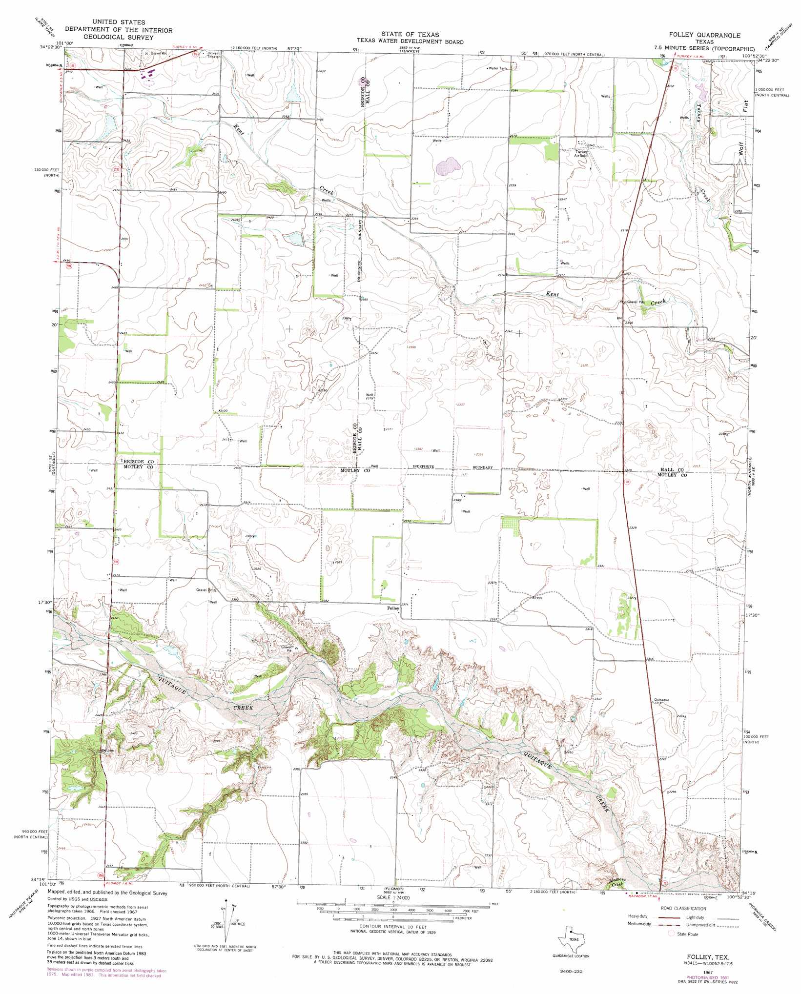
USGS Topo Quad 34100c8 - 1:24,000 scale
| Topo Map Name: | Folley |
| USGS Topo Quad ID: | 34100c8 |
| Print Size: | ca. 21 1/4" wide x 27" high |
| Southeast Coordinates: | 34.25° N latitude / 100.875° W longitude |
| Map Center Coordinates: | 34.3125° N latitude / 100.9375° W longitude |
| U.S. State: | TX |
| Filename: | o34100c8.jpg |
| Download Map JPG Image: | Folley topo map 1:24,000 scale |
| Map Type: | Topographic |
| Topo Series: | 7.5´ |
| Map Scale: | 1:24,000 |
| Source of Map Images: | United States Geological Survey (USGS) |
| Alternate Map Versions: |
Folley TX 1967, updated 1970 Download PDF Buy paper map Folley TX 1967, updated 1981 Download PDF Buy paper map Folley TX 2010 Download PDF Buy paper map Folley TX 2012 Download PDF Buy paper map Folley TX 2016 Download PDF Buy paper map |
1:24,000 Topo Quads surrounding Folley
Indian Peak |
Schott Mountain |
Hughes Canyon |
Heel Fly Draw |
Plaska |
Hay Lake |
Lake Theo |
Turkey |
Tampico Siding |
Blue Tank Canyon |
Edgemon Lake |
Quitaque |
Folley |
North Windmill |
Cottonwood Camp |
Wilson Creek |
Quitaque Peaks |
Flomot |
Hornica Creek |
Turtle Hole Camp |
Lockney 4 Sw |
Dick Moore Canyon |
Whiteflat |
Matador |
Ballard Camp |
> Back to 34100a1 at 1:100,000 scale
> Back to 34100a1 at 1:250,000 scale
> Back to U.S. Topo Maps home
Folley topo map: Gazetteer
Folley: Dams
Soil Conservation Service Site 5 Dam elevation 741m 2431′Soil Conservation Service Site 6 Dam elevation 731m 2398′
Soil Conservation Service Site 7 Dam elevation 732m 2401′
Folley: Populated Places
Folley elevation 724m 2375′Folley: Reservoirs
Soil Conservation Service Site 5 Reservoir elevation 741m 2431′Soil Conservation Service Site 6 Reservoir elevation 731m 2398′
Soil Conservation Service Site 7 Reservoir elevation 732m 2401′
Folley: Streams
Alamosa Creek elevation 668m 2191′Roberts Creek elevation 715m 2345′
Folley digital topo map on disk
Buy this Folley topo map showing relief, roads, GPS coordinates and other geographical features, as a high-resolution digital map file on DVD: