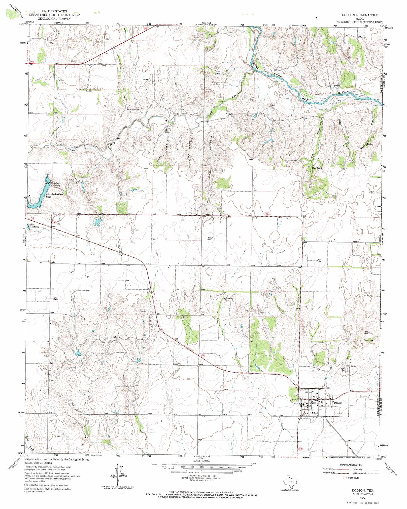
Dodson Topo Map Texas
To zoom in, hover over the map of Dodson
USGS Topo Quad 34100g1 - 1:24,000 scale
| Topo Map Name: | Dodson |
| USGS Topo Quad ID: | 34100g1 |
| Print Size: | ca. 21 1/4" wide x 27" high |
| Southeast Coordinates: | 34.75° N latitude / 100° W longitude |
| Map Center Coordinates: | 34.8125° N latitude / 100.0625° W longitude |
| U.S. State: | TX |
| Filename: | o34100g1.jpg |
| Download Map JPG Image: | Dodson topo map 1:24,000 scale |
| Map Type: | Topographic |
| Topo Series: | 7.5´ |
| Map Scale: | 1:24,000 |
| Source of Map Images: | United States Geological Survey (USGS) |
| Alternate Map Versions: |
Dodson TX 1964, updated 1967 Download PDF Buy paper map Dodson TX 2010 Download PDF Buy paper map Dodson TX 2013 Download PDF Buy paper map Dodson TX 2016 Download PDF Buy paper map |
1:24,000 Topo Quads surrounding Dodson
Dozier |
Lutie |
Little Wolf Creek |
Bull Creek |
Minnow Creek |
Rolla Ne |
Wellington Nw |
Shinnery Creek |
Madge |
Vinson |
Rolla |
Wellington |
Dodson |
Mcknight |
Shrewder |
Estelline Ne |
Loco |
Arlie |
Hollis |
Gould |
Estelline Se |
Smithdale |
Garden Valley |
Hollis Sw |
Hollis Se |
> Back to 34100e1 at 1:100,000 scale
> Back to 34100a1 at 1:250,000 scale
> Back to U.S. Topo Maps home
Dodson topo map: Gazetteer
Dodson: Populated Places
Dodson elevation 546m 1791′Dodson: Reservoirs
Allred-Sessions Lake elevation 579m 1899′Dodson: Springs
Sand Creek Springs elevation 593m 1945′Dodson: Streams
Billy Creek elevation 543m 1781′Di Gob Creek elevation 543m 1781′
Hunt Creek elevation 543m 1781′
Junkie Creek elevation 556m 1824′
Memo Creek elevation 561m 1840′
Sand Creek elevation 545m 1788′
Uncle Frank Creek elevation 558m 1830′
Dodson digital topo map on disk
Buy this Dodson topo map showing relief, roads, GPS coordinates and other geographical features, as a high-resolution digital map file on DVD: