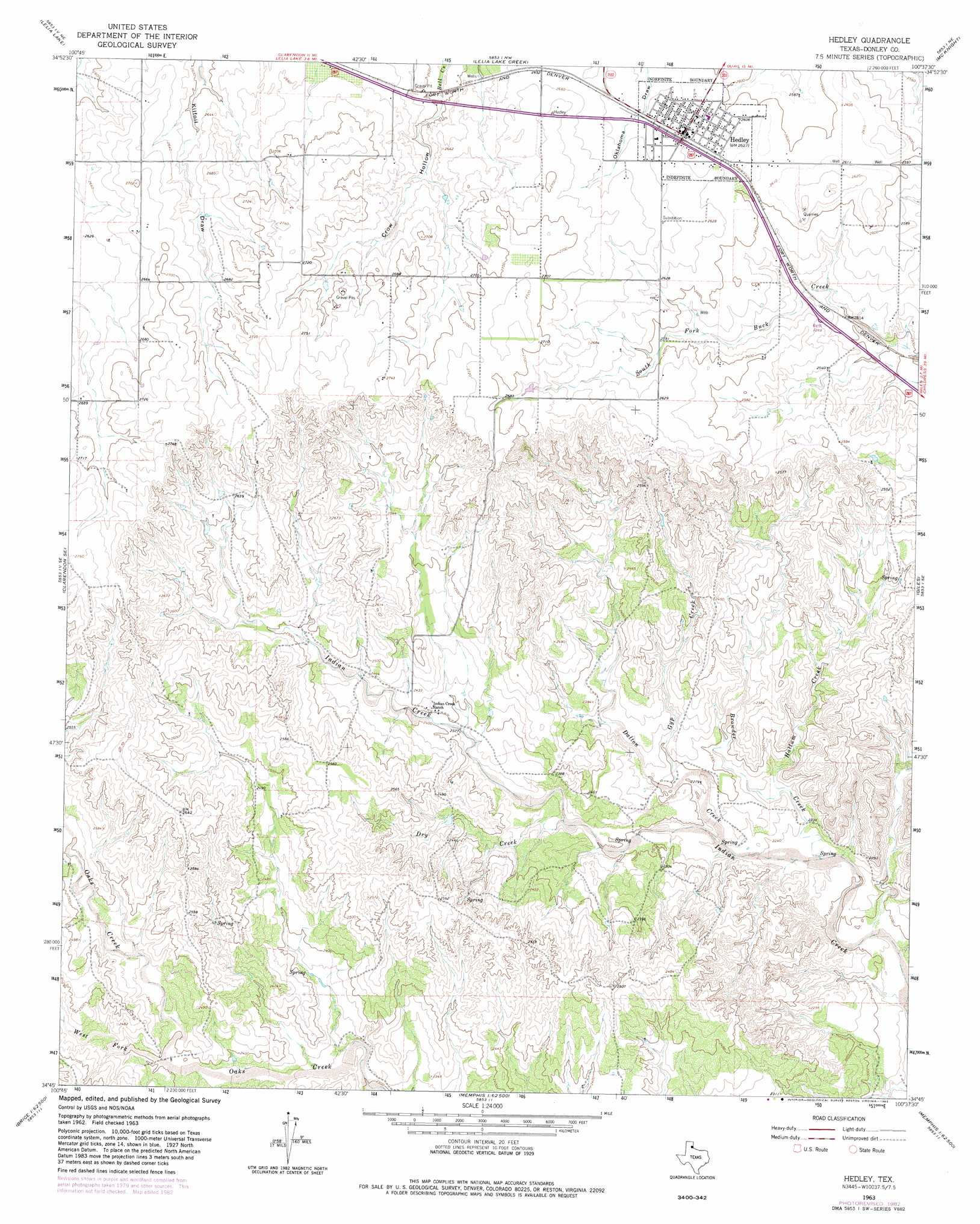
Hedley Topo Map Texas
To zoom in, hover over the map of Hedley
USGS Topo Quad 34100g6 - 1:24,000 scale
| Topo Map Name: | Hedley |
| USGS Topo Quad ID: | 34100g6 |
| Print Size: | ca. 21 1/4" wide x 27" high |
| Southeast Coordinates: | 34.75° N latitude / 100.625° W longitude |
| Map Center Coordinates: | 34.8125° N latitude / 100.6875° W longitude |
| U.S. State: | TX |
| Filename: | o34100g6.jpg |
| Download Map JPG Image: | Hedley topo map 1:24,000 scale |
| Map Type: | Topographic |
| Topo Series: | 7.5´ |
| Map Scale: | 1:24,000 |
| Source of Map Images: | United States Geological Survey (USGS) |
| Alternate Map Versions: |
Hedley TX 1963, updated 1965 Download PDF Buy paper map Hedley TX 1963, updated 1982 Download PDF Buy paper map Hedley TX 2010 Download PDF Buy paper map Hedley TX 2012 Download PDF Buy paper map Hedley TX 2016 Download PDF Buy paper map |
1:24,000 Topo Quads surrounding Hedley
Roach Ranch |
Griffin Ranch |
Troublesome Creek |
Spencer Lake |
Abra |
Clarendon |
Lelia Lake |
Lelia Lake Creek |
Mcknight |
Quail |
Clarendon Sw |
Clarendon Se |
Hedley |
Giles |
Rolla Sw |
Brice |
Lesley |
Memphis Nw |
Memphis |
Estelline Nw |
Hughes Canyon |
Heel Fly Draw |
Plaska |
Parnell |
Estelline |
> Back to 34100e1 at 1:100,000 scale
> Back to 34100a1 at 1:250,000 scale
> Back to U.S. Topo Maps home
Hedley topo map: Gazetteer
Hedley: Populated Places
Hedley elevation 799m 2621′Hedley: Springs
Indian Creek Spring elevation 761m 2496′Indian Creek Spring elevation 689m 2260′
Hedley: Streams
Browder Creek elevation 675m 2214′Dalton Creek elevation 689m 2260′
Dry Creek elevation 707m 2319′
Gyp Creek elevation 698m 2290′
Hallum Creek elevation 684m 2244′
West Fork Oaks Creek elevation 728m 2388′
Hedley: Valleys
Crow Hollow elevation 790m 2591′Hedley digital topo map on disk
Buy this Hedley topo map showing relief, roads, GPS coordinates and other geographical features, as a high-resolution digital map file on DVD: