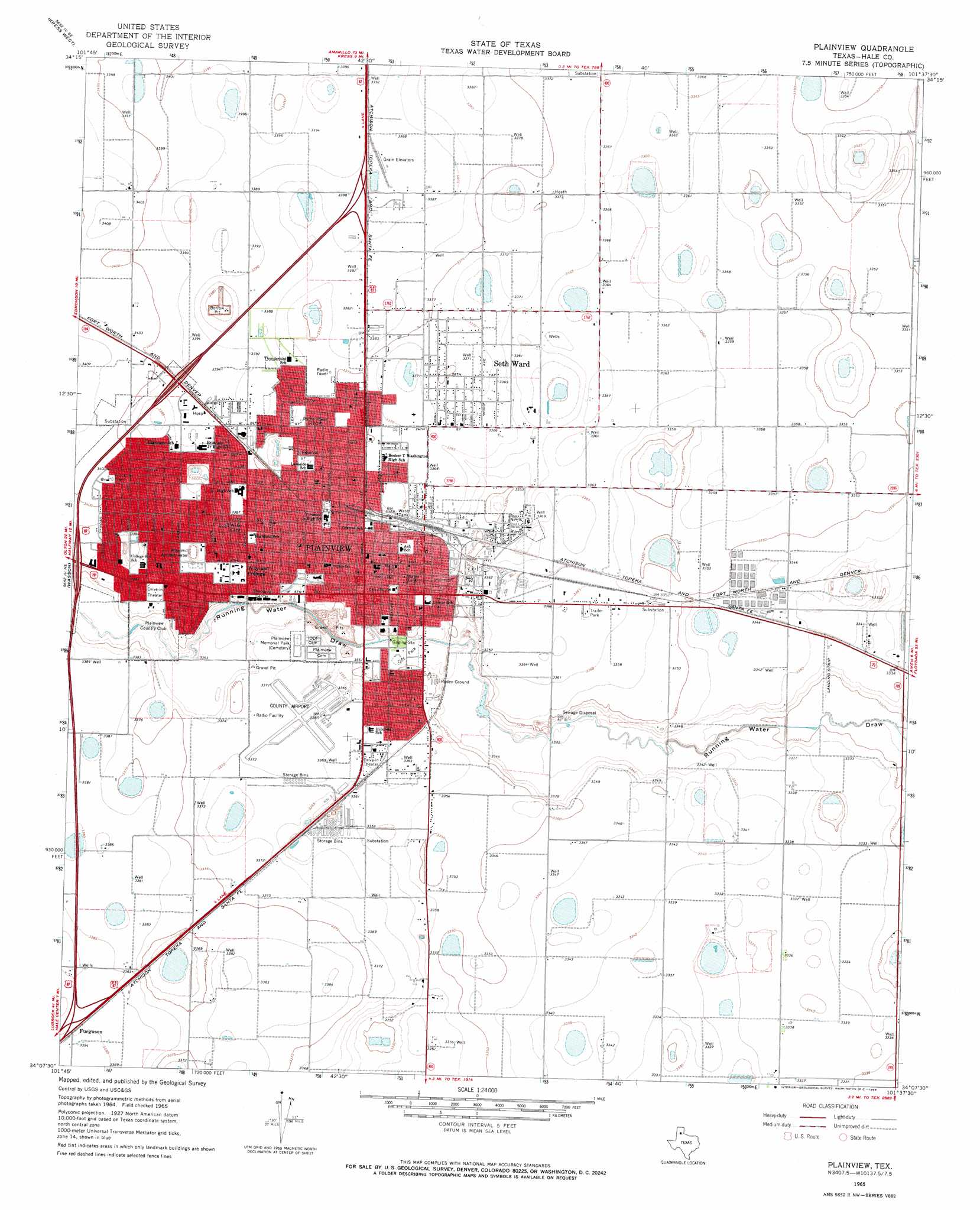
Plainview Topo Map Texas
To zoom in, hover over the map of Plainview
USGS Topo Quad 34101b6 - 1:24,000 scale
| Topo Map Name: | Plainview |
| USGS Topo Quad ID: | 34101b6 |
| Print Size: | ca. 21 1/4" wide x 27" high |
| Southeast Coordinates: | 34.125° N latitude / 101.625° W longitude |
| Map Center Coordinates: | 34.1875° N latitude / 101.6875° W longitude |
| U.S. State: | TX |
| Filename: | o34101b6.jpg |
| Download Map JPG Image: | Plainview topo map 1:24,000 scale |
| Map Type: | Topographic |
| Topo Series: | 7.5´ |
| Map Scale: | 1:24,000 |
| Source of Map Images: | United States Geological Survey (USGS) |
| Alternate Map Versions: |
Plainview TX 1965, updated 1968 Download PDF Buy paper map Plainview TX 2010 Download PDF Buy paper map Plainview TX 2012 Download PDF Buy paper map Plainview TX 2016 Download PDF Buy paper map |
1:24,000 Topo Quads surrounding Plainview
Center Plains School |
Edmonson Ne |
Claytonville Nw |
Claytonville |
Rock Creek |
Edmonson |
Kress West |
Kress East |
Providence |
Silverton Sw |
Halfway |
Wasson |
Plainview |
Aiken |
Sterley |
Hale Center Sw |
Hale Center |
Happy Union |
Plainview Se |
Lockney |
Cotton Center |
Underwood |
Julia Lake |
Barwise |
Sandhill |
> Back to 34101a1 at 1:100,000 scale
> Back to 34100a1 at 1:250,000 scale
> Back to U.S. Topo Maps home
Plainview topo map: Gazetteer
Plainview: Airports
Hale County Airport elevation 1028m 3372′Horan Airport elevation 1013m 3323′
Plainview: Parks
Broadway Park elevation 1021m 3349′E Givens Park elevation 1024m 3359′
Frisco Park elevation 1023m 3356′
Hood Park elevation 1036m 3398′
Lakeside Park elevation 1026m 3366′
Plainview City Park elevation 1022m 3353′
Running Water Draw Regional Park elevation 1016m 3333′
Plainview: Populated Places
Furguson elevation 1034m 3392′Plainview elevation 1025m 3362′
Seth Ward elevation 1028m 3372′
Plainview digital topo map on disk
Buy this Plainview topo map showing relief, roads, GPS coordinates and other geographical features, as a high-resolution digital map file on DVD: