Wasson Topo Map Texas
To zoom in, hover over the map of Wasson
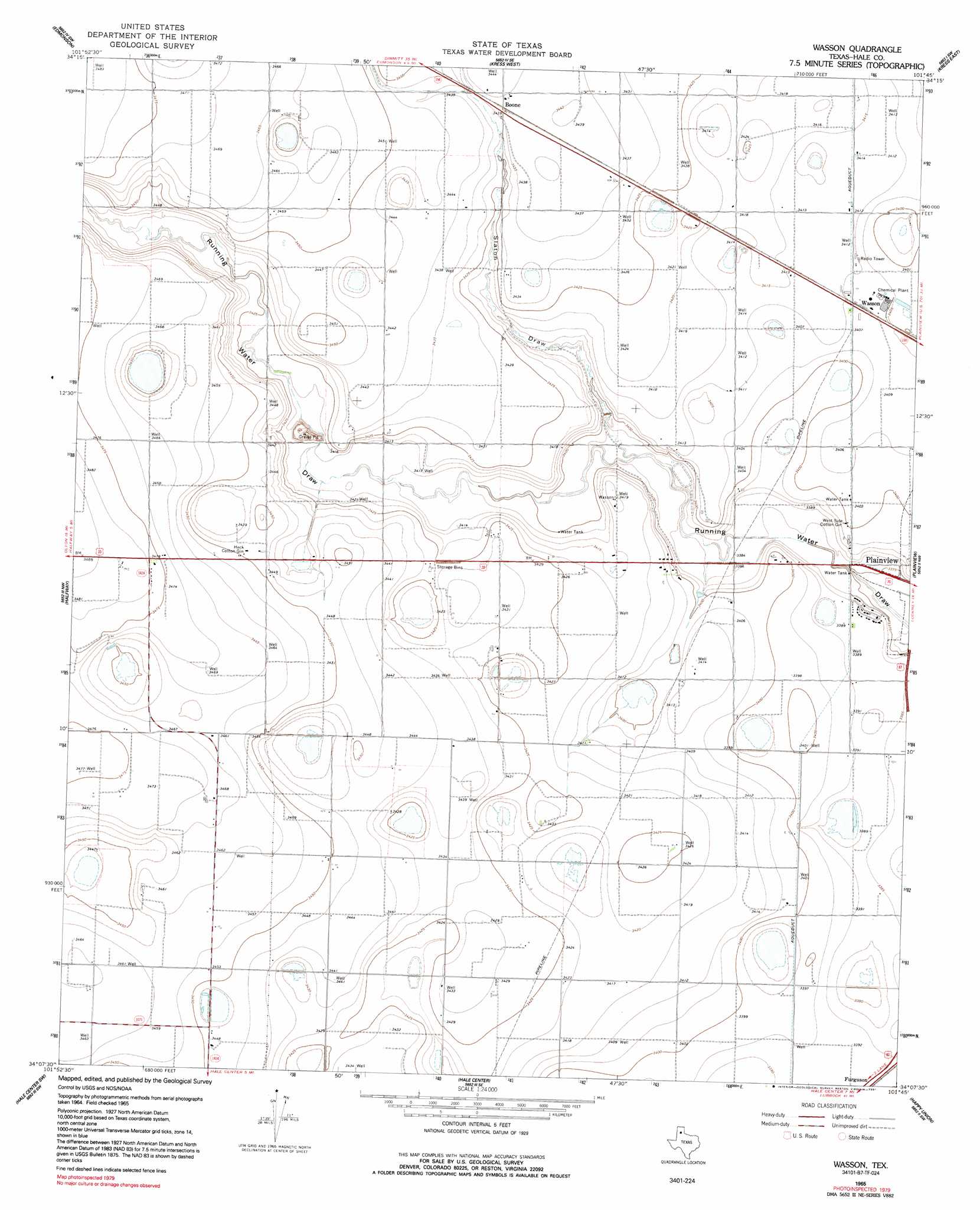
USGS Topo Quad 34101b7 - 1:24,000 scale
| Topo Map Name: | Wasson |
| USGS Topo Quad ID: | 34101b7 |
| Print Size: | ca. 21 1/4" wide x 27" high |
| Southeast Coordinates: | 34.125° N latitude / 101.75° W longitude |
| Map Center Coordinates: | 34.1875° N latitude / 101.8125° W longitude |
| U.S. State: | TX |
| Filename: | o34101b7.jpg |
| Download Map JPG Image: | Wasson topo map 1:24,000 scale |
| Map Type: | Topographic |
| Topo Series: | 7.5´ |
| Map Scale: | 1:24,000 |
| Source of Map Images: | United States Geological Survey (USGS) |
| Alternate Map Versions: |
Wasson TX 1965, updated 1968 Download PDF Buy paper map Wasson TX 1965, updated 1991 Download PDF Buy paper map Wasson TX 2010 Download PDF Buy paper map Wasson TX 2012 Download PDF Buy paper map Wasson TX 2016 Download PDF Buy paper map |
1:24,000 Topo Quads surrounding Wasson
Hart |
Center Plains School |
Edmonson Ne |
Claytonville Nw |
Claytonville |
Hilburn |
Edmonson |
Kress West |
Kress East |
Providence |
Olton Ne |
Halfway |
Wasson |
Plainview |
Aiken |
Corry |
Hale Center Sw |
Hale Center |
Happy Union |
Plainview Se |
Anton Ne |
Cotton Center |
Underwood |
Julia Lake |
Barwise |
> Back to 34101a1 at 1:100,000 scale
> Back to 34100a1 at 1:250,000 scale
> Back to U.S. Topo Maps home
Wasson topo map: Gazetteer
Wasson: Airports
Willis-Isler Airport elevation 1052m 3451′Wasson: Dams
Soil Conservation Service Site 4 Dam elevation 1036m 3398′Wasson: Populated Places
Boone elevation 1049m 3441′Wasson elevation 1040m 3412′
Wasson: Reservoirs
Soil Conservation Service Site 4 Reservoir elevation 1036m 3398′Wasson: Valleys
Slaton Draw elevation 1034m 3392′Wasson digital topo map on disk
Buy this Wasson topo map showing relief, roads, GPS coordinates and other geographical features, as a high-resolution digital map file on DVD: