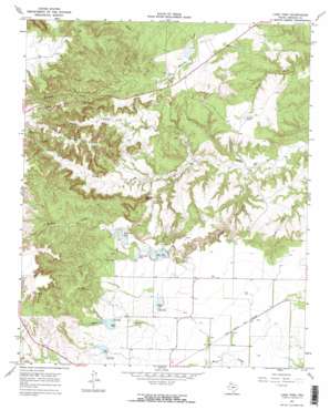
Lake Theo Topo Map Texas
To zoom in, hover over the map of Lake Theo
USGS Topo Quad 34101d1 - 1:24,000 scale
| Topo Map Name: | Lake Theo |
| USGS Topo Quad ID: | 34101d1 |
| Print Size: | ca. 21 1/4" wide x 27" high |
| Southeast Coordinates: | 34.375° N latitude / 101° W longitude |
| Map Center Coordinates: | 34.4375° N latitude / 101.0625° W longitude |
| U.S. State: | TX |
| Filename: | o34101d1.jpg |
| Download Map JPG Image: | Lake Theo topo map 1:24,000 scale |
| Map Type: | Topographic |
| Topo Series: | 7.5´ |
| Map Scale: | 1:24,000 |
| Source of Map Images: | United States Geological Survey (USGS) |
| Alternate Map Versions: |
Lake Theo TX 1967, updated 1970 Download PDF Buy paper map Lake Theo TX 1967, updated 1970 Download PDF Buy paper map Lake Theo TX 1967, updated 1970 Download PDF Buy paper map Lake Theo TX 2010 Download PDF Buy paper map Lake Theo TX 2012 Download PDF Buy paper map Lake Theo TX 2016 Download PDF Buy paper map |
1:24,000 Topo Quads surrounding Lake Theo
> Back to 34101a1 at 1:100,000 scale
> Back to 34100a1 at 1:250,000 scale
> Back to U.S. Topo Maps home
Lake Theo topo map: Gazetteer
Lake Theo: Arches
Natural Bridge elevation 717m 2352′Lake Theo: Dams
Collier Tank Dam elevation 759m 2490′Hawkins Lake Dam elevation 815m 2673′
Lake Theo Dam elevation 794m 2604′
Luther Lake Dam elevation 755m 2477′
Soil Conservation Service Site 1 Dam elevation 810m 2657′
Soil Conservation Service Site 2 Dam elevation 811m 2660′
Soil Conservation Service Site 3 Dam elevation 789m 2588′
Lake Theo: Parks
Caprock Canyons State Park elevation 743m 2437′Lake Theo: Reservoirs
Collier Tank elevation 759m 2490′Dry Creek Lake elevation 811m 2660′
Hawkins Lake elevation 811m 2660′
Ladder Tank elevation 745m 2444′
Lake Theo elevation 792m 2598′
Luther Lake elevation 755m 2477′
Soil Conservation Service Site 1 Reservoir elevation 810m 2657′
Soil Conservation Service Site 2 Reservoir elevation 811m 2660′
Soil Conservation Service Site 3 Reservoir elevation 789m 2588′
Lake Theo: Ridges
John Haynes Ridge elevation 929m 3047′Lake Theo: Springs
Gyp Springs elevation 736m 2414′Lake Theo: Streams
Dry Creek elevation 797m 2614′Holmes Creek elevation 682m 2237′
North Prong Little Red River elevation 694m 2276′
South Prong Little Red River elevation 694m 2276′
Lake Theo: Summits
Eagles Point elevation 847m 2778′Old Flat Top elevation 934m 3064′
Lake Theo: Trails
Caprock Canyons State Park and Trailway elevation 793m 2601′Lake Theo digital topo map on disk
Buy this Lake Theo topo map showing relief, roads, GPS coordinates and other geographical features, as a high-resolution digital map file on DVD:


