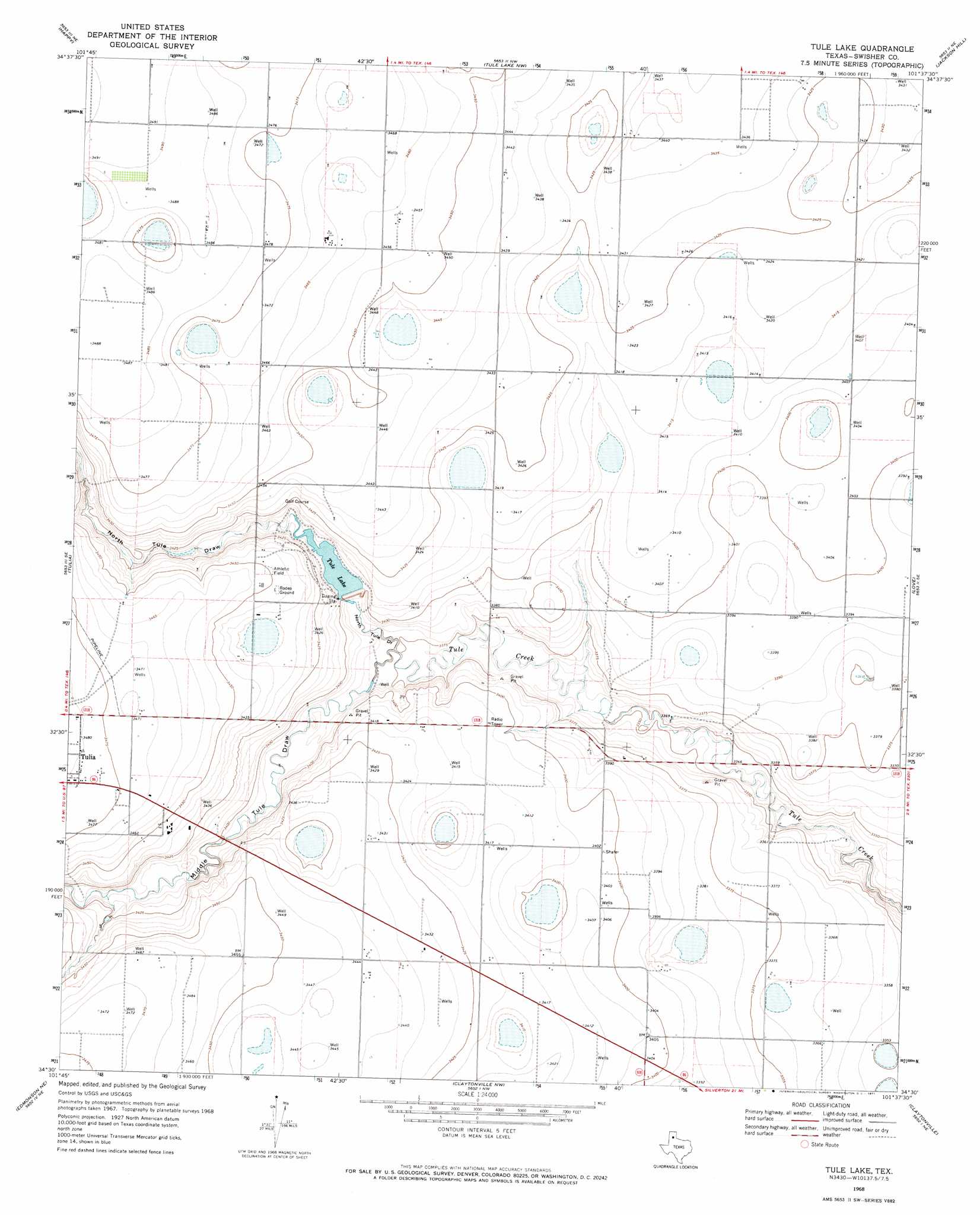
Tule Lake Topo Map Texas
To zoom in, hover over the map of Tule Lake
USGS Topo Quad 34101e6 - 1:24,000 scale
| Topo Map Name: | Tule Lake |
| USGS Topo Quad ID: | 34101e6 |
| Print Size: | ca. 21 1/4" wide x 27" high |
| Southeast Coordinates: | 34.5° N latitude / 101.625° W longitude |
| Map Center Coordinates: | 34.5625° N latitude / 101.6875° W longitude |
| U.S. State: | TX |
| Filename: | o34101e6.jpg |
| Download Map JPG Image: | Tule Lake topo map 1:24,000 scale |
| Map Type: | Topographic |
| Topo Series: | 7.5´ |
| Map Scale: | 1:24,000 |
| Source of Map Images: | United States Geological Survey (USGS) |
| Alternate Map Versions: |
Tule Lake TX 1968, updated 1971 Download PDF Buy paper map Tule Lake TX 2010 Download PDF Buy paper map Tule Lake TX 2012 Download PDF Buy paper map Tule Lake TX 2016 Download PDF Buy paper map |
1:24,000 Topo Quads surrounding Tule Lake
Ogg |
Canyon Se |
Wesley Point |
Wayside |
Pleasant Creek |
Tulia Nw |
Happy |
Tule Lake Nw |
Jackson Hill |
Vigo Peak |
Lakeview |
Tulia |
Tule Lake |
Love |
Cope Creek |
Center Plains School |
Edmonson Ne |
Claytonville Nw |
Claytonville |
Rock Creek |
Edmonson |
Kress West |
Kress East |
Providence |
Silverton Sw |
> Back to 34101e1 at 1:100,000 scale
> Back to 34100a1 at 1:250,000 scale
> Back to U.S. Topo Maps home
Tule Lake topo map: Gazetteer
Tule Lake: Dams
Bill Bivens Dam elevation 1039m 3408′Ray Bivens Dam elevation 1040m 3412′
Tule Lake Dam elevation 1032m 3385′
Tule Lake: Reservoirs
Bill Bivens Reservoir elevation 1039m 3408′Ray Bivens Lake elevation 1040m 3412′
Tule Lake elevation 1036m 3398′
Tule Lake: Valleys
Middle Tule Draw elevation 1029m 3375′North Tule Draw elevation 1029m 3375′
Tule Lake digital topo map on disk
Buy this Tule Lake topo map showing relief, roads, GPS coordinates and other geographical features, as a high-resolution digital map file on DVD: