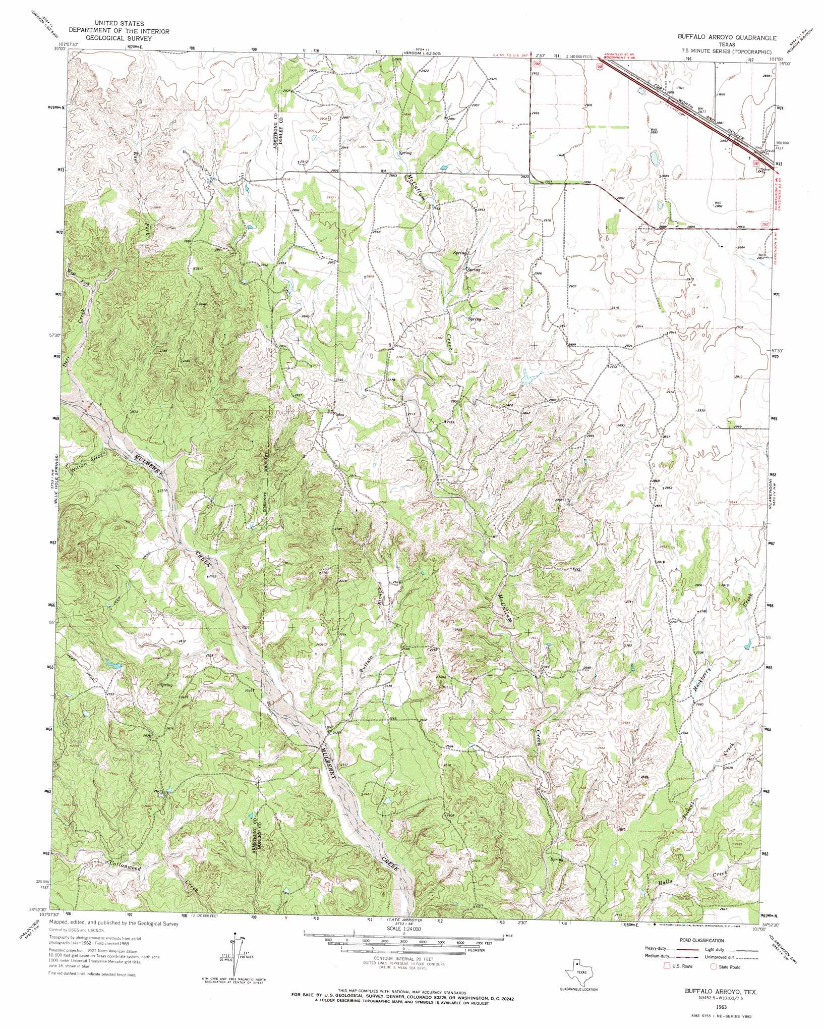
Buffalo Arroyo Topo Map Texas
To zoom in, hover over the map of Buffalo Arroyo
USGS Topo Quad 34101h1 - 1:24,000 scale
| Topo Map Name: | Buffalo Arroyo |
| USGS Topo Quad ID: | 34101h1 |
| Print Size: | ca. 21 1/4" wide x 27" high |
| Southeast Coordinates: | 34.875° N latitude / 101° W longitude |
| Map Center Coordinates: | 34.9375° N latitude / 101.0625° W longitude |
| U.S. State: | TX |
| Filename: | o34101h1.jpg |
| Download Map JPG Image: | Buffalo Arroyo topo map 1:24,000 scale |
| Map Type: | Topographic |
| Topo Series: | 7.5´ |
| Map Scale: | 1:24,000 |
| Source of Map Images: | United States Geological Survey (USGS) |
| Alternate Map Versions: |
Buffalo Arroyo TX 1963, updated 1966 Download PDF Buy paper map Buffalo Arroyo TX 2010 Download PDF Buy paper map Buffalo Arroyo TX 2012 Download PDF Buy paper map Buffalo Arroyo TX 2016 Download PDF Buy paper map |
1:24,000 Topo Quads surrounding Buffalo Arroyo
Claude Ne |
Lark |
Groom |
Jericho |
Rockledge |
Claude |
Goodnight |
Ashtola |
Roach Ranch |
Griffin Ranch |
Luttrell Springs Ne |
Blue Hole Springs |
Buffalo Arroyo |
Clarendon |
Lelia Lake |
Gip Creek |
Paloduro |
Tate Arroyo |
Clarendon Sw |
Clarendon Se |
Big Betty Reservoir |
Hardscrabble Creek |
Willow Arroyo |
Brice |
Lesley |
> Back to 34101e1 at 1:100,000 scale
> Back to 34100a1 at 1:250,000 scale
> Back to U.S. Topo Maps home
Buffalo Arroyo topo map: Gazetteer
Buffalo Arroyo: Streams
Deer Creek elevation 794m 2604′East Fork Deer Creek elevation 816m 2677′
Hackberry Creek elevation 797m 2614′
Polecat Creek elevation 773m 2536′
West Fork Deer Creek elevation 816m 2677′
Buffalo Arroyo: Valleys
Buffalo Arroyo elevation 764m 2506′Willow Arroyo elevation 789m 2588′
Buffalo Arroyo digital topo map on disk
Buy this Buffalo Arroyo topo map showing relief, roads, GPS coordinates and other geographical features, as a high-resolution digital map file on DVD: