Blue Hole Springs Topo Map Texas
To zoom in, hover over the map of Blue Hole Springs
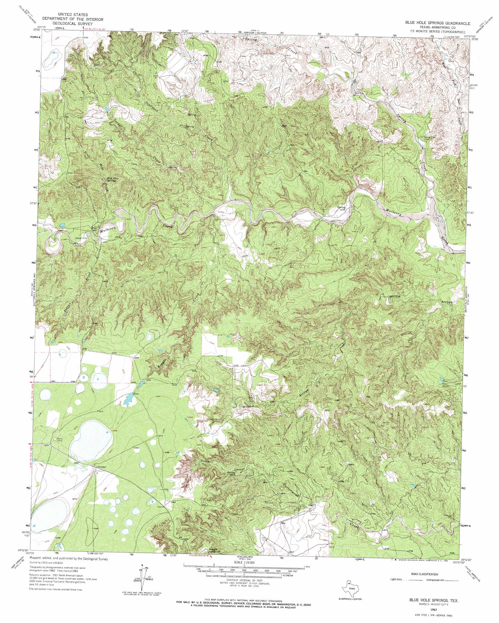
USGS Topo Quad 34101h2 - 1:24,000 scale
| Topo Map Name: | Blue Hole Springs |
| USGS Topo Quad ID: | 34101h2 |
| Print Size: | ca. 21 1/4" wide x 27" high |
| Southeast Coordinates: | 34.875° N latitude / 101.125° W longitude |
| Map Center Coordinates: | 34.9375° N latitude / 101.1875° W longitude |
| U.S. State: | TX |
| Filename: | o34101h2.jpg |
| Download Map JPG Image: | Blue Hole Springs topo map 1:24,000 scale |
| Map Type: | Topographic |
| Topo Series: | 7.5´ |
| Map Scale: | 1:24,000 |
| Source of Map Images: | United States Geological Survey (USGS) |
| Alternate Map Versions: |
Blue Hole Springs TX 1963, updated 1966 Download PDF Buy paper map Blue Hole Springs TX 2010 Download PDF Buy paper map Blue Hole Springs TX 2012 Download PDF Buy paper map Blue Hole Springs TX 2016 Download PDF Buy paper map |
1:24,000 Topo Quads surrounding Blue Hole Springs
Conway |
Claude Ne |
Lark |
Groom |
Jericho |
Claude Sw |
Claude |
Goodnight |
Ashtola |
Roach Ranch |
Luttrell Springs |
Luttrell Springs Ne |
Blue Hole Springs |
Buffalo Arroyo |
Clarendon |
Pleasant Creek |
Gip Creek |
Paloduro |
Tate Arroyo |
Clarendon Sw |
Vigo Peak |
Big Betty Reservoir |
Hardscrabble Creek |
Willow Arroyo |
Brice |
> Back to 34101e1 at 1:100,000 scale
> Back to 34100a1 at 1:250,000 scale
> Back to U.S. Topo Maps home
Blue Hole Springs topo map: Gazetteer
Blue Hole Springs: Cliffs
Koogle Jump-Off elevation 964m 3162′Blue Hole Springs: Springs
Blue Hole Springs elevation 907m 2975′Blue Hole Springs: Streams
Blue Hole Creek elevation 864m 2834′Deadwood Creek elevation 835m 2739′
Indian Creek elevation 872m 2860′
Koogle Creek elevation 841m 2759′
Parker Creek elevation 837m 2746′
Spring Creek elevation 803m 2634′
Blue Hole Springs: Valleys
Dutch Canyon elevation 882m 2893′Blue Hole Springs digital topo map on disk
Buy this Blue Hole Springs topo map showing relief, roads, GPS coordinates and other geographical features, as a high-resolution digital map file on DVD: