Luttrell Springs Topo Map Texas
To zoom in, hover over the map of Luttrell Springs
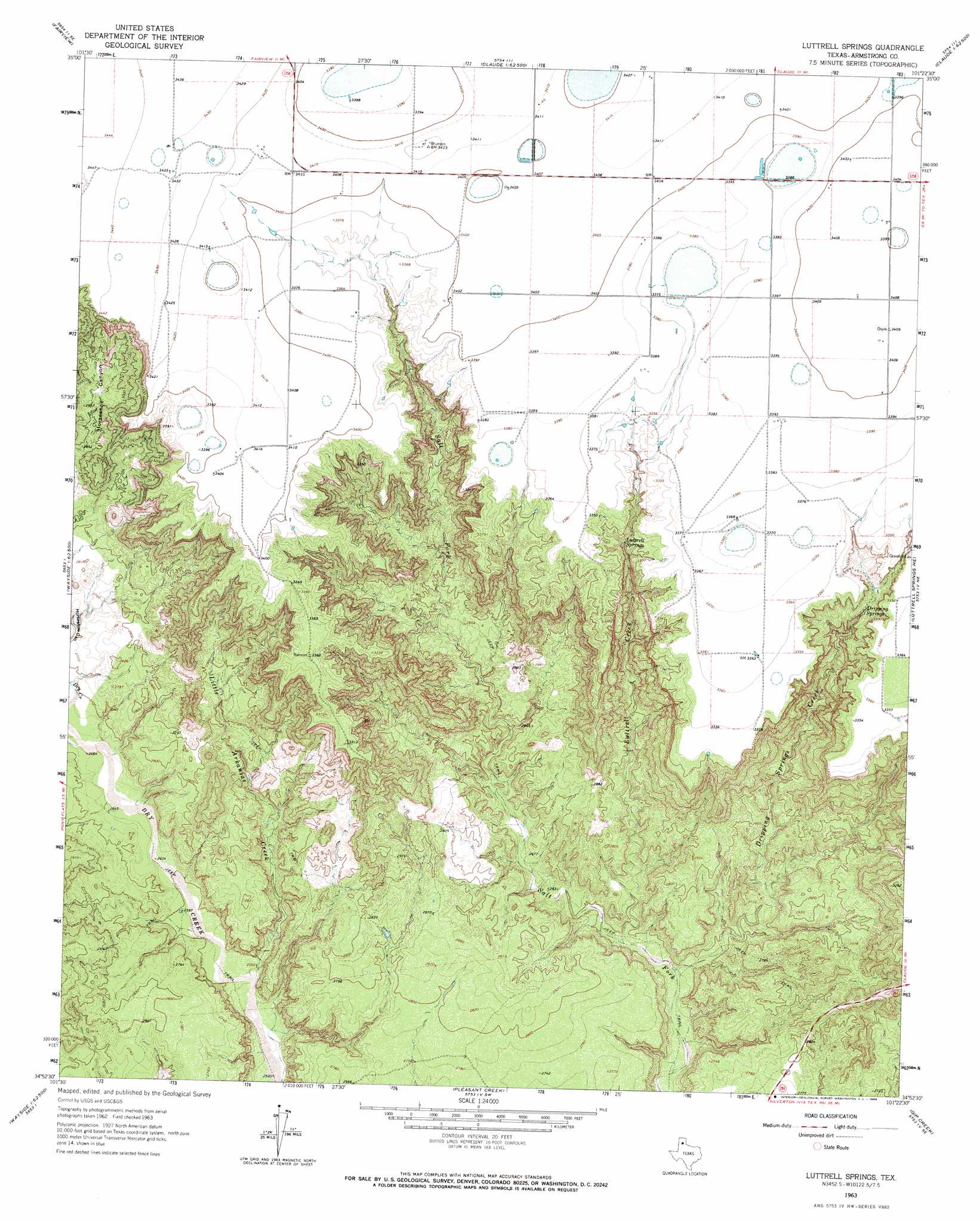
USGS Topo Quad 34101h4 - 1:24,000 scale
| Topo Map Name: | Luttrell Springs |
| USGS Topo Quad ID: | 34101h4 |
| Print Size: | ca. 21 1/4" wide x 27" high |
| Southeast Coordinates: | 34.875° N latitude / 101.375° W longitude |
| Map Center Coordinates: | 34.9375° N latitude / 101.4375° W longitude |
| U.S. State: | TX |
| Filename: | o34101h4.jpg |
| Download Map JPG Image: | Luttrell Springs topo map 1:24,000 scale |
| Map Type: | Topographic |
| Topo Series: | 7.5´ |
| Map Scale: | 1:24,000 |
| Source of Map Images: | United States Geological Survey (USGS) |
| Alternate Map Versions: |
Luttrell Springs TX 1963, updated 1966 Download PDF Buy paper map Luttrell Springs TX 2010 Download PDF Buy paper map Luttrell Springs TX 2012 Download PDF Buy paper map Luttrell Springs TX 2016 Download PDF Buy paper map |
1:24,000 Topo Quads surrounding Luttrell Springs
Pullman |
Washburn |
Conway |
Claude Ne |
Lark |
Thomas Ranch |
Fairview |
Claude Sw |
Claude |
Goodnight |
Fortress Cliff |
Pony Flats |
Luttrell Springs |
Luttrell Springs Ne |
Blue Hole Springs |
Wesley Point |
Wayside |
Pleasant Creek |
Gip Creek |
Paloduro |
Tule Lake Nw |
Jackson Hill |
Vigo Peak |
Big Betty Reservoir |
Hardscrabble Creek |
> Back to 34101e1 at 1:100,000 scale
> Back to 34100a1 at 1:250,000 scale
> Back to U.S. Topo Maps home
Luttrell Springs topo map: Gazetteer
Luttrell Springs: Springs
Dripping Spring elevation 978m 3208′Luttrell Springs elevation 992m 3254′
Luttrell Springs: Streams
Dripping Springs Creek elevation 780m 2559′Little Arkansas Creek elevation 780m 2559′
Luttrell Creek elevation 786m 2578′
Luttrell Springs digital topo map on disk
Buy this Luttrell Springs topo map showing relief, roads, GPS coordinates and other geographical features, as a high-resolution digital map file on DVD: