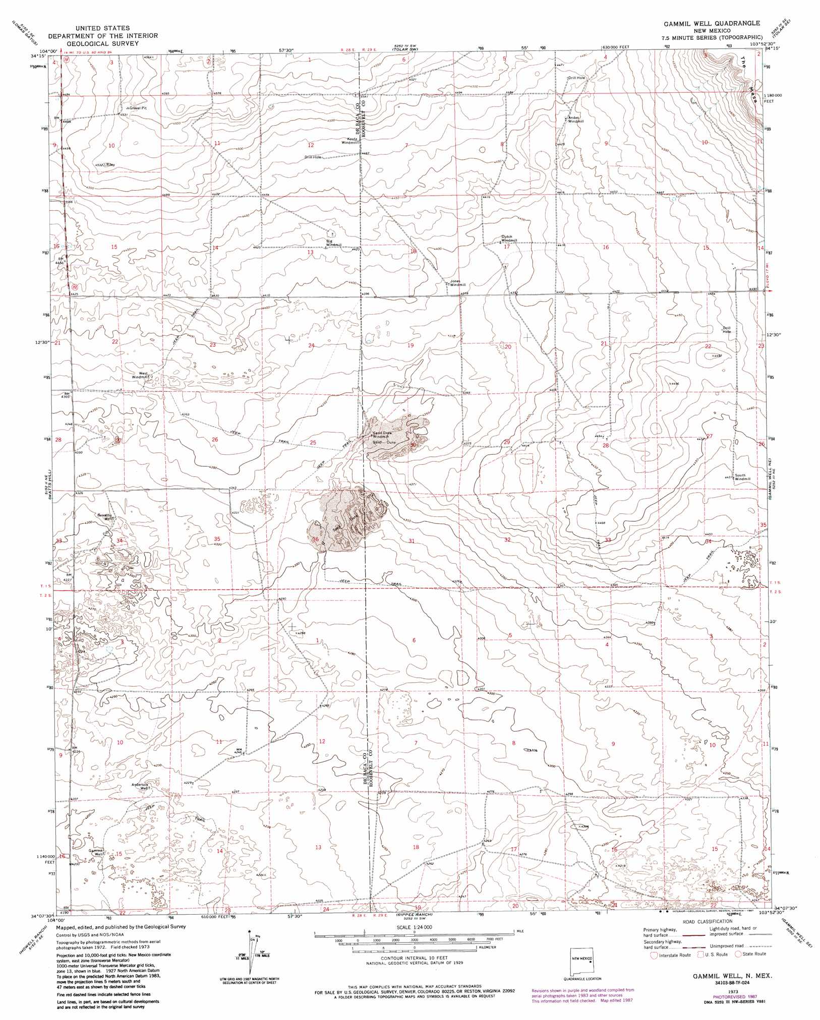
Gammil Well Topo Map New Mexico
To zoom in, hover over the map of Gammil Well
USGS Topo Quad 34103b8 - 1:24,000 scale
| Topo Map Name: | Gammil Well |
| USGS Topo Quad ID: | 34103b8 |
| Print Size: | ca. 21 1/4" wide x 27" high |
| Southeast Coordinates: | 34.125° N latitude / 103.875° W longitude |
| Map Center Coordinates: | 34.1875° N latitude / 103.9375° W longitude |
| U.S. State: | NM |
| Filename: | o34103b8.jpg |
| Download Map JPG Image: | Gammil Well topo map 1:24,000 scale |
| Map Type: | Topographic |
| Topo Series: | 7.5´ |
| Map Scale: | 1:24,000 |
| Source of Map Images: | United States Geological Survey (USGS) |
| Alternate Map Versions: |
Gammil Well NM 1973, updated 1975 Download PDF Buy paper map Gammil Well NM 1973, updated 1987 Download PDF Buy paper map Gammil Well NM 2010 Download PDF Buy paper map Gammil Well NM 2013 Download PDF Buy paper map Gammil Well NM 2017 Download PDF Buy paper map |
1:24,000 Topo Quads surrounding Gammil Well
Fort Sumner East |
Taiban |
Tolar |
Krider |
Melrose West |
Bonner Lake |
Lomas Gatos |
Tolar Sw |
Tolar Se |
Tule Lake |
Eighteenmile Hill |
Watts Hill |
Gammil Well |
Gammil Well Ne |
Upton |
Cooley Lake |
Howell Ranch |
Rippee Ranch |
Gammil Well Se |
Lewiston Lake |
Hernandez Lake |
Olive |
San Juan Mesa West |
San Juan Mesa East |
Elida |
> Back to 34103a1 at 1:100,000 scale
> Back to 34102a1 at 1:250,000 scale
> Back to U.S. Topo Maps home
Gammil Well topo map: Gazetteer
Gammil Well: Wells
Anderson Well elevation 1286m 4219′Benathy Well elevation 1314m 4311′
Gammil Well elevation 1283m 4209′
Gammil Well digital topo map on disk
Buy this Gammil Well topo map showing relief, roads, GPS coordinates and other geographical features, as a high-resolution digital map file on DVD: