Pleasant Hill Ne Topo Map New Mexico
To zoom in, hover over the map of Pleasant Hill Ne
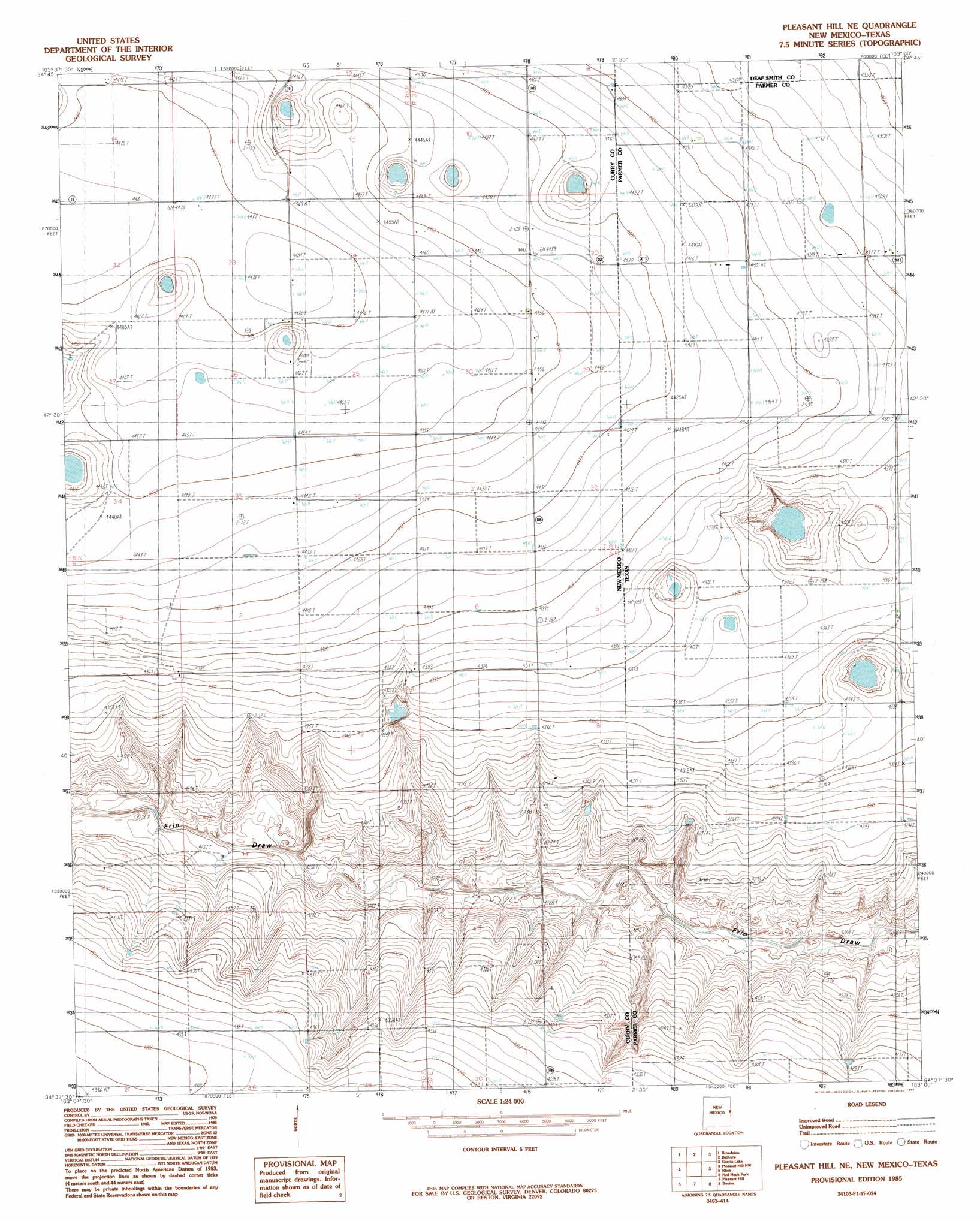
USGS Topo Quad 34103f1 - 1:24,000 scale
| Topo Map Name: | Pleasant Hill Ne |
| USGS Topo Quad ID: | 34103f1 |
| Print Size: | ca. 21 1/4" wide x 27" high |
| Southeast Coordinates: | 34.625° N latitude / 103° W longitude |
| Map Center Coordinates: | 34.6875° N latitude / 103.0625° W longitude |
| U.S. States: | NM, TX |
| Filename: | o34103f1.jpg |
| Download Map JPG Image: | Pleasant Hill Ne topo map 1:24,000 scale |
| Map Type: | Topographic |
| Topo Series: | 7.5´ |
| Map Scale: | 1:24,000 |
| Source of Map Images: | United States Geological Survey (USGS) |
| Alternate Map Versions: |
Pleasant Hill NE NM 1985, updated 1985 Download PDF Buy paper map Pleasant Hill NE NM 2010 Download PDF Buy paper map Pleasant Hill NE NM 2013 Download PDF Buy paper map Pleasant Hill NE NM 2017 Download PDF Buy paper map |
1:24,000 Topo Quads surrounding Pleasant Hill Ne
Wheatland |
Day Canyon |
Endee Hill |
Mustang Lake |
Walcott |
Grady |
Broadview |
Bellview |
Garcia Lake |
Bootleg |
Smith Ranch |
Pleasant Hill Nw |
Pleasant Hill Ne |
Rhea |
Twin Lakes |
Garrett Ranch |
Ned Houk Park |
Pleasant Hill |
Bovina |
Parmerton |
Portair |
Clovis |
Farwell |
Oklahoma Lane |
Lariat Ne |
> Back to 34103e1 at 1:100,000 scale
> Back to 34102a1 at 1:250,000 scale
> Back to U.S. Topo Maps home
Pleasant Hill Ne digital topo map on disk
Buy this Pleasant Hill Ne topo map showing relief, roads, GPS coordinates and other geographical features, as a high-resolution digital map file on DVD: