Wire Lake Topo Map New Mexico
To zoom in, hover over the map of Wire Lake
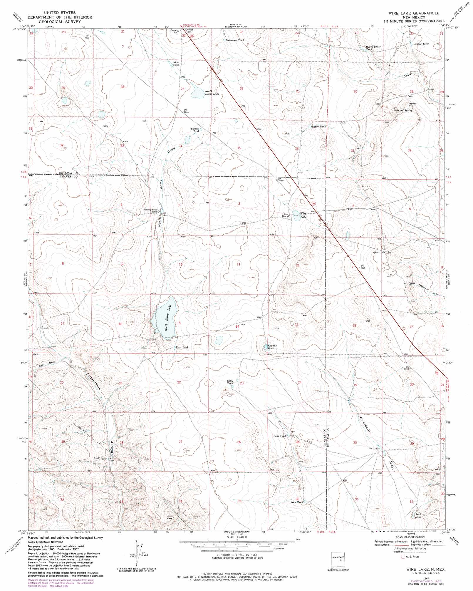
USGS Topo Quad 34104a7 - 1:24,000 scale
| Topo Map Name: | Wire Lake |
| USGS Topo Quad ID: | 34104a7 |
| Print Size: | ca. 21 1/4" wide x 27" high |
| Southeast Coordinates: | 34° N latitude / 104.75° W longitude |
| Map Center Coordinates: | 34.0625° N latitude / 104.8125° W longitude |
| U.S. State: | NM |
| Filename: | o34104a7.jpg |
| Download Map JPG Image: | Wire Lake topo map 1:24,000 scale |
| Map Type: | Topographic |
| Topo Series: | 7.5´ |
| Map Scale: | 1:24,000 |
| Source of Map Images: | United States Geological Survey (USGS) |
| Alternate Map Versions: |
Wire Lake NM 1967, updated 1971 Download PDF Buy paper map Wire Lake NM 1967, updated 1982 Download PDF Buy paper map Wire Lake NM 2010 Download PDF Buy paper map Wire Lake NM 2013 Download PDF Buy paper map Wire Lake NM 2017 Download PDF Buy paper map |
1:24,000 Topo Quads surrounding Wire Lake
Gacho Hill Se |
Loco Draw |
Yeso Mesa Se |
El Morro Mesa |
Horney Ranch |
Cowboy Mesa Ne |
Ramon |
Wright Ranch |
The Old Dry Lake |
Dunlap Ne |
Cowboy Mesa |
Ramon Sw |
Wire Lake |
Devils Well |
Dunlap |
Juan Largo Canyon East |
Chivita Canyon |
Round Mountain |
Mesa |
Dunlap Sill |
Cistern Draw |
North Lake |
Round Mountain Se |
Mesa Sw |
Mesa Se |
> Back to 34104a1 at 1:100,000 scale
> Back to 34104a1 at 1:250,000 scale
> Back to U.S. Topo Maps home
Wire Lake topo map: Gazetteer
Wire Lake: Lakes
Casaus Lake elevation 1425m 4675′North Home Lake elevation 1448m 4750′
Rock Lake elevation 1387m 4550′
South Home Lake elevation 1417m 4648′
Wire Lake elevation 1438m 4717′
Wire Lake: Reservoirs
Burro Draw Tank elevation 1416m 4645′Burro Tank elevation 1435m 4708′
Corona Tank elevation 1443m 4734′
East Tank elevation 1425m 4675′
Graces Tank elevation 1412m 4632′
New Tank elevation 1452m 4763′
New Tank elevation 1416m 4645′
Robertson Tank elevation 1453m 4767′
Sally Tank elevation 1425m 4675′
Sons Tank elevation 1416m 4645′
Wire Lake: Springs
Burro Spring elevation 1404m 4606′Wire Lake: Summits
Burro Hill elevation 1421m 4662′Wire Lake: Valleys
Automobile Draw elevation 1428m 4685′Corn Draw elevation 1421m 4662′
North Home Draw elevation 1418m 4652′
North Home Draw elevation 1453m 4767′
Wire Lake digital topo map on disk
Buy this Wire Lake topo map showing relief, roads, GPS coordinates and other geographical features, as a high-resolution digital map file on DVD: