Loco Draw Topo Map New Mexico
To zoom in, hover over the map of Loco Draw
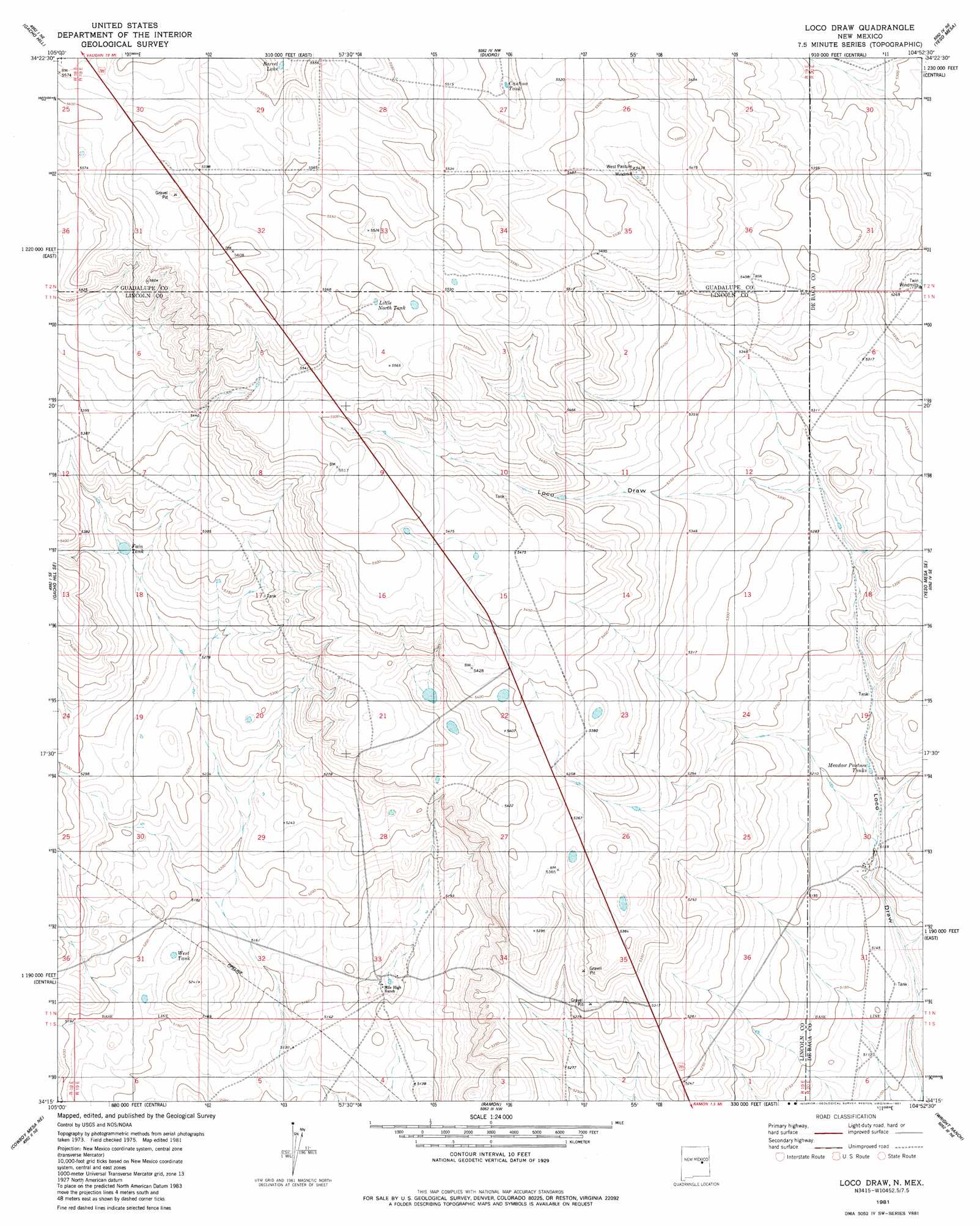
USGS Topo Quad 34104c8 - 1:24,000 scale
| Topo Map Name: | Loco Draw |
| USGS Topo Quad ID: | 34104c8 |
| Print Size: | ca. 21 1/4" wide x 27" high |
| Southeast Coordinates: | 34.25° N latitude / 104.875° W longitude |
| Map Center Coordinates: | 34.3125° N latitude / 104.9375° W longitude |
| U.S. State: | NM |
| Filename: | o34104c8.jpg |
| Download Map JPG Image: | Loco Draw topo map 1:24,000 scale |
| Map Type: | Topographic |
| Topo Series: | 7.5´ |
| Map Scale: | 1:24,000 |
| Source of Map Images: | United States Geological Survey (USGS) |
| Alternate Map Versions: |
Loco Draw NM 1981, updated 1981 Download PDF Buy paper map Loco Draw NM 2010 Download PDF Buy paper map Loco Draw NM 2013 Download PDF Buy paper map Loco Draw NM 2017 Download PDF Buy paper map |
1:24,000 Topo Quads surrounding Loco Draw
Vaughn |
Long Draw |
El Morro Ranch |
El Morro Ranch Se |
Borica Sw |
Gacho Hill Nw |
Gacho Hill |
Duoro |
Yeso Mesa |
Yeso Nw |
Gacho Hill Sw |
Gacho Hill Se |
Loco Draw |
Yeso Mesa Se |
El Morro Mesa |
Cowboy Mesa Nw |
Cowboy Mesa Ne |
Ramon |
Wright Ranch |
The Old Dry Lake |
Cowboy Mesa Sw |
Cowboy Mesa |
Ramon Sw |
Wire Lake |
Devils Well |
> Back to 34104a1 at 1:100,000 scale
> Back to 34104a1 at 1:250,000 scale
> Back to U.S. Topo Maps home
Loco Draw topo map: Gazetteer
Loco Draw: Reservoirs
Barrel Lake elevation 1681m 5515′Cantina Tank elevation 1673m 5488′
Fain Tank elevation 1621m 5318′
Little North Tank elevation 1692m 5551′
Meadow Pasture Tanks elevation 1579m 5180′
West Tank elevation 1578m 5177′
Loco Draw digital topo map on disk
Buy this Loco Draw topo map showing relief, roads, GPS coordinates and other geographical features, as a high-resolution digital map file on DVD: