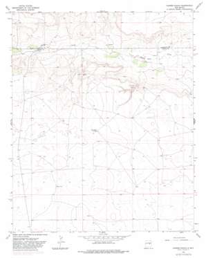
Cooper Ranch Topo Map New Mexico
To zoom in, hover over the map of Cooper Ranch
USGS Topo Quad 34104e5 - 1:24,000 scale
| Topo Map Name: | Cooper Ranch |
| USGS Topo Quad ID: | 34104e5 |
| Print Size: | ca. 21 1/4" wide x 27" high |
| Southeast Coordinates: | 34.5° N latitude / 104.5° W longitude |
| Map Center Coordinates: | 34.5625° N latitude / 104.5625° W longitude |
| U.S. State: | NM |
| Filename: | o34104e5.jpg |
| Download Map JPG Image: | Cooper Ranch topo map 1:24,000 scale |
| Map Type: | Topographic |
| Topo Series: | 7.5´ |
| Map Scale: | 1:24,000 |
| Source of Map Images: | United States Geological Survey (USGS) |
| Alternate Map Versions: |
Cooper Ranch NM 1966, updated 1969 Download PDF Buy paper map Cooper Ranch NM 1966, updated 1982 Download PDF Buy paper map Cooper Ranch NM 2010 Download PDF Buy paper map Cooper Ranch NM 2013 Download PDF Buy paper map Cooper Ranch NM 2017 Download PDF Buy paper map |
1:24,000 Topo Quads surrounding Cooper Ranch
> Back to 34104e1 at 1:100,000 scale
> Back to 34104a1 at 1:250,000 scale
> Back to U.S. Topo Maps home
Cooper Ranch topo map: Gazetteer
Cooper Ranch: Wells
10270 Water Well elevation 1402m 4599′10271 Water Well elevation 1443m 4734′
10462 Water Well elevation 1368m 4488′
10463 Water Well elevation 1355m 4445′
10464 Water Well elevation 1424m 4671′
10465 Water Well elevation 1331m 4366′
10466 Water Well elevation 1410m 4625′
10467 Water Well elevation 1450m 4757′
10471 Water Well elevation 1403m 4603′
10472 Water Well elevation 1427m 4681′
10898 Water Well elevation 1391m 4563′
10899 Water Well elevation 1451m 4760′
10902 Water Well elevation 1444m 4737′
10903 Water Well elevation 1468m 4816′
10905 Water Well elevation 1465m 4806′
Cooper Ranch digital topo map on disk
Buy this Cooper Ranch topo map showing relief, roads, GPS coordinates and other geographical features, as a high-resolution digital map file on DVD:


