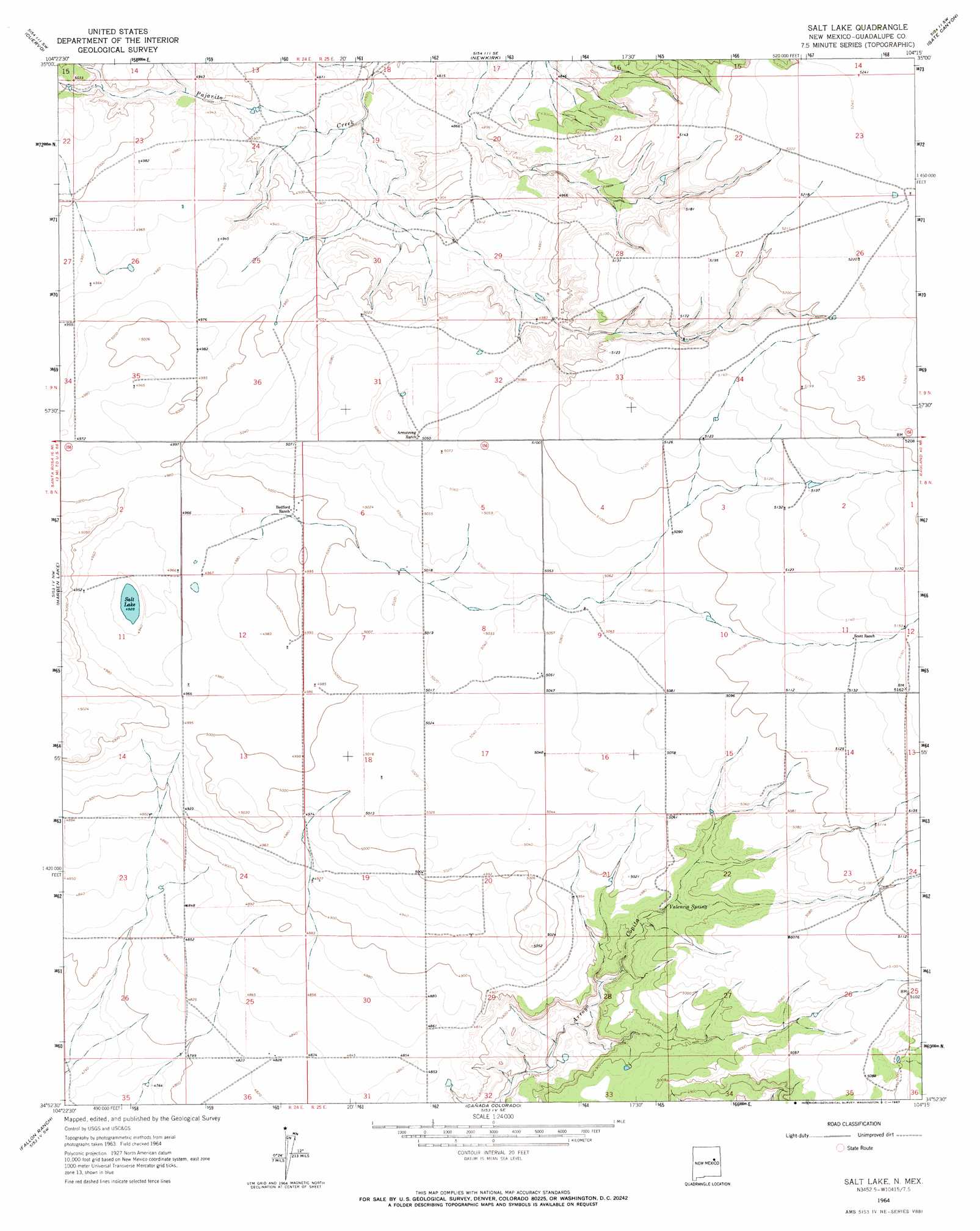
Salt Lake Topo Map New Mexico
To zoom in, hover over the map of Salt Lake
USGS Topo Quad 34104h3 - 1:24,000 scale
| Topo Map Name: | Salt Lake |
| USGS Topo Quad ID: | 34104h3 |
| Print Size: | ca. 21 1/4" wide x 27" high |
| Southeast Coordinates: | 34.875° N latitude / 104.25° W longitude |
| Map Center Coordinates: | 34.9375° N latitude / 104.3125° W longitude |
| U.S. State: | NM |
| Filename: | o34104h3.jpg |
| Download Map JPG Image: | Salt Lake topo map 1:24,000 scale |
| Map Type: | Topographic |
| Topo Series: | 7.5´ |
| Map Scale: | 1:24,000 |
| Source of Map Images: | United States Geological Survey (USGS) |
| Alternate Map Versions: |
Salt Lake NM 1964, updated 1967 Download PDF Buy paper map Salt Lake NM 2010 Download PDF Buy paper map Salt Lake NM 2013 Download PDF Buy paper map Salt Lake NM 2017 Download PDF Buy paper map |
1:24,000 Topo Quads surrounding Salt Lake
Mesa Cherisco |
Mesita Del Gato |
Neafus Ranch |
Ortega Tank |
Muniz Canyon |
Sacaton Draw |
Cuervo |
Newkirk |
Gate Canyon |
Montoya |
Sunshine Mesa |
Harben Lake |
Salt Lake |
Ima Nw |
Ima |
Puerto De Luna |
Fallon Ranch |
Canada Colorado |
Ima Sw |
Ima Se |
Ojo Negro Creek |
Gibbons Ranch |
Colorado Canyon |
Twin Mesa Nw |
Hassell |
> Back to 34104e1 at 1:100,000 scale
> Back to 34104a1 at 1:250,000 scale
> Back to U.S. Topo Maps home
Salt Lake topo map: Gazetteer
Salt Lake: Lakes
Salt Lake elevation 1503m 4931′Salt Lake: Springs
Valencia Spring elevation 1498m 4914′Salt Lake digital topo map on disk
Buy this Salt Lake topo map showing relief, roads, GPS coordinates and other geographical features, as a high-resolution digital map file on DVD: