Corono North Topo Map New Mexico
To zoom in, hover over the map of Corono North
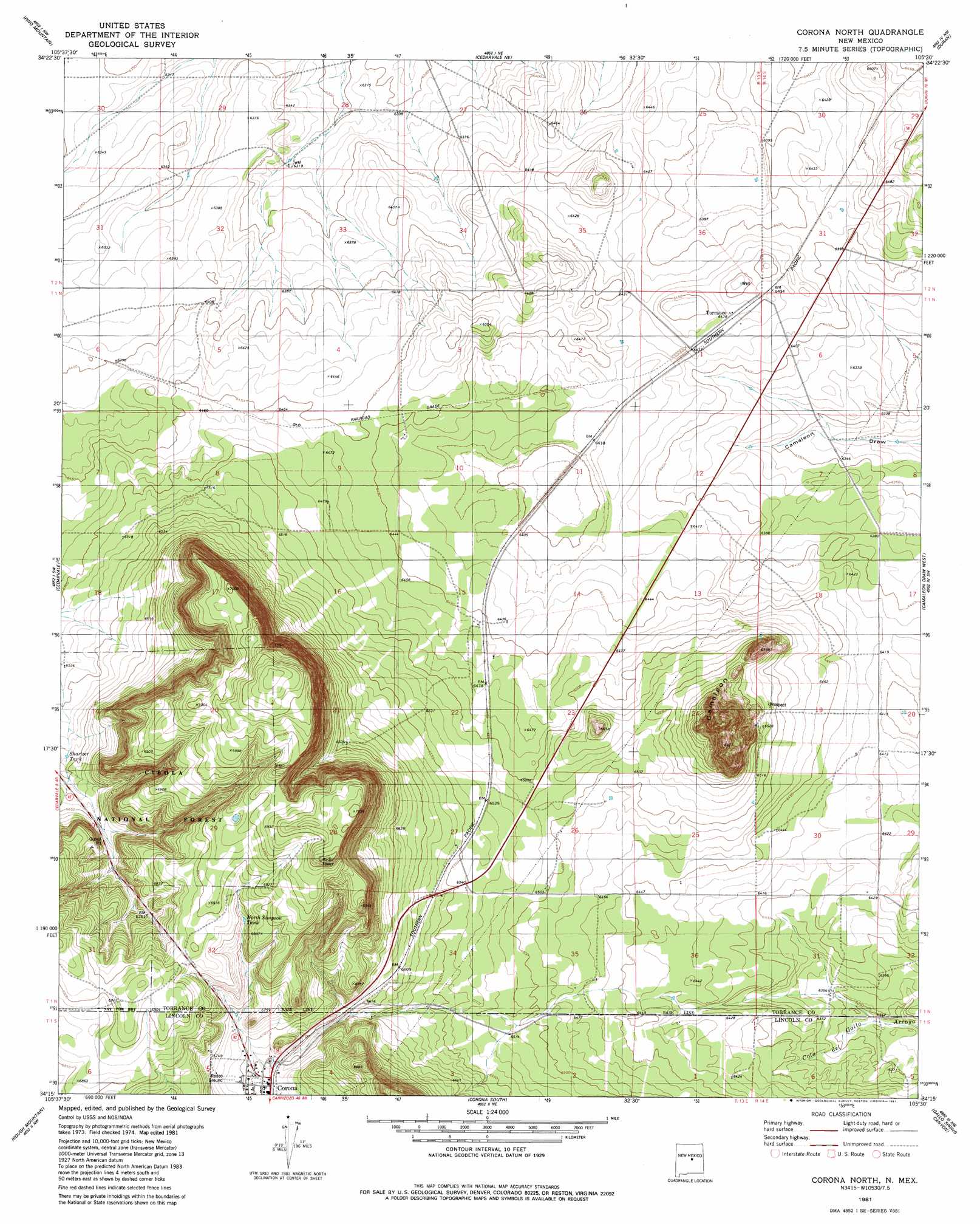
USGS Topo Quad 34105c5 - 1:24,000 scale
| Topo Map Name: | Corono North |
| USGS Topo Quad ID: | 34105c5 |
| Print Size: | ca. 21 1/4" wide x 27" high |
| Southeast Coordinates: | 34.25° N latitude / 105.5° W longitude |
| Map Center Coordinates: | 34.3125° N latitude / 105.5625° W longitude |
| U.S. State: | NM |
| Filename: | o34105c5.jpg |
| Download Map JPG Image: | Corono North topo map 1:24,000 scale |
| Map Type: | Topographic |
| Topo Series: | 7.5´ |
| Map Scale: | 1:24,000 |
| Source of Map Images: | United States Geological Survey (USGS) |
| Alternate Map Versions: |
Corona North NM 1981, updated 1981 Download PDF Buy paper map Corona North NM 1995, updated 1998 Download PDF Buy paper map Corona North NM 2011 Download PDF Buy paper map Corona North NM 2013 Download PDF Buy paper map Corona North NM 2017 Download PDF Buy paper map |
| FStopo: | US Forest Service topo Corona North is available: Download FStopo PDF Download FStopo TIF |
1:24,000 Topo Quads surrounding Corono North
Rattlesnake Hill |
Negra Sw |
Negra Se |
Dunlap Ranch |
Tejon |
Progresso Ne |
Pino Mountain |
Cedarvale Ne |
Duran |
Duran Ne |
Progresso Se |
Cedarvale |
Corono North |
Camaleon Draw West |
Camaleon Draw East |
Pajaro Canyon |
Rough Mountain |
Corona South |
Gallo Spring Canyon |
Gallo Spring Canyon Ne |
Claunch Se |
Tecolote Peak |
Pelan Hill |
Red Bluff Draw West |
Red Bluff Draw East |
> Back to 34105a1 at 1:100,000 scale
> Back to 34104a1 at 1:250,000 scale
> Back to U.S. Topo Maps home
Corono North topo map: Gazetteer
Corono North: Populated Places
Corona elevation 2039m 6689′Torrance elevation 1959m 6427′
Varney elevation 1970m 6463′
Corono North: Post Offices
Corona Post Office elevation 2039m 6689′Torrance Post Office elevation 1959m 6427′
Corono North: Reservoirs
Lee Tank elevation 2109m 6919′North Simpson Tank elevation 2081m 6827′
Shartzer Tank elevation 2008m 6587′
Corono North: Summits
Camaleon elevation 2120m 6955′Corono North digital topo map on disk
Buy this Corono North topo map showing relief, roads, GPS coordinates and other geographical features, as a high-resolution digital map file on DVD: