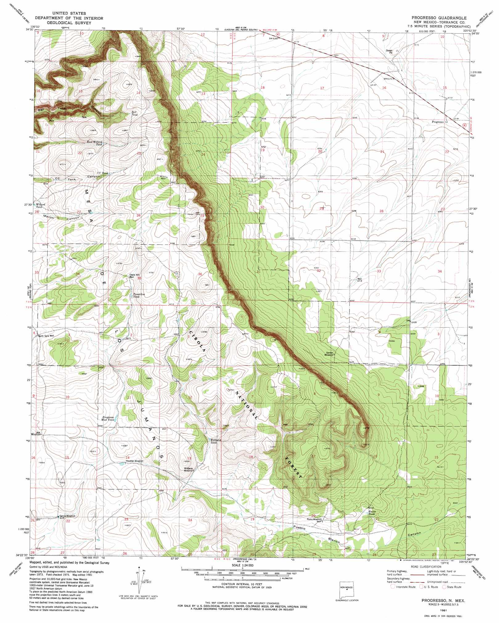
Progresso Topo Map New Mexico
To zoom in, hover over the map of Progresso
USGS Topo Quad 34105d8 - 1:24,000 scale
| Topo Map Name: | Progresso |
| USGS Topo Quad ID: | 34105d8 |
| Print Size: | ca. 21 1/4" wide x 27" high |
| Southeast Coordinates: | 34.375° N latitude / 105.875° W longitude |
| Map Center Coordinates: | 34.4375° N latitude / 105.9375° W longitude |
| U.S. State: | NM |
| Filename: | o34105d8.jpg |
| Download Map JPG Image: | Progresso topo map 1:24,000 scale |
| Map Type: | Topographic |
| Topo Series: | 7.5´ |
| Map Scale: | 1:24,000 |
| Source of Map Images: | United States Geological Survey (USGS) |
| Alternate Map Versions: |
Progresso NM 1981, updated 1981 Download PDF Buy paper map Progresso NM 1995, updated 1998 Download PDF Buy paper map Progresso NM 2011 Download PDF Buy paper map Progresso NM 2013 Download PDF Buy paper map Progresso NM 2017 Download PDF Buy paper map |
| FStopo: | US Forest Service topo Progresso is available: Download FStopo PDF Download FStopo TIF |
1:24,000 Topo Quads surrounding Progresso
Ewing |
Mountainair Ne |
Laguna Del Perro North |
Lucy |
Pedernal |
Mountainair |
Willard |
Laguna Del Perro South |
Rattlesnake Hill |
Negra Sw |
Mesa Draw |
Round Top |
Progresso |
Progresso Ne |
Pino Mountain |
Bigbee Draw |
Gran Quivira |
Progresso Sw |
Progresso Se |
Cedarvale |
Turkey Ridge |
Turkey Ridge Ne |
Claunch |
Pajaro Canyon |
Rough Mountain |
> Back to 34105a1 at 1:100,000 scale
> Back to 34104a1 at 1:250,000 scale
> Back to U.S. Topo Maps home
Progresso topo map: Gazetteer
Progresso: Forests
Mountainair Ranger District elevation 2041m 6696′Progresso: Populated Places
Progresso elevation 1887m 6190′Progresso: Post Offices
Progresso Post Office (historical) elevation 1888m 6194′Progresso: Reservoirs
Bell Tank elevation 2077m 6814′CC Tank elevation 2065m 6774′
East Willard Tank elevation 2056m 6745′
Powerline Tank elevation 2040m 6692′
Progresso West Tank elevation 1998m 6555′
Ruins Tank elevation 1958m 6423′
Wiltbank Tank elevation 1988m 6522′
Progresso: Summits
Mesa de los Jumanos elevation 2103m 6899′Progresso: Wells
Chalk Hill Well elevation 2045m 6709′North Gora Well elevation 2022m 6633′
Progresso digital topo map on disk
Buy this Progresso topo map showing relief, roads, GPS coordinates and other geographical features, as a high-resolution digital map file on DVD: