Pedernal Mountain Topo Map New Mexico
To zoom in, hover over the map of Pedernal Mountain
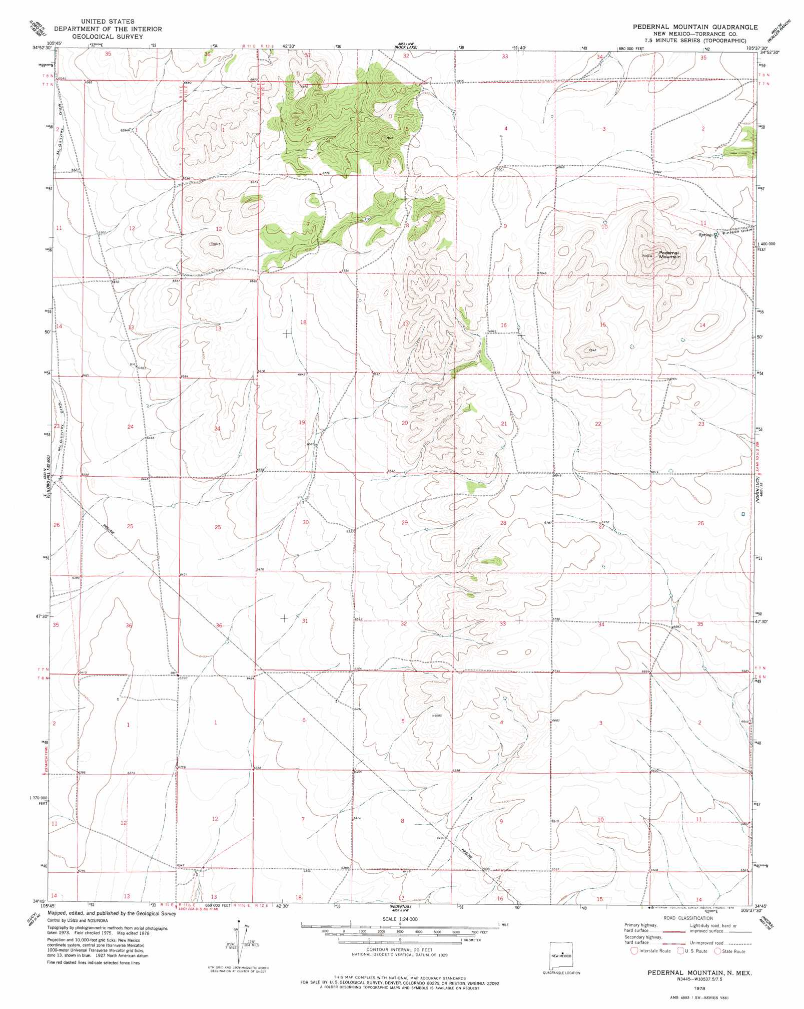
USGS Topo Quad 34105g6 - 1:24,000 scale
| Topo Map Name: | Pedernal Mountain |
| USGS Topo Quad ID: | 34105g6 |
| Print Size: | ca. 21 1/4" wide x 27" high |
| Southeast Coordinates: | 34.75° N latitude / 105.625° W longitude |
| Map Center Coordinates: | 34.8125° N latitude / 105.6875° W longitude |
| U.S. State: | NM |
| Filename: | o34105g6.jpg |
| Download Map JPG Image: | Pedernal Mountain topo map 1:24,000 scale |
| Map Type: | Topographic |
| Topo Series: | 7.5´ |
| Map Scale: | 1:24,000 |
| Source of Map Images: | United States Geological Survey (USGS) |
| Alternate Map Versions: |
Pedernal Mountain NM 1978, updated 1978 Download PDF Buy paper map Pedernal Mountain NM 2010 Download PDF Buy paper map Pedernal Mountain NM 2013 Download PDF Buy paper map Pedernal Mountain NM 2017 Download PDF Buy paper map |
1:24,000 Topo Quads surrounding Pedernal Mountain
Longhorn Reservoir |
El Cuervo Butte |
Clines Corners |
El Cabo |
Jacinto Mesa |
Lobo Hill |
Lobo Hill Ne |
Rock Lake |
Waller Ranch |
Palma |
Lobo Hill Sw |
Lobo Hill Se |
Pedernal Mountain |
North Lucy |
Santo Nino Canyon |
Laguna Del Perro North |
Lucy |
Pedernal |
Negra |
Encino |
Laguna Del Perro South |
Rattlesnake Hill |
Negra Sw |
Negra Se |
Dunlap Ranch |
> Back to 34105e1 at 1:100,000 scale
> Back to 34104a1 at 1:250,000 scale
> Back to U.S. Topo Maps home
Pedernal Mountain topo map: Gazetteer
Pedernal Mountain: Ranges
Pedernal Hills elevation 2276m 7467′Pedernal Mountain: Summits
Pedernal Mountain elevation 2301m 7549′Pedernal Mountain digital topo map on disk
Buy this Pedernal Mountain topo map showing relief, roads, GPS coordinates and other geographical features, as a high-resolution digital map file on DVD: