Waller Ranch Topo Map New Mexico
To zoom in, hover over the map of Waller Ranch
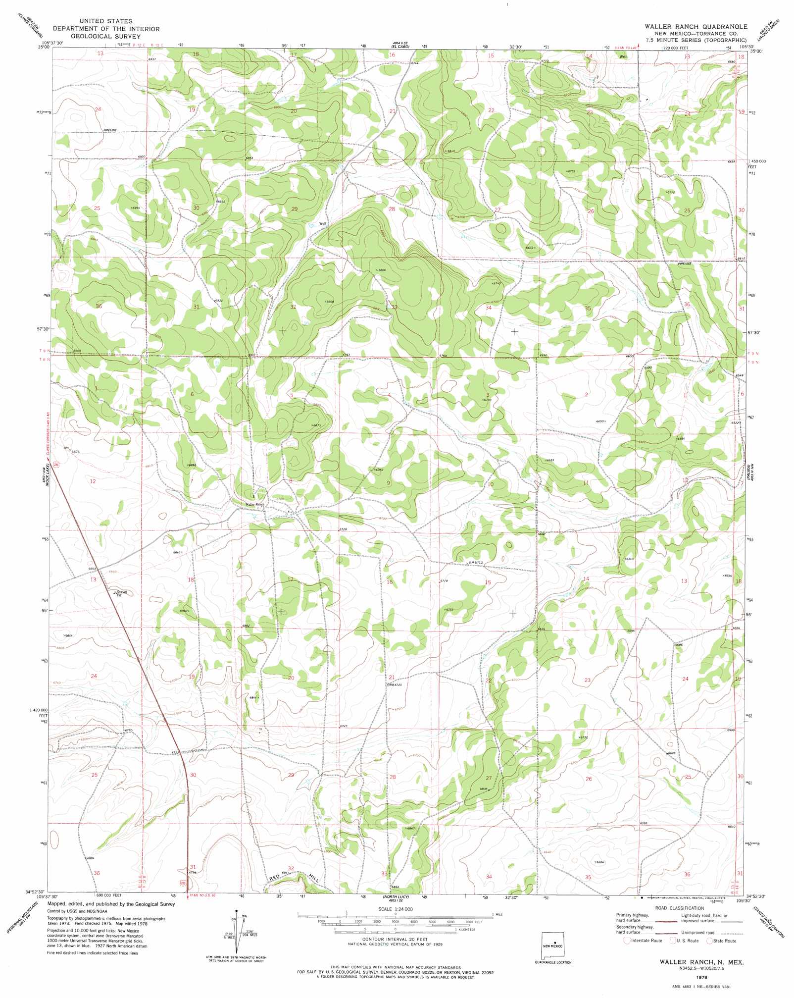
USGS Topo Quad 34105h5 - 1:24,000 scale
| Topo Map Name: | Waller Ranch |
| USGS Topo Quad ID: | 34105h5 |
| Print Size: | ca. 21 1/4" wide x 27" high |
| Southeast Coordinates: | 34.875° N latitude / 105.5° W longitude |
| Map Center Coordinates: | 34.9375° N latitude / 105.5625° W longitude |
| U.S. State: | NM |
| Filename: | o34105h5.jpg |
| Download Map JPG Image: | Waller Ranch topo map 1:24,000 scale |
| Map Type: | Topographic |
| Topo Series: | 7.5´ |
| Map Scale: | 1:24,000 |
| Source of Map Images: | United States Geological Survey (USGS) |
| Alternate Map Versions: |
Waller Ranch NM 1978, updated 1978 Download PDF Buy paper map Waller Ranch NM 2010 Download PDF Buy paper map Waller Ranch NM 2013 Download PDF Buy paper map Waller Ranch NM 2017 Download PDF Buy paper map |
1:24,000 Topo Quads surrounding Waller Ranch
White |
Mesa El Toro |
Leyba |
Aurora |
San Juan |
El Cuervo Butte |
Clines Corners |
El Cabo |
Jacinto Mesa |
Potrillo Hill |
Lobo Hill Ne |
Rock Lake |
Waller Ranch |
Palma |
Milagro Spring |
Lobo Hill Se |
Pedernal Mountain |
North Lucy |
Santo Nino Canyon |
Pinavete Canyon |
Lucy |
Pedernal |
Negra |
Encino |
Santa Barbara Lake |
> Back to 34105e1 at 1:100,000 scale
> Back to 34104a1 at 1:250,000 scale
> Back to U.S. Topo Maps home
Waller Ranch topo map: Gazetteer
Waller Ranch: Summits
Red Hill elevation 2087m 6847′Waller Ranch: Wells
East Water Well elevation 2031m 6663′Home Water Well elevation 2067m 6781′
Waller Ranch digital topo map on disk
Buy this Waller Ranch topo map showing relief, roads, GPS coordinates and other geographical features, as a high-resolution digital map file on DVD: