Cat Mesa Topo Map New Mexico
To zoom in, hover over the map of Cat Mesa
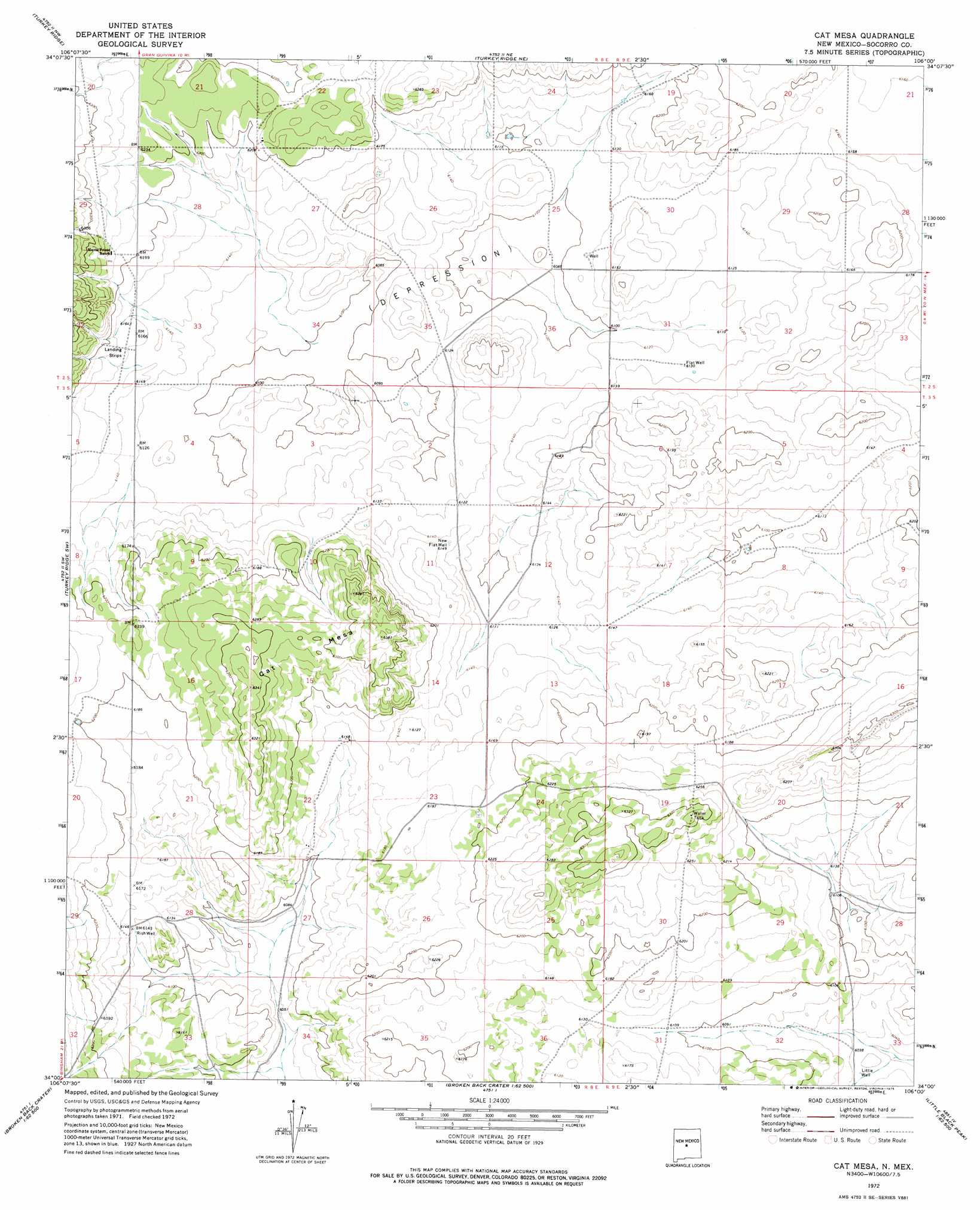
USGS Topo Quad 34106a1 - 1:24,000 scale
| Topo Map Name: | Cat Mesa |
| USGS Topo Quad ID: | 34106a1 |
| Print Size: | ca. 21 1/4" wide x 27" high |
| Southeast Coordinates: | 34° N latitude / 106° W longitude |
| Map Center Coordinates: | 34.0625° N latitude / 106.0625° W longitude |
| U.S. State: | NM |
| Filename: | o34106a1.jpg |
| Download Map JPG Image: | Cat Mesa topo map 1:24,000 scale |
| Map Type: | Topographic |
| Topo Series: | 7.5´ |
| Map Scale: | 1:24,000 |
| Source of Map Images: | United States Geological Survey (USGS) |
| Alternate Map Versions: |
Cat Mesa NM 1972, updated 1975 Download PDF Buy paper map Cat Mesa NM 2010 Download PDF Buy paper map Cat Mesa NM 2013 Download PDF Buy paper map Cat Mesa NM 2017 Download PDF Buy paper map |
1:24,000 Topo Quads surrounding Cat Mesa
Chupadera |
Bigbee Draw |
Gran Quivira |
Progresso Sw |
Progresso Se |
Chupadera Spring |
Turkey Ridge |
Turkey Ridge Ne |
Claunch |
Pajaro Canyon |
Wilson Ranch |
Turkey Ridge Sw |
Cat Mesa |
Polecat Draw |
Claunch Se |
Wrye Peak |
Cooper Canyon |
Lovelace Mesa |
Dulce Draw |
Little Black Peak Ne |
Garden Spring Canyon |
Pink Peak |
Broken Back Crater |
Little Black Peak |
Lone Mountain |
> Back to 34106a1 at 1:100,000 scale
> Back to 34106a1 at 1:250,000 scale
> Back to U.S. Topo Maps home
Cat Mesa topo map: Gazetteer
Cat Mesa: Airports
Monte Prieto Ranch Airport elevation 1883m 6177′Cat Mesa: Summits
Cat Mesa elevation 1947m 6387′Cat Mesa: Wells
Flat Well elevation 1870m 6135′New Flat Well elevation 1874m 6148′
Rish Well elevation 1870m 6135′
Cat Mesa digital topo map on disk
Buy this Cat Mesa topo map showing relief, roads, GPS coordinates and other geographical features, as a high-resolution digital map file on DVD: