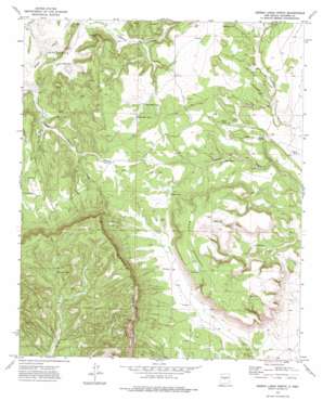
Sierra Larga North Topo Map New Mexico
To zoom in, hover over the map of Sierra Larga North
USGS Topo Quad 34106b5 - 1:24,000 scale
| Topo Map Name: | Sierra Larga North |
| USGS Topo Quad ID: | 34106b5 |
| Print Size: | ca. 21 1/4" wide x 27" high |
| Southeast Coordinates: | 34.125° N latitude / 106.5° W longitude |
| Map Center Coordinates: | 34.1875° N latitude / 106.5625° W longitude |
| U.S. State: | NM |
| Filename: | o34106b5.jpg |
| Download Map JPG Image: | Sierra Larga North topo map 1:24,000 scale |
| Map Type: | Topographic |
| Topo Series: | 7.5´ |
| Map Scale: | 1:24,000 |
| Source of Map Images: | United States Geological Survey (USGS) |
| Alternate Map Versions: |
Sierra Larga North NM 1972, updated 1975 Download PDF Buy paper map Sierra Larga North NM 2010 Download PDF Buy paper map Sierra Larga North NM 2013 Download PDF Buy paper map Sierra Larga North NM 2017 Download PDF Buy paper map |
1:24,000 Topo Quads surrounding Sierra Larga North
> Back to 34106a1 at 1:100,000 scale
> Back to 34106a1 at 1:250,000 scale
> Back to U.S. Topo Maps home
Sierra Larga North topo map: Gazetteer
Sierra Larga North: Parks
Stallion Wilderness Study Area elevation 2044m 6706′Sierra Larga North: Reservoirs
Adolpho Tank elevation 1806m 5925′Cañon Tank elevation 1815m 5954′
Indian Tank elevation 1758m 5767′
Kessler Tank elevation 1870m 6135′
La May Tank elevation 1865m 6118′
Lower Marr Tank elevation 1876m 6154′
Mesa Tank elevation 1943m 6374′
Mountain Tank elevation 1978m 6489′
Oney Tank elevation 1913m 6276′
Rock Tank elevation 1787m 5862′
Shores Tank elevation 1830m 6003′
Split Tank elevation 1931m 6335′
Upper Marr Tank elevation 1889m 6197′
Sierra Larga North: Summits
Black Mesa elevation 1861m 6105′Brown Top elevation 1917m 6289′
Mesa Redonda elevation 2012m 6601′
Sierra Larga North: Valleys
Entraniosa Draw elevation 1787m 5862′Sierra Larga North: Wells
Ponciana Water Well elevation 1884m 6181′Sierra Larga North digital topo map on disk
Buy this Sierra Larga North topo map showing relief, roads, GPS coordinates and other geographical features, as a high-resolution digital map file on DVD:


