Gran Quivira Topo Map New Mexico
To zoom in, hover over the map of Gran Quivira
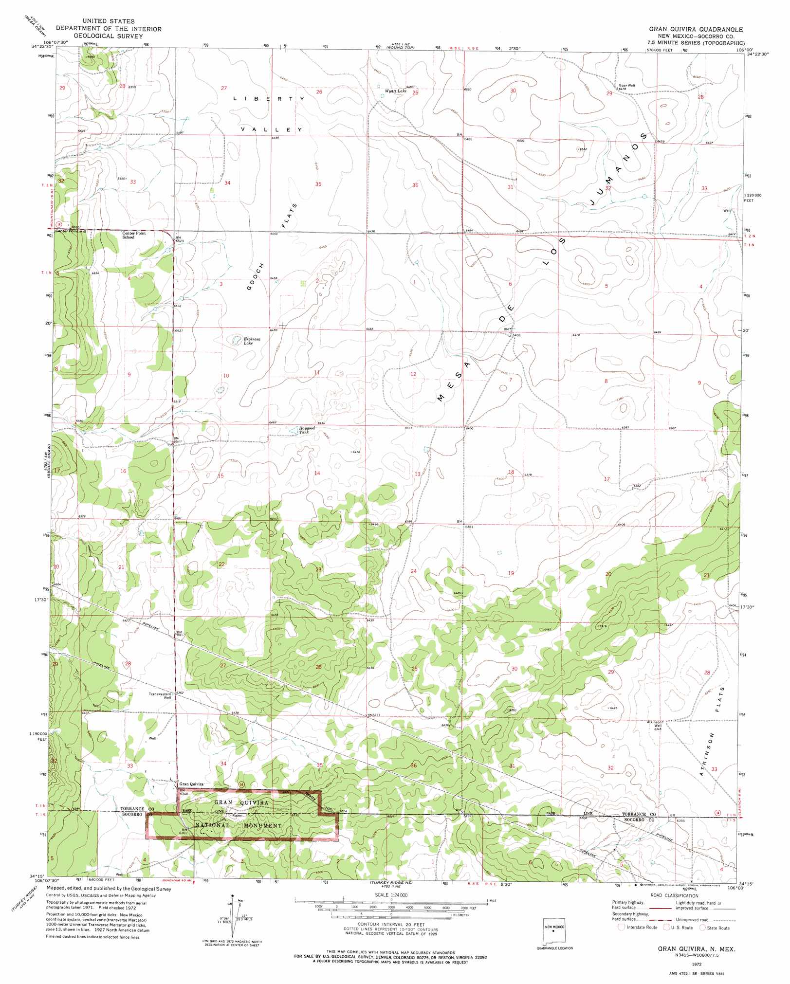
USGS Topo Quad 34106c1 - 1:24,000 scale
| Topo Map Name: | Gran Quivira |
| USGS Topo Quad ID: | 34106c1 |
| Print Size: | ca. 21 1/4" wide x 27" high |
| Southeast Coordinates: | 34.25° N latitude / 106° W longitude |
| Map Center Coordinates: | 34.3125° N latitude / 106.0625° W longitude |
| U.S. State: | NM |
| Filename: | o34106c1.jpg |
| Download Map JPG Image: | Gran Quivira topo map 1:24,000 scale |
| Map Type: | Topographic |
| Topo Series: | 7.5´ |
| Map Scale: | 1:24,000 |
| Source of Map Images: | United States Geological Survey (USGS) |
| Alternate Map Versions: |
Gran Quivira NM 1972, updated 1975 Download PDF Buy paper map Gran Quivira NM 2011 Download PDF Buy paper map Gran Quivira NM 2013 Download PDF Buy paper map Gran Quivira NM 2017 Download PDF Buy paper map |
1:24,000 Topo Quads surrounding Gran Quivira
Punta De Agua |
Mountainair |
Willard |
Laguna Del Perro South |
Rattlesnake Hill |
Abo |
Mesa Draw |
Round Top |
Progresso |
Progresso Ne |
Chupadera |
Bigbee Draw |
Gran Quivira |
Progresso Sw |
Progresso Se |
Chupadera Spring |
Turkey Ridge |
Turkey Ridge Ne |
Claunch |
Pajaro Canyon |
Wilson Ranch |
Turkey Ridge Sw |
Cat Mesa |
Polecat Draw |
Claunch Se |
> Back to 34106a1 at 1:100,000 scale
> Back to 34106a1 at 1:250,000 scale
> Back to U.S. Topo Maps home
Gran Quivira topo map: Gazetteer
Gran Quivira: Flats
Gooch Flats elevation 1969m 6459′Gran Quivira: Lakes
Espinosa Lake elevation 1961m 6433′Wyatt Lake elevation 1960m 6430′
Gran Quivira: Parks
Gran Quivira National Monument elevation 1981m 6499′Salinas Pueblo Missions National Monument elevation 1984m 6509′
Gran Quivira: Populated Places
Gran Quivira elevation 1935m 6348′Gran Quivira: Post Offices
Gran Quivira Post Office (historical) elevation 1935m 6348′Gran Quivira: Reservoirs
Haygood Tank elevation 1966m 6450′Gran Quivira: Summits
Beatty Hill elevation 2006m 6581′Center Point Hill elevation 2037m 6683′
Gran Quivira: Valleys
Liberty Valley elevation 1960m 6430′North Canyon elevation 1944m 6377′
South Canyon elevation 1932m 6338′
Gran Quivira: Wells
Atkinson Well elevation 1934m 6345′Goar Well elevation 1975m 6479′
Transwestern Well elevation 1941m 6368′
Gran Quivira digital topo map on disk
Buy this Gran Quivira topo map showing relief, roads, GPS coordinates and other geographical features, as a high-resolution digital map file on DVD: