Bigbee Draw Topo Map New Mexico
To zoom in, hover over the map of Bigbee Draw
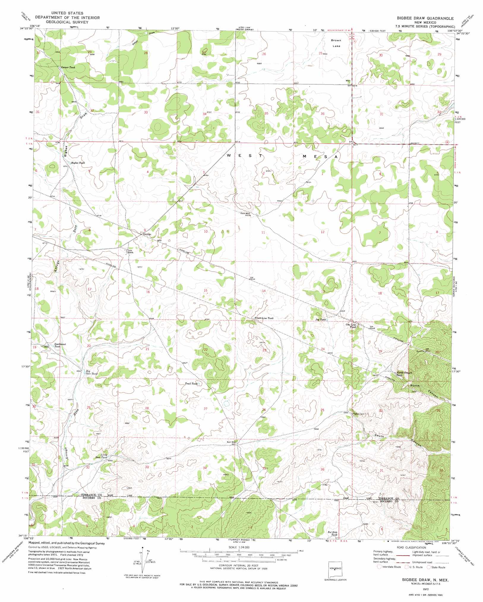
USGS Topo Quad 34106c2 - 1:24,000 scale
| Topo Map Name: | Bigbee Draw |
| USGS Topo Quad ID: | 34106c2 |
| Print Size: | ca. 21 1/4" wide x 27" high |
| Southeast Coordinates: | 34.25° N latitude / 106.125° W longitude |
| Map Center Coordinates: | 34.3125° N latitude / 106.1875° W longitude |
| U.S. State: | NM |
| Filename: | o34106c2.jpg |
| Download Map JPG Image: | Bigbee Draw topo map 1:24,000 scale |
| Map Type: | Topographic |
| Topo Series: | 7.5´ |
| Map Scale: | 1:24,000 |
| Source of Map Images: | United States Geological Survey (USGS) |
| Alternate Map Versions: |
Bigbee Draw NM 1972, updated 1975 Download PDF Buy paper map Bigbee Draw NM 2010 Download PDF Buy paper map Bigbee Draw NM 2013 Download PDF Buy paper map Bigbee Draw NM 2017 Download PDF Buy paper map |
1:24,000 Topo Quads surrounding Bigbee Draw
Manzano Peak |
Punta De Agua |
Mountainair |
Willard |
Laguna Del Perro South |
Scholle |
Abo |
Mesa Draw |
Round Top |
Progresso |
Rayo Hills |
Chupadera |
Bigbee Draw |
Gran Quivira |
Progresso Sw |
Bishop Ranch |
Chupadera Spring |
Turkey Ridge |
Turkey Ridge Ne |
Claunch |
Orndorff Ranch |
Wilson Ranch |
Turkey Ridge Sw |
Cat Mesa |
Polecat Draw |
> Back to 34106a1 at 1:100,000 scale
> Back to 34106a1 at 1:250,000 scale
> Back to U.S. Topo Maps home
Bigbee Draw topo map: Gazetteer
Bigbee Draw: Areas
West Mesa elevation 2037m 6683′Bigbee Draw: Basins
Brown Lake elevation 2021m 6630′Bigbee Draw: Reservoirs
Big Seco Tank elevation 1992m 6535′Bigbee Tank elevation 2060m 6758′
Corner Tank elevation 2109m 6919′
Fence Line Tank elevation 2021m 6630′
Gas Line Tank elevation 2011m 6597′
Jog Tank elevation 2016m 6614′
Little Seco Tank elevation 1993m 6538′
North Canyon Tank elevation 2011m 6597′
Pogue Tank elevation 2028m 6653′
Pot Hole Tank elevation 1987m 6519′
Southwest Tank elevation 2008m 6587′
Trail Tank elevation 2012m 6601′
Bigbee Draw: Valleys
Bigbee Draw elevation 2064m 6771′Bigbee Draw: Wells
East Well elevation 2031m 6663′Kerr Well elevation 2029m 6656′
Bigbee Draw digital topo map on disk
Buy this Bigbee Draw topo map showing relief, roads, GPS coordinates and other geographical features, as a high-resolution digital map file on DVD: