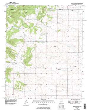
Milbourn Ranch Topo Map New Mexico
To zoom in, hover over the map of Milbourn Ranch
USGS Topo Quad 34106g2 - 1:24,000 scale
| Topo Map Name: | Milbourn Ranch |
| USGS Topo Quad ID: | 34106g2 |
| Print Size: | ca. 21 1/4" wide x 27" high |
| Southeast Coordinates: | 34.75° N latitude / 106.125° W longitude |
| Map Center Coordinates: | 34.8125° N latitude / 106.1875° W longitude |
| U.S. State: | NM |
| Filename: | o34106g2.jpg |
| Download Map JPG Image: | Milbourn Ranch topo map 1:24,000 scale |
| Map Type: | Topographic |
| Topo Series: | 7.5´ |
| Map Scale: | 1:24,000 |
| Source of Map Images: | United States Geological Survey (USGS) |
| Alternate Map Versions: |
Milbourn Ranch NM 1954, updated 1955 Download PDF Buy paper map Milbourn Ranch NM 1954, updated 1973 Download PDF Buy paper map Milbourn Ranch NM 1954, updated 1977 Download PDF Buy paper map Milbourn Ranch NM 1991, updated 1996 Download PDF Buy paper map Milbourn Ranch NM 2010 Download PDF Buy paper map Milbourn Ranch NM 2013 Download PDF Buy paper map Milbourn Ranch NM 2017 Download PDF Buy paper map |
1:24,000 Topo Quads surrounding Milbourn Ranch
> Back to 34106e1 at 1:100,000 scale
> Back to 34106a1 at 1:250,000 scale
> Back to U.S. Topo Maps home
Milbourn Ranch topo map: Gazetteer
Milbourn Ranch: Arroyos
Cañada de Chinchonte elevation 2012m 6601′Cañada de la Miga elevation 1976m 6482′
Cañada de la Perra elevation 1970m 6463′
Milbourn Ranch: Mines
Chief 1-A Pace Mine elevation 1950m 6397′Chief I Pace elevation 1925m 6315′
Drice I Garland elevation 1984m 6509′
Esatancia 2 Dehart elevation 1946m 6384′
Estancia 1 Kellogg Mine elevation 1950m 6397′
Estancia 1 Kutchin elevation 1978m 6489′
Estancia 1 Roland elevation 1935m 6348′
Estancia 3 Dehart elevation 1946m 6384′
Estancia 4 Dehart elevation 1947m 6387′
Estancia 5 Dehart elevation 1944m 6377′
Lee I Milburn elevation 1926m 6318′
Meyers 1 Milburn elevation 1938m 6358′
Meyers 1 Smith elevation 1922m 6305′
Milbourn Ranch: Summits
Cerro del Conejo elevation 1982m 6502′Milbourn Ranch: Valleys
Arroyo de la Miga elevation 1957m 6420′Cañon del Pino elevation 1970m 6463′
Milbourn Ranch: Wells
Windmill Water Well elevation 2008m 6587′Milbourn Ranch digital topo map on disk
Buy this Milbourn Ranch topo map showing relief, roads, GPS coordinates and other geographical features, as a high-resolution digital map file on DVD:


