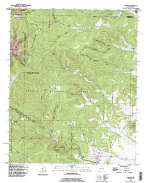
Tajique Topo Map New Mexico
To zoom in, hover over the map of Tajique
USGS Topo Quad 34106g3 - 1:24,000 scale
| Topo Map Name: | Tajique |
| USGS Topo Quad ID: | 34106g3 |
| Print Size: | ca. 21 1/4" wide x 27" high |
| Southeast Coordinates: | 34.75° N latitude / 106.25° W longitude |
| Map Center Coordinates: | 34.8125° N latitude / 106.3125° W longitude |
| U.S. State: | NM |
| Filename: | o34106g3.jpg |
| Download Map JPG Image: | Tajique topo map 1:24,000 scale |
| Map Type: | Topographic |
| Topo Series: | 7.5´ |
| Map Scale: | 1:24,000 |
| Source of Map Images: | United States Geological Survey (USGS) |
| Alternate Map Versions: |
Tajique NM 1954, updated 1955 Download PDF Buy paper map Tajique NM 1954, updated 1964 Download PDF Buy paper map Tajique NM 1990, updated 1996 Download PDF Buy paper map Tajique NM 1995, updated 1998 Download PDF Buy paper map Tajique NM 2011 Download PDF Buy paper map Tajique NM 2013 Download PDF Buy paper map Tajique NM 2017 Download PDF Buy paper map |
| FStopo: | US Forest Service topo Tajique is available: Download FStopo PDF Download FStopo TIF |
1:24,000 Topo Quads surrounding Tajique
> Back to 34106e1 at 1:100,000 scale
> Back to 34106a1 at 1:250,000 scale
> Back to U.S. Topo Maps home
Tajique topo map: Gazetteer
Tajique: Populated Places
Glover Place elevation 2123m 6965′King Place elevation 2165m 7103′
Nelson Place elevation 2152m 7060′
Riley Place elevation 2268m 7440′
Tajique elevation 2043m 6702′
Tajique: Post Offices
Tajique Post Office elevation 2043m 6702′Tajique: Reservoirs
Baca Dirt Tank elevation 2151m 7057′North End Trick Tank elevation 2418m 7933′
Pino Tank elevation 2098m 6883′
White Tank elevation 2140m 7020′
Tajique: Springs
Apache Spring elevation 2188m 7178′Deer Spring elevation 2208m 7244′
Glover Spring elevation 2181m 7155′
Hawkins Spring elevation 2259m 7411′
Ojo del Rancho del Medio elevation 2219m 7280′
Ojo La Casa elevation 2319m 7608′
Ojo los Caso elevation 2323m 7621′
Ojo Terreo Spring elevation 2233m 7326′
Riley Ranch Spring elevation 2276m 7467′
Tejano Spring elevation 2137m 7011′
Three Tree Spring elevation 2283m 7490′
Tajique: Valleys
Canon de la Fuera elevation 2143m 7030′Cañon de la Gallina elevation 2255m 7398′
Canon de la Miga elevation 2082m 6830′
Cañon de la Mula elevation 2143m 7030′
Cañon de la Perra elevation 2169m 7116′
Cañon de Oso elevation 2207m 7240′
Cañon de Tajique elevation 2018m 6620′
Cañon de Terrero elevation 2166m 7106′
Cañon de Troncon Negro elevation 2148m 7047′
Cañon del Agua Azul elevation 2171m 7122′
Cañon del Apache elevation 2132m 6994′
Cañon del Ojo del Venado elevation 2120m 6955′
Cañon del Ojo Redondo elevation 2300m 7545′
Cañon Largo elevation 2265m 7431′
Cañon los Joyos elevation 2018m 6620′
Cañoncito de Medio elevation 2120m 6955′
Tajique: Wells
E-3658 Water Well elevation 2169m 7116′Tajique digital topo map on disk
Buy this Tajique topo map showing relief, roads, GPS coordinates and other geographical features, as a high-resolution digital map file on DVD:


