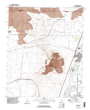
Dalies Topo Map New Mexico
To zoom in, hover over the map of Dalies
USGS Topo Quad 34106g7 - 1:24,000 scale
| Topo Map Name: | Dalies |
| USGS Topo Quad ID: | 34106g7 |
| Print Size: | ca. 21 1/4" wide x 27" high |
| Southeast Coordinates: | 34.75° N latitude / 106.75° W longitude |
| Map Center Coordinates: | 34.8125° N latitude / 106.8125° W longitude |
| U.S. State: | NM |
| Filename: | o34106g7.jpg |
| Download Map JPG Image: | Dalies topo map 1:24,000 scale |
| Map Type: | Topographic |
| Topo Series: | 7.5´ |
| Map Scale: | 1:24,000 |
| Source of Map Images: | United States Geological Survey (USGS) |
| Alternate Map Versions: |
Dalies NM 1952, updated 1953 Download PDF Buy paper map Dalies NM 1952, updated 1973 Download PDF Buy paper map Dalies NM 1991, updated 1996 Download PDF Buy paper map Dalies NM 1991, updated 1996 Download PDF Buy paper map Dalies NM 2010 Download PDF Buy paper map Dalies NM 2013 Download PDF Buy paper map Dalies NM 2017 Download PDF Buy paper map |
1:24,000 Topo Quads surrounding Dalies
> Back to 34106e1 at 1:100,000 scale
> Back to 34106a1 at 1:250,000 scale
> Back to U.S. Topo Maps home
Dalies topo map: Gazetteer
Dalies: Canals
Los Lunas Wasteway elevation 1476m 4842′New Belen Ditch elevation 1477m 4845′
Prison Lateral elevation 1472m 4829′
Dalies: Parks
Artistic Park elevation 1511m 4957′Valley View Park elevation 1513m 4963′
Dalies: Populated Places
Dalies elevation 1618m 5308′Paquita elevation 1546m 5072′
Sandia elevation 1614m 5295′
Dalies: Post Offices
Dalies Post Office (historical) elevation 1618m 5308′Sandia Post Office (historical) elevation 1614m 5295′
Dalies: Summits
El Cerro De Los Lunas elevation 1804m 5918′Dalies: Wells
10008 Water Well elevation 1618m 5308′10017 Water Well elevation 1521m 4990′
10026 Water Well elevation 1472m 4829′
10027 Water Well elevation 1601m 5252′
10028 Water Well elevation 1522m 4993′
Dalies Oil Well elevation 1619m 5311′
Grasslands Water Well elevation 1521m 4990′
Dalies digital topo map on disk
Buy this Dalies topo map showing relief, roads, GPS coordinates and other geographical features, as a high-resolution digital map file on DVD:


