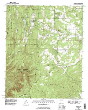
Escabosa Topo Map New Mexico
To zoom in, hover over the map of Escabosa
USGS Topo Quad 34106h3 - 1:24,000 scale
| Topo Map Name: | Escabosa |
| USGS Topo Quad ID: | 34106h3 |
| Print Size: | ca. 21 1/4" wide x 27" high |
| Southeast Coordinates: | 34.875° N latitude / 106.25° W longitude |
| Map Center Coordinates: | 34.9375° N latitude / 106.3125° W longitude |
| U.S. State: | NM |
| Filename: | o34106h3.jpg |
| Download Map JPG Image: | Escabosa topo map 1:24,000 scale |
| Map Type: | Topographic |
| Topo Series: | 7.5´ |
| Map Scale: | 1:24,000 |
| Source of Map Images: | United States Geological Survey (USGS) |
| Alternate Map Versions: |
Escabosa NM 1954, updated 1955 Download PDF Buy paper map Escabosa NM 1954, updated 1963 Download PDF Buy paper map Escabosa NM 1954, updated 1977 Download PDF Buy paper map Escabosa NM 1991, updated 1996 Download PDF Buy paper map Escabosa NM 1995, updated 1998 Download PDF Buy paper map Escabosa NM 2011 Download PDF Buy paper map Escabosa NM 2013 Download PDF Buy paper map Escabosa NM 2017 Download PDF Buy paper map |
| FStopo: | US Forest Service topo Escabosa is available: Download FStopo PDF Download FStopo TIF |
1:24,000 Topo Quads surrounding Escabosa
> Back to 34106e1 at 1:100,000 scale
> Back to 34106a1 at 1:250,000 scale
> Back to U.S. Topo Maps home
Escabosa topo map: Gazetteer
Escabosa: Populated Places
Alley Place elevation 2197m 7208′Escabosa elevation 2226m 7303′
Miera elevation 2196m 7204′
Ponderosa Pine elevation 2294m 7526′
Yrisarri elevation 2201m 7221′
Escabosa: Post Offices
Escabosa Post Office (historical) elevation 2226m 7303′Escabosa: Springs
Ojo de la Gotera elevation 2143m 7030′Escabosa: Valleys
Cañon de los Alamitos elevation 2140m 7020′Cañon de Rajadero de los Negros elevation 2199m 7214′
Cañon Turrieta elevation 2200m 7217′
Carolino Canyon elevation 2179m 7148′
Charlies Canyon elevation 2220m 7283′
David Canyon elevation 2091m 6860′
Lujan Canyon elevation 2177m 7142′
Escabosa: Wells
10051 Water Well elevation 2251m 7385′104 Water Well elevation 2221m 7286′
105 Water Well elevation 2288m 7506′
109 Water Well elevation 2217m 7273′
110 Water Well elevation 2249m 7378′
114 Water Well elevation 2246m 7368′
123 Water Well elevation 2220m 7283′
124 Water Well elevation 2243m 7358′
182 Water Well elevation 2273m 7457′
195 Water Well elevation 2208m 7244′
196 Water Well elevation 2240m 7349′
204 Water Well elevation 2224m 7296′
205 Water Well elevation 2158m 7080′
508 Water Well elevation 2286m 7500′
71 Water Well elevation 2307m 7568′
80 Water Well elevation 2261m 7417′
81 Water Well elevation 2261m 7417′
82 Water Well elevation 2261m 7417′
83 Water Well elevation 2295m 7529′
Department 11 Water Well elevation 2292m 7519′
E2290 Water Well elevation 2284m 7493′
E-2750 Water Well elevation 2296m 7532′
E-2759 Water Well elevation 2293m 7522′
E-3176 Water Well elevation 2245m 7365′
E-3829 Water Well elevation 2215m 7267′
E-3868 Water Well elevation 2257m 7404′
E-3928 Water Well elevation 2198m 7211′
E-4147 Water Well elevation 2185m 7168′
RG-29443 Water Well elevation 2264m 7427′
RG-32850 Water Well elevation 2276m 7467′
RG-32865 Water Well elevation 2224m 7296′
RG-32865-S Water Well elevation 2227m 7306′
RG32865S-2 Water Well elevation 2259m 7411′
RG-33179 Water Well elevation 2262m 7421′
RG-35143 Water Well elevation 2336m 7664′
RG-35320 Water Well elevation 2292m 7519′
RG36912 Water Well elevation 2296m 7532′
RG-36912 Water Well elevation 2295m 7529′
RG38657 Water Well elevation 2275m 7463′
RG-41674 Water Well elevation 2292m 7519′
S-343 Water Well elevation 2282m 7486′
Escabosa digital topo map on disk
Buy this Escabosa topo map showing relief, roads, GPS coordinates and other geographical features, as a high-resolution digital map file on DVD:


