San Lorenzo Spring Topo Map New Mexico
To zoom in, hover over the map of San Lorenzo Spring
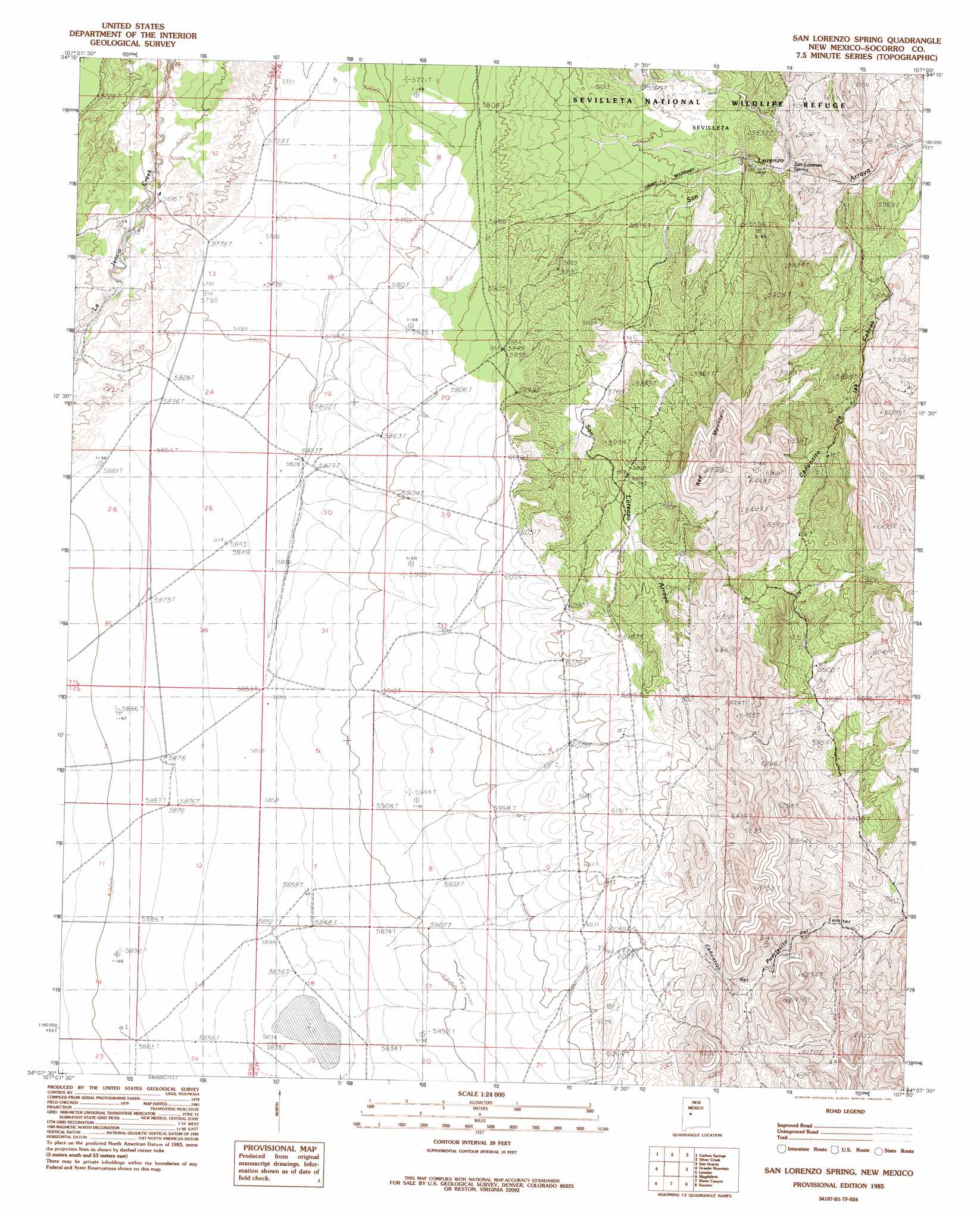
USGS Topo Quad 34107b1 - 1:24,000 scale
| Topo Map Name: | San Lorenzo Spring |
| USGS Topo Quad ID: | 34107b1 |
| Print Size: | ca. 21 1/4" wide x 27" high |
| Southeast Coordinates: | 34.125° N latitude / 107° W longitude |
| Map Center Coordinates: | 34.1875° N latitude / 107.0625° W longitude |
| U.S. State: | NM |
| Filename: | o34107b1.jpg |
| Download Map JPG Image: | San Lorenzo Spring topo map 1:24,000 scale |
| Map Type: | Topographic |
| Topo Series: | 7.5´ |
| Map Scale: | 1:24,000 |
| Source of Map Images: | United States Geological Survey (USGS) |
| Alternate Map Versions: |
San Lorenzo Spring NM 1985, updated 1985 Download PDF Buy paper map San Lorenzo Spring NM 2010 Download PDF Buy paper map San Lorenzo Spring NM 2013 Download PDF Buy paper map San Lorenzo Spring NM 2017 Download PDF Buy paper map |
1:24,000 Topo Quads surrounding San Lorenzo Spring
La Jara Peak |
Riley |
Ladron Peak |
La Joya Nw |
Abeytas |
Mesa Cencerro |
Carbon Springs |
Silver Creek |
San Acacia |
La Joya |
Silver Hill |
Granite Mountain |
San Lorenzo Spring |
Lemitar |
Mesa Del Yeso |
Arroyo Landavaso |
Magdalena |
Water Canyon |
Socorro |
Loma De Las Canas |
Squaw Peak |
South Baldy |
Molino Peak |
Luis Lopez |
San Antonio |
> Back to 34107a1 at 1:100,000 scale
> Back to 34106a1 at 1:250,000 scale
> Back to U.S. Topo Maps home
San Lorenzo Spring topo map: Gazetteer
San Lorenzo Spring: Mines
San Lorenzo elevation 1844m 6049′San Lorenzo Spring: Springs
San Lorenzo Spring elevation 1661m 5449′San Lorenzo Spring: Summits
Red Mountain elevation 2010m 6594′San Lorenzo Spring digital topo map on disk
Buy this San Lorenzo Spring topo map showing relief, roads, GPS coordinates and other geographical features, as a high-resolution digital map file on DVD: