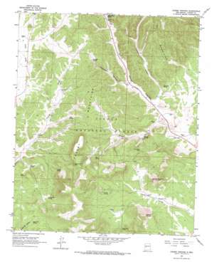
Crosby Springs Topo Map New Mexico
To zoom in, hover over the map of Crosby Springs
USGS Topo Quad 34107b8 - 1:24,000 scale
| Topo Map Name: | Crosby Springs |
| USGS Topo Quad ID: | 34107b8 |
| Print Size: | ca. 21 1/4" wide x 27" high |
| Southeast Coordinates: | 34.125° N latitude / 107.875° W longitude |
| Map Center Coordinates: | 34.1875° N latitude / 107.9375° W longitude |
| U.S. State: | NM |
| Filename: | o34107b8.jpg |
| Download Map JPG Image: | Crosby Springs topo map 1:24,000 scale |
| Map Type: | Topographic |
| Topo Series: | 7.5´ |
| Map Scale: | 1:24,000 |
| Source of Map Images: | United States Geological Survey (USGS) |
| Alternate Map Versions: |
Crosby Springs NM 1964, updated 1967 Download PDF Buy paper map Crosby Springs NM 1964, updated 1967 Download PDF Buy paper map Crosby Springs NM 1995, updated 1998 Download PDF Buy paper map Crosby Springs NM 2011 Download PDF Buy paper map Crosby Springs NM 2013 Download PDF Buy paper map Crosby Springs NM 2017 Download PDF Buy paper map |
| FStopo: | US Forest Service topo Crosby Springs is available: Download FStopo PDF Download FStopo TIF |
1:24,000 Topo Quads surrounding Crosby Springs
> Back to 34107a1 at 1:100,000 scale
> Back to 34106a1 at 1:250,000 scale
> Back to U.S. Topo Maps home
Crosby Springs topo map: Gazetteer
Crosby Springs: Populated Places
Webster Place elevation 2353m 7719′Crosby Springs: Reservoirs
Deep Tank elevation 2413m 7916′Driveway Tank elevation 2315m 7595′
Government Tank elevation 2508m 8228′
Hidden Tank elevation 2438m 7998′
Hidden Tank elevation 2456m 8057′
Lower Tank elevation 2373m 7785′
Pine Park Tank elevation 2404m 7887′
Rock Cliff Tank elevation 2407m 7896′
Sweeten Windmill elevation 2320m 7611′
Upper Tank elevation 2386m 7828′
Crosby Springs: Ridges
Crosby Mountains elevation 2669m 8756′Crosby Springs: Springs
Crosby Springs elevation 2457m 8061′Flying V Spring elevation 2342m 7683′
Hidden Spring elevation 2480m 8136′
Pine Spring elevation 2340m 7677′
Pipe Spring elevation 2348m 7703′
Rene Spring elevation 2475m 8120′
Road Spring elevation 2413m 7916′
Slaughter Spring elevation 2443m 8015′
Sugarloaf Spring elevation 2463m 8080′
Swingle Spring elevation 2352m 7716′
Thompson Spring elevation 2390m 7841′
Turkey Park Spring elevation 2482m 8143′
Turkey Spring elevation 2446m 8024′
White House Spring elevation 2450m 8038′
Crosby Springs: Summits
Anderson Mountain elevation 2713m 8900′East Sugarloaf Mountain elevation 2640m 8661′
Crosby Springs: Valleys
Slaughter Canyon elevation 2350m 7709′Swingle Canyon elevation 2299m 7542′
Thompson Canyon elevation 2320m 7611′
Crosby Springs: Wells
Baldwincab Water Well elevation 2287m 7503′Buck Water Well elevation 2388m 7834′
Flying V 1A Water Well elevation 2343m 7687′
Flying V 1B Water Well elevation 2343m 7687′
Flying V 2 Water Well elevation 2405m 7890′
Harveys Well elevation 2337m 7667′
Home Water Well elevation 2356m 7729′
Jonnies Well elevation 2336m 7664′
Sawmill Well elevation 2352m 7716′
Stewart Well elevation 2304m 7559′
Vega Well elevation 2299m 7542′
White House Well elevation 2431m 7975′
Whitehouse Water Well elevation 2415m 7923′
Z Slash Well elevation 2358m 7736′
Crosby Springs digital topo map on disk
Buy this Crosby Springs topo map showing relief, roads, GPS coordinates and other geographical features, as a high-resolution digital map file on DVD:


